
VIKING WIND POWER
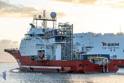
Multi Purpose Offshore Vessel
Current Trip
HELGOLAND
| Time Travelled | 13 days |
|---|---|
| Remaining Time | --- |
| Distance Travelled | 543.08 nm |
| Remaining Distance | --- |
| AVG Speed | 5.6 Knopen |
| MAX Speed | 11 Knopen |
| AVG Wind | 16.4 knots |
| MAX Wind | 29.9 knots |
| MIN Temp | 5.2°C / 41.36°F |
| MAX Temp | 10.7°C / 51.26°F |
| Diepgang | 6.9 M |
| Positie ontvangen | 2 m geleden |
Current Position
| Lengtegraad | 6.71102° |
|---|---|
| Breedtegraat | 53.54097° |
| Status | Under way using engine |
| Snelheid | 11.4 Knopen |
| Koers | 129.2° |
| Gebied | North Sea |
| Station | T-AIS |
| Positie ontvangen | 2 m geleden |
Info
Information
The current position of VIKING WIND POWER is in North Sea with coordinates 53.54097° / 6.71102° as reported on 2024-04-23 17:50 by AIS to our vessel tracker app. The vessel's current speed is 11.4 Knopen
The vessel VIKING WIND POWER (IMO: 9378149, MMSI: 257195000) is a Multi Purpose Offshore Vessel that was built in 2007 ( 17 Jaar oud ). It's sailing under the flag of [NO] Norway.
In this page you can find informations about the vessels current position, last detected port calls, and current voyage information. If the vessels is not in coverage by AIS you will find the latest position.
The current position of VIKING WIND POWER is detected by our AIS receivers and we are not responsible for the reliability of the data. The last position was recorded while the vessel was in Coverage by the Ais receivers of our vessel tracking app.
The current draught of VIKING WIND POWER as reported by AIS is 6.9 meters
Weather
| Temperature | 7.1°C / 44.78°F |
|---|---|
| Wind Speed | 17 knots |
| Direction | 332° NNW |
| Pressure | 1012.9 hPa |
| Humidity | 82.1 % |
| Cloud Coverage | 100 % |
Featured Company
Last Port Calls
| Port | Arrival | Departure | Time In Port |
|---|---|---|---|
| 2024-04-10 04:54 | 2024-04-10 16:35 | 11 h | |
| 2024-03-27 05:19 | 2024-03-27 22:08 | 16 h | |
| 2024-03-13 05:34 | 2024-03-13 19:11 | 13 h | |
| 2024-02-28 05:28 | 2024-02-28 19:26 | 13 h | |
| 2024-02-14 06:17 | 2024-02-14 20:18 | 14 h | |
| 2024-02-03 12:39 |
Most Visited Ports (Last year)
| Port | Arrivals | |
|---|---|---|
| 26 |
Last Trips
| Origin | Departure | Destination | Arrival | Distance | |
|---|---|---|---|---|---|
| 2024-03-27 23:08 | 2024-04-10 06:54 | 540.61 nm | |||
| 2024-03-13 20:11 | 2024-03-27 06:19 | 401.31 nm | |||
| 2024-02-28 20:26 | 2024-03-13 06:34 | 414.26 nm | |||
| 2024-02-14 21:18 | 2024-02-28 06:28 | 349.35 nm | |||
| 2024-02-03 13:39 | 2024-02-14 07:17 | 39.15 nm |
Events
| Tijd | Evenement | Details | Positie / Bestemming | Info |
|---|---|---|---|---|
| 2024-04-23 17:35 | Binnenbereik |
53.56755 / 6.65032
North Sea
|
Snelheid: 10 kn Koers: 127.8° |
|
| 2024-04-23 12:55 | Buitenbereik |
53.91299 / 6.97370
North Sea
|
Snelheid: 8.9 kn Koers: 254.9° |
|
| 2024-04-23 12:49 | Binnenbereik |
53.91703 / 6.99958
North Sea
|
Snelheid: 8.9 kn Koers: 255.3° |
|
| 2024-04-23 11:45 | Buitenbereik |
53.95421 / 7.25640
North Sea
|
Snelheid: 8.6 kn Koers: 256.6° |
|
| 2024-04-23 11:38 | Binnenbereik |
53.95845 / 7.28519
North Sea
|
Snelheid: 8.5 kn Koers: 255.7° |
|
| 2024-04-22 21:44 | Buitenbereik |
54.49548 / 7.65426
North Sea
|
Snelheid: Koers: 279.3° |
|
| 2024-04-22 21:40 | Binnenbereik |
54.49547 / 7.65428
North Sea
|
Snelheid: Koers: 279.3° |
|
| 2024-04-22 19:16 | Buitenbereik |
54.49214 / 7.66253
North Sea
|
Snelheid: 3.3 kn Koers: 92.3° |
|
| 2024-04-22 18:41 | Binnenbereik |
54.49222 / 7.66083
North Sea
|
Snelheid: 0.2 kn Koers: 289.1° |
|
| 2024-04-22 17:01 | Buitenbereik |
54.47572 / 7.72670
North Sea
|
Snelheid: 6.1 kn Koers: 78.7° |