
BBC WASHINGTON
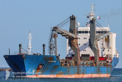
General Cargo
Current Trip
| Time Travelled | 4 days |
|---|---|
| Remaining Time | --- |
| Distance Travelled | 1306.30 nm |
| Remaining Distance | --- |
| AVG Speed | 13.1 Knopen |
| MAX Speed | 16.2 Knopen |
| AVG Wind | 14 knots |
| MAX Wind | 23 knots |
| MIN Temp | 27°C / 80.6°F |
| MAX Temp | 29.7°C / 85.46°F |
| Diepgang | 5.4 M |
| Positie ontvangen | 2024-02-17 14:50 |
Current Position
| Lengtegraad | 129.22280° |
|---|---|
| Breedtegraat | 34.79208° |
| Status | Under way using engine |
| Snelheid | 12.9 Knopen |
| Koers | 209.2° |
| Gebied | Japan Sea |
| Station | T-AIS |
| Positie ontvangen | 2024-02-17 14:50 |
Info
Information
The current position of BBC WASHINGTON is in Japan Sea with coordinates 34.79208° / 129.22280° as reported on 2024-02-17 14:50 by AIS to our vessel tracker app. The vessel's current speed is 12.9 Knopen and is heading at the port of ZHOUSHAN.
The vessel BBC WASHINGTON (IMO: 9283954, MMSI: 255806288) is a General Cargo that was built in 2004 ( 20 Jaar oud ). It's sailing under the flag of [PT] Portugal.
In this page you can find informations about the vessels current position, last detected port calls, and current voyage information. If the vessels is not in coverage by AIS you will find the latest position.
The current position of BBC WASHINGTON is detected by our AIS receivers and we are not responsible for the reliability of the data. The last position was recorded while the vessel was in Coverage by the Ais receivers of our vessel tracking app.
The current draught of BBC WASHINGTON as reported by AIS is 5.4 meters
Weather
| Temperature | 28.8°C / 83.84°F |
|---|---|
| Wind Speed | 14 knots |
| Direction | 115° ESE |
| Pressure | 1007.9 hPa |
| Humidity | 81.5 % |
| Cloud Coverage | 100 % |
Featured Company
Most Visited Ports (Last year)
| Port | Arrivals | |
|---|---|---|
| 8 | ||
| 3 | ||
| 2 | ||
| 2 | ||
| 2 | ||
| 2 |
Last Trips
| Origin | Departure | Destination | Arrival | Distance | |
|---|---|---|---|---|---|
| 2024-04-03 11:16 | 2024-04-10 09:51 | 2118.74 nm | |||
| 2024-02-17 20:27 | 2024-04-01 09:49 | 636.77 nm | |||
| 2024-02-14 15:27 | 2024-02-16 19:40 | 675.53 nm | |||
| 2024-02-10 20:30 | 2024-02-12 08:06 | 341.20 nm | |||
| 2024-01-25 14:49 | 2024-02-09 19:54 | 1126.09 nm |
Events
| Tijd | Evenement | Details | Positie / Bestemming | Info |
|---|---|---|---|---|
| 2024-04-12 09:06 | Start beweging | 3.55 nm, South West of VUNG TAU |
10.36612 / 107.04100
CN ZOS
|
Snelheid: 7 kn Koers: 152° |
| 2024-04-11 17:29 | Stop beweging | 3.55 nm, South West of VUNG TAU |
10.37093 / 107.03822
CN ZOS
|
Snelheid: 0.1 kn Koers: 145° |
| 2024-04-11 15:58 | Start beweging | 0.07 nm, West of CAI MEP |
10.54088 / 107.02618
CN ZOS
|
Snelheid: 9.2 kn Koers: 178° |
| 2024-04-11 15:57 | Vertrekhaven |
|
10.54088 / 107.02618
CN ZOS
|
Snelheid: Koers: 122° |
| 2024-04-10 02:51 | Stop beweging |
10.54832 / 107.02253
[VN] CAI MEP
|
Snelheid: 0.3 kn Koers: 105° |
|
| 2024-04-10 02:51 | Aankomsthaven |
|
10.54832 / 107.02253
[VN] CAI MEP
|
Snelheid: 1.5 kn Koers: 42° |