
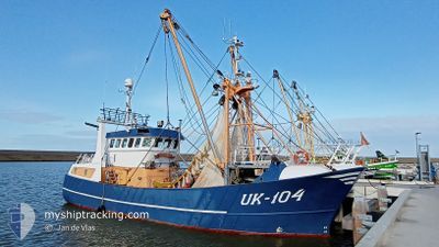
UK104 EBEN HAEZER
Fishing
Current Trip
| Trip Time | 2 days |
|---|---|
| Trip Distance | 68.27 nm |
| AVG Speed | 7 Noeuds |
| MAX Speed | 11.3 Noeuds |
| Tirant d eau | 0 m |
| AVG Wind | 16.3 knots |
| MAX Wind | 26.3 knots |
| MIN Temp | 6.8°C / 44.24°F |
| MAX Temp | 9.4°C / 48.92°F |
| Position reçue | Maintenant |
Current Position
| Longitude | 5.41469° |
|---|---|
| Latitude | 53.18012° |
| Etat | Engaged in Fishing |
| Vitesse | |
| Parcours | --- |
| Zone | North Sea |
| Station | T-AIS |
| Position reçue | Maintenant |
Info
Information
The current position of UK104 EBEN HAEZER is in North Sea with coordinates 53.18012° / 5.41469° as reported on 2024-04-19 15:35 by AIS to our vessel tracker app. The vessel's current speed is 0 Noeuds and is currently inside the port of HARLINGEN.
The vessel UK104 EBEN HAEZER (IMO: 9219757, MMSI: 245345000) is a Fishing It's sailing under the flag of [NL] Netherlands.
In this page you can find informations about the vessels current position, last detected port calls, and current voyage information. If the vessels is not in coverage by AIS you will find the latest position.
The current position of UK104 EBEN HAEZER is detected by our AIS receivers and we are not responsible for the reliability of the data. The last position was recorded while the vessel was in Coverage by the Ais receivers of our vessel tracking app.
Weather
| Temperature | 7.8°C / 46.04°F |
|---|---|
| Wind Speed | 24 knots |
| Direction | 332° NNW |
| Pressure | 1007.5 hPa |
| Humidity | 78.7 % |
| Cloud Coverage | 43 % |
Featured Company
Last Port Calls
| Port | Arrival | Departure | Time In Port |
|---|---|---|---|
| 2024-04-19 06:14 | |||
| 2024-04-12 08:21 | 2024-04-16 13:52 | 4 d | |
| 2024-04-09 16:28 | 2024-04-10 02:40 | 10 h | |
| 2024-04-05 06:06 | 2024-04-07 23:12 | 2 d | |
| 2024-03-29 08:35 | 2024-04-01 14:26 | 3 d | |
| 2024-03-22 07:09 | 2024-03-25 00:03 | 2 d | |
| 2024-03-20 06:38 | 2024-03-20 12:27 | 5 h | |
| 2024-03-15 08:26 | 2024-03-18 00:07 | 2 d | |
| 2024-02-08 07:40 | 2024-03-11 00:09 | ||
| 2024-02-07 05:46 |
Most Visited Ports (Last year)
| Port | Arrivals | |
|---|---|---|
| 14 | ||
| 13 | ||
| 12 | ||
| 7 | ||
| 3 | ||
| 2 |
Last Trips
| Origin | Departure | Destination | Arrival | Distance | |
|---|---|---|---|---|---|
| 2024-04-16 15:52 | 2024-04-19 08:14 | 68.27 nm | |||
| 2024-04-10 04:40 | 2024-04-12 10:21 | 109.75 nm | |||
| 2024-04-08 01:12 | 2024-04-09 18:28 | 117.36 nm | |||
| 2024-04-01 16:26 | 2024-04-05 08:06 | 129.24 nm | |||
| 2024-03-25 01:03 | 2024-03-29 09:35 | 211.52 nm | |||
| 2024-03-20 13:27 | 2024-03-22 08:09 | 118.89 nm | |||
| 2024-03-18 01:07 | 2024-03-20 07:38 | 169.10 nm | |||
| 2024-03-11 01:09 | 2024-03-15 09:26 | 107.82 nm | |||
| 2024-02-07 06:46 | 2024-02-08 08:40 | 43.57 nm |
Events
| Heure | Evenement | Détails | Position/ Destination | Info |
|---|---|---|---|---|
| 2024-04-19 06:15 | Arret |
53.18006 / 5.41469
[NL] HARLINGEN
|
Vitesse: 0.1 kn Parcours: 118° |
|
| 2024-04-19 06:14 | Port d'arrivée |
|
53.18006 / 5.41469
[NL] HARLINGEN
|
Vitesse: 1.1 kn Parcours: 112° |
| 2024-04-19 03:58 | Dans la zone couverte |
53.34204 / 4.98138
North Sea
|
Vitesse: 8.1 kn Parcours: 98.9° |
|
| 2024-04-19 02:26 | Hors de la zone couverte |
53.35150 / 4.95621
North Sea
|
Vitesse: 3.1 kn Parcours: 331.1° |
|
| 2024-04-19 02:21 | Dans la zone couverte |
53.34749 / 4.95920
North Sea
|
Vitesse: 3.7 kn Parcours: 330.8° |
|
| 2024-04-18 21:54 | Hors de la zone couverte |
53.36799 / 4.99239
North Sea
|
Vitesse: 3.1 kn Parcours: 243.9° |
|
| 2024-04-18 21:54 | Dans la zone couverte |
53.36799 / 4.99239
North Sea
|
Vitesse: 3.1 kn Parcours: 243.9° |
|
| 2024-04-18 06:41 | Hors de la zone couverte |
53.32144 / 4.94940
North Sea
|
Vitesse: 3.6 kn Parcours: 178.2° |
|
| 2024-04-18 02:10 | Démarrage | 5.33 nm, North West of VLIELAND |
53.36238 / 4.98591
FISHING
|
Vitesse: 6.7 kn Parcours: 237.7° |
| 2024-04-18 02:08 | Arret | 5.35 nm, North West of VLIELAND |
53.36469 / 4.98950
FISHING
|
Vitesse: Parcours: 243° |