
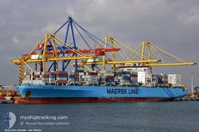
DIMITRIS Y
Container Ship
Current Trip
| Trip Time | 4 days |
|---|---|
| Trip Distance | 585.10 nm |
| AVG Speed | 12.3 Noeuds |
| MAX Speed | 17.2 Noeuds |
| Tirant d eau | 8.1 m |
| AVG Wind | 11.6 knots |
| MAX Wind | 22 knots |
| MIN Temp | 17.7°C / 63.86°F |
| MAX Temp | 27.4°C / 81.32°F |
| Position reçue | 4 d depuis |
Current Position
| Longitude | 118.70985° |
|---|---|
| Latitude | 24.31984° |
| Etat | Under way using engine |
| Vitesse | 16 Noeuds |
| Parcours | 58.4° |
| Zone | South China Sea |
| Station | T-AIS |
| Position reçue | 4 d depuis |
Info
Information
The current position of DIMITRIS Y is in South China Sea with coordinates 24.31984° / 118.70985° as reported on 2024-04-20 11:20 by AIS to our vessel tracker app. The vessel's current speed is 16 Noeuds and is currently inside the port of LUOYUAN.
The vessel DIMITRIS Y (IMO: 9189354, MMSI: 636016979) is a Container Ship that was built in 2000 ( 24 Age ). It's sailing under the flag of [LR] Liberia.
In this page you can find informations about the vessels current position, last detected port calls, and current voyage information. If the vessels is not in coverage by AIS you will find the latest position.
The current position of DIMITRIS Y is detected by our AIS receivers and we are not responsible for the reliability of the data. The last position was recorded while the vessel was in Coverage by the Ais receivers of our vessel tracking app.
The current draught of DIMITRIS Y as reported by AIS is 8.1 meters
Weather
| Temperature | 18.6°C / 65.48°F |
|---|---|
| Wind Speed | 2 knots |
| Direction | 117° ESE |
| Pressure | 1011.3 hPa |
| Humidity | 78.8 % |
| Cloud Coverage | 98 % |
Featured Company
Last Port Calls
| Port | Arrival | Departure | Time In Port |
|---|---|---|---|
| 2024-04-22 02:28 | |||
| 2024-04-16 23:59 | 2024-04-17 11:44 | 11 h | |
| 2024-03-06 15:34 | 2024-03-07 05:57 | 14 h | |
| 2024-03-05 22:44 | 2024-03-06 10:01 | 11 h | |
| 2024-02-29 05:10 | 2024-03-03 11:39 | 3 d | |
| 2024-02-26 11:56 | 2024-02-27 22:37 | 1 d |
Most Visited Ports (Last year)
| Port | Arrivals | |
|---|---|---|
| 3 | ||
| 2 | ||
| 2 | ||
| 2 | ||
| 2 | ||
| 2 |
Last Trips
| Origin | Departure | Destination | Arrival | Distance | |
|---|---|---|---|---|---|
| 2024-04-17 19:44 | 2024-04-22 10:28 | 585.10 nm | |||
| 2024-03-07 08:57 | 2024-04-17 07:59 | 14094.45 nm | |||
| 2024-03-06 13:01 | 2024-03-06 18:34 | 60.78 nm | |||
| 2024-03-03 13:39 | 2024-03-06 01:44 | 921.37 nm | |||
| 2024-02-28 00:37 | 2024-02-29 07:10 | 124.75 nm | |||
| 2024-01-20 18:34 | 2024-02-26 13:56 | 14638.23 nm |
Events
| Heure | Evenement | Détails | Position/ Destination | Info |
|---|---|---|---|---|
| 2024-04-22 09:08 | Arret |
26.45037 / 119.71137
[CN] LUOYUAN
|
Vitesse: 0.2 kn Parcours: 307° |
|
| 2024-04-22 08:36 | Démarrage |
26.43703 / 119.72006
[CN] LUOYUAN
|
Vitesse: 4.8 kn Parcours: 331° |
|
| 2024-04-22 02:58 | Arret |
26.43266 / 119.72475
[CN] LUOYUAN
|
Vitesse: 0.2 kn Parcours: 300° |
|
| 2024-04-22 02:28 | Port d'arrivée |
|
26.41246 / 119.75272
[CN] LUOYUAN
|
Vitesse: 11.1 kn Parcours: 287° |
| 2024-04-22 01:00 | Démarrage | 7.12 nm, North East of LIAN JIANG |
26.41917 / 119.94945
CNJLY
|
Vitesse: 4.7 kn Parcours: 3° |
| 2024-04-21 00:46 | Arret | 6.73 nm, North East of LIAN JIANG |
26.41195 / 119.94839
CNJLY
|
Vitesse: 0.3 kn Parcours: 84° |
| 2024-04-20 11:25 | Etat Changé | Default Under way using engine |
24.33334 / 118.72716
CNJLY
|
Vitesse: 16 kn Parcours: 58.4° |
| 2024-04-20 11:20 | Hors de la zone couverte |
24.31984 / 118.70985
South China Sea
CNJLY
|
Vitesse: 16 kn Parcours: 58.4° |
|
| 2024-04-20 08:44 | Démarrage | 8.61 nm, South East of ZHANGZHOU |
24.34557 / 118.19159
CNJLY
|
Vitesse: 3.5 kn Parcours: 111° |
| 2024-04-20 08:44 | Changement de destination | CNJLY CNXIA |
24.34542 / 118.18957
CNJLY
|
Vitesse: 1.6 kn Parcours: 85° |