
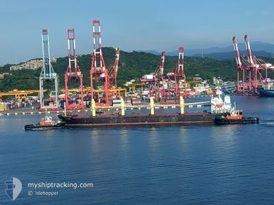
YUAN SHUN
Bulk Carrier
Current Trip
| Time Travelled | 3 days |
|---|---|
| Remaining Time | --- |
| Distance Travelled | 636.08 nm |
| Remaining Distance | --- |
| AVG Speed | 11.5 Noeuds |
| MAX Speed | 14 Noeuds |
| AVG Wind | 14.1 knots |
| MAX Wind | 32 knots |
| MIN Temp | 19.5°C / 67.1°F |
| MAX Temp | 23.5°C / 74.3°F |
| Tirant d eau | 6 m |
| Position reçue | 3 d depuis |
Current Position
| Longitude | 121.67018° |
|---|---|
| Latitude | 25.51740° |
| Etat | Under way using engine |
| Vitesse | 12.1 Noeuds |
| Parcours | 46.9° |
| Zone | Eastern China Sea |
| Station | T-AIS |
| Position reçue | 3 d depuis |
Info
Information
The current position of YUAN SHUN is in Eastern China Sea with coordinates 25.51740° / 121.67018° as reported on 2024-04-13 09:17 by AIS to our vessel tracker app. The vessel's current speed is 12.1 Noeuds
The vessel YUAN SHUN (IMO: 9252058, MMSI: 477300400) is a Bulk Carrier that was built in 2001 ( 23 Age ). It's sailing under the flag of [HK] Hong Kong.
In this page you can find informations about the vessels current position, last detected port calls, and current voyage information. If the vessels is not in coverage by AIS you will find the latest position.
The current position of YUAN SHUN is detected by our AIS receivers and we are not responsible for the reliability of the data. The last position was recorded while the vessel was in Coverage by the Ais receivers of our vessel tracking app.
The current draught of YUAN SHUN as reported by AIS is 6 meters
Weather
| Temperature | 20.7°C / 69.26°F |
|---|---|
| Wind Speed | 19 knots |
| Direction | 169° S |
| Pressure | 1014.2 hPa |
| Humidity | 92.6 % |
| Cloud Coverage | 100 % |
Featured Company
Last Port Calls
| Port | Arrival | Departure | Time In Port |
|---|---|---|---|
| 2024-04-11 14:57 | 2024-04-13 06:54 | 1 d | |
| 2024-04-10 09:51 | 2024-04-11 02:09 | 16 h | |
| 2024-04-08 11:58 | 2024-04-09 17:53 | 1 d | |
| 2024-04-07 06:01 | 2024-04-08 00:33 | 18 h | |
| 2024-04-03 19:49 | 2024-04-06 17:25 | 2 d | |
| 2024-04-02 06:33 | 2024-04-03 08:37 | 1 d | |
| 2024-03-31 17:31 | 2024-04-01 20:55 | 1 d | |
| 2024-03-30 07:01 | 2024-03-31 04:33 | 21 h | |
| 2024-03-28 00:00 | 2024-03-29 19:52 | 1 d | |
| 2024-03-27 03:48 | 2024-03-27 18:44 | 14 h |
Last Trips
| Origin | Departure | Destination | Arrival | Distance | |
|---|---|---|---|---|---|
| 2024-04-11 10:09 | 2024-04-11 22:57 | 122.92 nm | |||
| 2024-04-10 01:53 | 2024-04-10 17:51 | 130.41 nm | |||
| 2024-04-08 08:33 | 2024-04-08 19:58 | 122.65 nm | |||
| 2024-04-07 01:25 | 2024-04-07 14:01 | 121.75 nm | |||
| 2024-04-03 16:37 | 2024-04-04 03:49 | 123.56 nm | |||
| 2024-04-02 04:55 | 2024-04-02 14:33 | 120.12 nm | |||
| 2024-03-31 12:33 | 2024-04-01 01:31 | 122.93 nm | |||
| 2024-03-30 03:52 | 2024-03-30 15:01 | 122.07 nm | |||
| 2024-03-28 02:44 | 2024-03-28 08:00 | 43.35 nm | |||
| 2024-03-16 17:43 | 2024-03-27 11:48 | 1816.79 nm |
Events
| Heure | Evenement | Détails | Position/ Destination | Info |
|---|---|---|---|---|
| 2024-04-13 09:24 | Etat Changé | Default Under way using engine |
25.53333 / 121.68833
JP NGO
|
Vitesse: 12.1 kn Parcours: 46.9° |
| 2024-04-13 09:17 | Hors de la zone couverte |
25.51740 / 121.67018
Eastern China Sea
JP NGO
|
Vitesse: 12.1 kn Parcours: 46.9° |
|
| 2024-04-13 08:27 | Etat Changé | Under way using engine Default |
25.40931 / 121.51579
JP NGO
|
Vitesse: 13 kn Parcours: 53° |
| 2024-04-13 07:56 | Etat Changé | Default Under way using engine |
25.32994 / 121.41485
JP NGO
|
Vitesse: 13.7 kn Parcours: 41.9° |
| 2024-04-13 07:53 | Etat Changé | Under way using engine Default |
25.32244 / 121.40747
JP NGO
|
Vitesse: 13.3 kn Parcours: 42° |
| 2024-04-13 07:53 | Changement de zone | Taiwanese part of the Eastern China Sea Taiwanese part of the South China Sea |
25.32244 / 121.40747
Eastern China Sea
JP NGO
|
Vitesse: 13.7 kn Parcours: 41.9° |
| 2024-04-13 07:26 | Etat Changé | Default Under way using engine |
25.24539 / 121.33672
JP NGO
|
Vitesse: 12.2 kn Parcours: 32.2° |
| 2024-04-13 07:14 | Tirant d'eau modifié | 6 9.8 |
25.20948 / 121.31605
JP NGO
|
Vitesse: 11.8 kn Parcours: 359.4° |
| 2024-04-13 07:14 | Changement de destination | JP NGO TAIPEI |
25.20948 / 121.31605
JP NGO
|
Vitesse: 11.8 kn Parcours: 359.4° |
| 2024-04-13 07:14 | Changement d'ETA | 2024/04/17 01:00 |
25.20948 / 121.31605
JP NGO
|
Vitesse: 11.8 kn Parcours: 359.4° |