
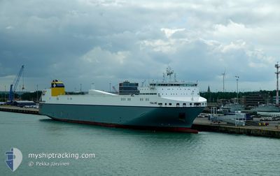
YSALINE
Cargo
Current Trip
| Time Travelled | 20 h, 35 mins |
|---|---|
| Remaining Time | 19 h, 44 mins |
| Distance Travelled | 335.57 nm |
| Remaining Distance | 306.19 nm |
| AVG Speed | 16 Noeuds |
| MAX Speed | 19.4 Noeuds |
| AVG Wind | 10.9 knots |
| MAX Wind | 15.5 knots |
| MIN Temp | 9.9°C / 49.82°F |
| MAX Temp | 10.9°C / 51.62°F |
| Tirant d eau | 6.8 m |
| Position reçue | 7 m depuis |
Current Position
| Longitude | -2.71990° |
|---|---|
| Latitude | 49.86734° |
| Etat | Under way using engine |
| Vitesse | 15.4 Noeuds |
| Parcours | 75.9° |
| Zone | English Channel |
| Station | T-AIS |
| Position reçue | 7 m depuis |
Info
Information
The current position of YSALINE is in English Channel with coordinates 49.86734° / -2.71990° as reported on 2024-04-23 15:59 by AIS to our vessel tracker app. The vessel's current speed is 15.4 Noeuds and is heading at the port of ROTTERDAM. The estimated time of arrival as calculated by MyShipTracking vessel tracking app is 2024-04-24 11:50 LT
The vessel YSALINE (IMO: 9823364, MMSI: 248744000) is a Cargo It's sailing under the flag of [MT] Malta.
In this page you can find informations about the vessels current position, last detected port calls, and current voyage information. If the vessels is not in coverage by AIS you will find the latest position.
The current position of YSALINE is detected by our AIS receivers and we are not responsible for the reliability of the data. The last position was recorded while the vessel was in Coverage by the Ais receivers of our vessel tracking app.
The current draught of YSALINE as reported by AIS is 6.8 meters
Weather
| Temperature | 9.8°C / 49.64°F |
|---|---|
| Wind Speed | 6 knots |
| Direction | 321° NW |
| Pressure | 1022.9 hPa |
| Humidity | 78.1 % |
| Cloud Coverage | 100 % |
Featured Company
Last Port Calls
| Port | Arrival | Departure | Time In Port |
|---|---|---|---|
| 2024-04-22 08:12 | 2024-04-22 19:31 | 11 h | |
| 2024-04-20 05:29 | 2024-04-20 15:30 | 10 h | |
| 2024-04-20 04:16 | 2024-04-20 05:15 | 59 m | |
| 2024-04-18 02:55 | 2024-04-18 15:01 | 12 h | |
| 2024-04-15 13:43 | 2024-04-16 12:40 | 22 h | |
| 2024-04-15 12:24 | 2024-04-15 13:21 | 56 m | |
| 2024-04-13 10:16 | 2024-04-13 21:35 | 11 h | |
| 2024-04-10 15:47 | 2024-04-11 18:28 | 1 d | |
| 2024-04-10 14:34 | 2024-04-10 15:27 | 53 m | |
| 2024-04-08 06:09 | 2024-04-08 20:45 | 14 h |
Last Trips
| Origin | Departure | Destination | Arrival | Distance | |
|---|---|---|---|---|---|
| 2024-04-20 17:30 | 2024-04-22 09:12 | 636.83 nm | |||
| 2024-04-20 07:15 | 2024-04-20 07:29 | 0.46 nm | |||
| 2024-04-18 16:01 | 2024-04-20 06:16 | 642.30 nm | |||
| 2024-04-16 14:40 | 2024-04-18 03:55 | 637.12 nm | |||
| 2024-04-15 15:21 | 2024-04-15 15:43 | 0.67 nm | |||
| 2024-04-13 22:35 | 2024-04-15 14:24 | 642.71 nm | |||
| 2024-04-11 20:28 | 2024-04-13 11:16 | 636.31 nm | |||
| 2024-04-10 17:27 | 2024-04-10 17:47 | 0.66 nm | |||
| 2024-04-08 21:45 | 2024-04-10 16:34 | 641.60 nm | |||
| 2024-04-04 17:49 | 2024-04-08 07:09 | 1003.06 nm |
Events
| Heure | Evenement | Détails | Position/ Destination | Info |
|---|---|---|---|---|
| 2024-04-23 15:58 | Etat Changé | Under way using engine Default |
49.86610 / -2.72763
NLRTM
|
Vitesse: 15.5 kn Parcours: 76° |
| 2024-04-23 15:54 | Etat Changé | Default Under way using engine |
49.86222 / -2.75212
NLRTM
|
Vitesse: 15.6 kn Parcours: 76° |
| 2024-04-23 15:48 | Etat Changé | Under way using engine Default |
49.85616 / -2.79033
NLRTM
|
Vitesse: 15.5 kn Parcours: 76° |
| 2024-04-23 15:42 | Etat Changé | Default Under way using engine |
49.85006 / -2.82928
NLRTM
|
Vitesse: 15.5 kn Parcours: 76.5° |
| 2024-04-23 15:07 | Detecté en mer | Guernsey part of the English Channel |
49.82147 / -3.06321
English Channel
NLRTM
|
Vitesse: 15.5 kn Parcours: 87.9° |
| 2024-04-23 15:07 | Etat Changé | Under way using engine Default |
49.82147 / -3.06321
NLRTM
|
Vitesse: 15.5 kn Parcours: 88° |
| 2024-04-23 14:30 | Etat Changé | Default Under way using engine |
49.81561 / -3.30103
NLRTM
|
Vitesse: 15.1 kn Parcours: 91.6° |
| 2024-04-23 09:14 | Changement de zone | United Kingdom part of the English Channel United Kingdom part of the Celtic Sea |
49.86686 / -5.36873
English Channel
NLRTM
|
Vitesse: 15.5 kn Parcours: 92.4° |
| 2024-04-23 09:14 | Etat Changé | Under way using engine Default |
49.86695 / -5.37205
NLRTM
|
Vitesse: 15.5 kn Parcours: 92° |
| 2024-04-23 08:54 | Dans la zone couverte |
49.86686 / -5.36873
English Channel
NLRTM
|
Vitesse: 15.5 kn Parcours: 92.4° |