
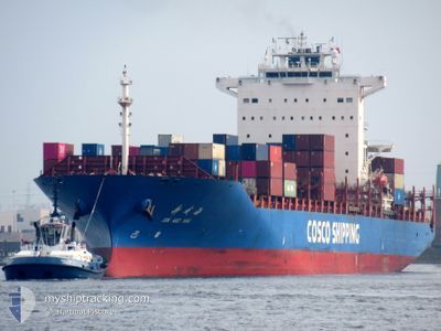
XIN WEI HAI
Container Ship
Current Trip
| Time Travelled | 4 days |
|---|---|
| Remaining Time | 7 days |
| Distance Travelled | 1443.24 nm |
| Remaining Distance | 2803.81 nm |
| AVG Speed | 14.1 Noeuds |
| MAX Speed | 15.8 Noeuds |
| AVG Wind | 8.3 knots |
| MAX Wind | 17 knots |
| MIN Temp | 19.8°C / 67.64°F |
| MAX Temp | 29.5°C / 85.1°F |
| Tirant d eau | 11.5 m |
| Position reçue | 3 d depuis |
Current Position
| Longitude | -40.35699° |
|---|---|
| Latitude | -22.00053° |
| Etat | Under way using engine |
| Vitesse | 15.5 Noeuds |
| Parcours | 48.2° |
| Zone | South Atlantic Ocean |
| Station | T-AIS |
| Position reçue | 3 d depuis |
Info
Information
The current position of XIN WEI HAI is in South Atlantic Ocean with coordinates -22.00053° / -40.35699° as reported on 2024-04-22 00:11 by AIS to our vessel tracker app. The vessel's current speed is 15.5 Noeuds and is heading at the port of ALGECIRAS. The estimated time of arrival as calculated by MyShipTracking vessel tracking app is 2024-05-03 12:51 LT
The vessel XIN WEI HAI (IMO: 9312573, MMSI: 413149000) is a Container Ship that was built in 2006 ( 18 Age ). It's sailing under the flag of [CN] China.
In this page you can find informations about the vessels current position, last detected port calls, and current voyage information. If the vessels is not in coverage by AIS you will find the latest position.
The current position of XIN WEI HAI is detected by our AIS receivers and we are not responsible for the reliability of the data. The last position was recorded while the vessel was in Coverage by the Ais receivers of our vessel tracking app.
The current draught of XIN WEI HAI as reported by AIS is 11.5 meters
Weather
| Temperature | 28.2°C / 82.76°F |
|---|---|
| Wind Speed | 11 knots |
| Direction | 110° ESE |
| Pressure | 1011 hPa |
| Humidity | 81.6 % |
| Cloud Coverage | 41 % |
Featured Company
Last Port Calls
| Port | Arrival | Departure | Time In Port |
|---|---|---|---|
| 2024-04-20 19:59 | 2024-04-20 20:04 | 4 m | |
| 2024-04-19 06:33 | 2024-04-20 05:25 | 22 h | |
| 2024-04-13 23:43 | 2024-04-14 17:51 | 18 h | |
| 2024-04-12 08:31 | 2024-04-12 22:23 | 13 h | |
| 2024-04-07 00:48 | 2024-04-07 17:55 | 17 h | |
| 2024-04-06 01:23 | 2024-04-06 08:04 | 6 h | |
| 2024-04-01 18:41 | 2024-04-02 09:58 | 15 h | |
| 2024-03-21 04:56 | 2024-03-21 17:36 | 12 h | |
| 2024-03-17 17:11 | 2024-03-18 16:53 | 23 h | |
| 2024-03-13 18:29 | 2024-03-14 07:37 | 13 h |
Most Visited Ports (Last year)
| Port | Arrivals | |
|---|---|---|
| 8 | ||
| 7 | ||
| 6 | ||
| 4 | ||
| 4 | ||
| 4 |
Last Trips
| Origin | Departure | Destination | Arrival | Distance | |
|---|---|---|---|---|---|
| 2024-04-20 02:25 | 2024-04-20 16:59 | 222.92 nm | |||
| 2024-04-14 14:51 | 2024-04-19 03:33 | 182.74 nm | |||
| 2024-04-12 19:23 | 2024-04-13 20:43 | 70.73 nm | |||
| 2024-04-07 14:55 | 2024-04-12 05:31 | 873.41 nm | |||
| 2024-04-06 05:04 | 2024-04-06 21:48 | 147.82 nm | |||
| 2024-04-02 06:58 | 2024-04-05 22:23 | 926.39 nm | |||
| 2024-03-21 18:36 | 2024-04-01 15:41 | 4460.00 nm | |||
| 2024-03-18 16:53 | 2024-03-21 05:56 | 536.18 nm | |||
| 2024-03-14 08:37 | 2024-03-17 17:11 | 1162.21 nm | |||
| 2024-03-12 15:46 | 2024-03-13 19:29 | 384.14 nm |
Events
| Heure | Evenement | Détails | Position/ Destination | Info |
|---|---|---|---|---|
| 2024-04-22 00:16 | Etat Changé | Default Under way using engine |
-21.98450 / -40.33940
ESALG
|
Vitesse: 15.5 kn Parcours: 48.2° |
| 2024-04-22 00:11 | Hors de la zone couverte |
-22.00053 / -40.35699
South Atlantic Ocean
ESALG
|
Vitesse: 15.5 kn Parcours: 48.2° |
|
| 2024-04-22 00:09 | Etat Changé | Under way using engine Default |
-22.00475 / -40.36213
ESALG
|
Vitesse: 15.6 kn Parcours: 48° |
| 2024-04-22 00:03 | Etat Changé | Default Under way using engine |
-22.02198 / -40.38323
ESALG
|
Vitesse: 15.5 kn Parcours: 47.7° |
| 2024-04-21 22:18 | Etat Changé | Under way using engine Default |
-22.31261 / -40.75009
ESALG
|
Vitesse: 15.1 kn Parcours: 49° |
| 2024-04-21 22:11 | Etat Changé | Default Under way using engine |
-22.33097 / -40.77255
ESALG
|
Vitesse: 15.1 kn Parcours: 51° |
| 2024-04-21 22:04 | Etat Changé | Under way using engine Default |
-22.35033 / -40.79691
ESALG
|
Vitesse: 15 kn Parcours: 51° |
| 2024-04-21 22:00 | Etat Changé | Default Under way using engine |
-22.36197 / -40.81224
ESALG
|
Vitesse: 15 kn Parcours: 52.4° |
| 2024-04-21 21:56 | Etat Changé | Under way using engine Default |
-22.37180 / -40.82571
ESALG
|
Vitesse: 14.9 kn Parcours: 54° |
| 2024-04-21 21:09 | Etat Changé | Default Under way using engine |
-22.49286 / -40.99188
ESALG
|
Vitesse: 14.7 kn Parcours: 51.1° |