
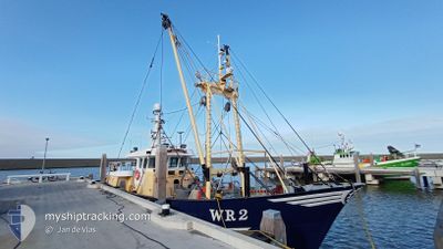
WR2 DUNJA-LYNN
Fishing Vessel
Current Trip
Unknown
| Time Travelled | 43 days |
|---|---|
| Remaining Time | --- |
| Distance Travelled | 843.94 nm |
| Remaining Distance | --- |
| AVG Speed | 5.4 Noeuds |
| MAX Speed | 11.9 Noeuds |
| AVG Wind | 16.1 knots |
| MAX Wind | 25.9 knots |
| MIN Temp | 4.3°C / 39.74°F |
| MAX Temp | 11.6°C / 52.88°F |
| Tirant d eau | 0 m |
| Position reçue | 7 m depuis |
Current Position
| Longitude | 8.15043° |
|---|---|
| Latitude | 54.63016° |
| Etat | Under way using engine |
| Vitesse | 3.1 Noeuds |
| Parcours | 98° |
| Zone | North Sea |
| Station | T-AIS |
| Position reçue | 7 m depuis |
Info
Information
The current position of WR2 DUNJA-LYNN is in North Sea with coordinates 54.63016° / 8.15043° as reported on 2024-04-23 17:44 by AIS to our vessel tracker app. The vessel's current speed is 3.1 Noeuds
The vessel WR2 DUNJA-LYNN (IMO: 8985139, MMSI: 246030000) is a Fishing Vessel that was built in 2000 ( 24 Age ). It's sailing under the flag of [NL] Netherlands.
In this page you can find informations about the vessels current position, last detected port calls, and current voyage information. If the vessels is not in coverage by AIS you will find the latest position.
The current position of WR2 DUNJA-LYNN is detected by our AIS receivers and we are not responsible for the reliability of the data. The last position was recorded while the vessel was in Coverage by the Ais receivers of our vessel tracking app.
Weather
| Temperature | 6.4°C / 43.52°F |
|---|---|
| Wind Speed | 21 knots |
| Direction | 320° NW |
| Pressure | 1010 hPa |
| Humidity | 69.6 % |
| Cloud Coverage | 95 % |
Featured Company
Most Visited Ports (Last year)
| Port | Arrivals | |
|---|---|---|
| 34 | ||
| 4 | ||
| 3 | ||
| 2 | ||
| 2 |
Last Trips
Events
| Heure | Evenement | Détails | Position/ Destination | Info |
|---|---|---|---|---|
| 2024-04-23 12:48 | Dans la zone couverte |
54.73717 / 8.17522
North Sea
|
Vitesse: 2.5 kn Parcours: 171.5° |
|
| 2024-04-23 10:44 | Hors de la zone couverte |
54.81714 / 8.17360
North Sea
|
Vitesse: 2.9 kn Parcours: 180.9° |
|
| 2024-04-23 10:44 | Dans la zone couverte |
54.81714 / 8.17360
North Sea
|
Vitesse: 2.9 kn Parcours: 180.9° |
|
| 2024-04-23 08:21 | Hors de la zone couverte |
54.91813 / 8.15049
North Sea
|
Vitesse: 2.8 kn Parcours: 190.3° |
|
| 2024-04-23 07:16 | Dans la zone couverte |
54.95669 / 8.09307
North Sea
|
Vitesse: 6.2 kn Parcours: 143.7° |
|
| 2024-04-17 22:30 | Hors de la zone couverte |
54.64751 / 8.03270
North Sea
|
Vitesse: 2.8 kn Parcours: 186.2° |
|
| 2024-04-17 22:30 | Dans la zone couverte |
54.64751 / 8.03270
North Sea
|
Vitesse: 2.8 kn Parcours: 186.2° |
|
| 2024-04-17 20:31 | Hors de la zone couverte |
54.73623 / 8.06851
North Sea
|
Vitesse: 2.7 kn Parcours: 192.2° |
|
| 2024-04-17 20:31 | Dans la zone couverte |
54.73623 / 8.06851
North Sea
|
Vitesse: 2.7 kn Parcours: 192.2° |
|
| 2024-04-17 17:53 | Hors de la zone couverte |
54.69135 / 8.04355
North Sea
|
Vitesse: 3.2 kn Parcours: 130.8° |