
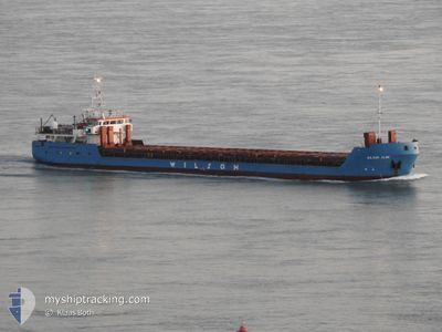
WILSON ELBE
General Cargo
Current Trip
| Time Travelled | 1 day |
|---|---|
| Remaining Time | 1 day |
| Distance Travelled | 259.75 nm |
| Remaining Distance | 410.81 nm |
| AVG Speed | 7.8 Noeuds |
| MAX Speed | 11.2 Noeuds |
| AVG Wind | 18 knots |
| MAX Wind | 28 knots |
| MIN Temp | 5.6°C / 42.08°F |
| MAX Temp | 10°C / 50°F |
| Tirant d eau | 3.3 m |
| Position reçue | Maintenant |
Current Position
| Longitude | 5.44783° |
|---|---|
| Latitude | 55.82791° |
| Etat | Under way using engine |
| Vitesse | 9.2 Noeuds |
| Parcours | 348.6° |
| Zone | North Sea |
| Station | T-AIS |
| Position reçue | Maintenant |
Info
Information
The current position of WILSON ELBE is in North Sea with coordinates 55.82791° / 5.44783° as reported on 2024-04-25 00:33 by AIS to our vessel tracker app. The vessel's current speed is 9.2 Noeuds and is heading at the port of ARDALSTANGEN. The estimated time of arrival as calculated by MyShipTracking vessel tracking app is 2024-04-26 23:01 LT
The vessel WILSON ELBE (IMO: 9060675, MMSI: 314423000) is a General Cargo that was built in 1993 ( 31 Age ). It's sailing under the flag of [BB] Barbados.
In this page you can find informations about the vessels current position, last detected port calls, and current voyage information. If the vessels is not in coverage by AIS you will find the latest position.
The current position of WILSON ELBE is detected by our AIS receivers and we are not responsible for the reliability of the data. The last position was recorded while the vessel was in Coverage by the Ais receivers of our vessel tracking app.
The current draught of WILSON ELBE as reported by AIS is 3.3 meters
Weather
| Temperature | 5.6°C / 42.08°F |
|---|---|
| Wind Speed | 8 knots |
| Direction | 333° NNW |
| Pressure | 1005.9 hPa |
| Humidity | 65.8 % |
| Cloud Coverage | 94 % |
Featured Company
Last Port Calls
| Port | Arrival | Departure | Time In Port |
|---|---|---|---|
| 2024-04-22 19:45 | 2024-04-23 12:21 | 16 h | |
| 2024-04-21 17:36 | 2024-04-22 16:47 | 23 h | |
| 2024-04-19 12:11 | |||
| 2024-04-17 13:25 | |||
| 2024-04-17 13:25 | |||
| 2024-04-13 05:38 | |||
| 2024-04-13 04:46 | 2024-04-13 05:20 | 33 m | |
| 2024-04-02 15:03 | 2024-04-04 16:29 | 2 d | |
| 2024-03-24 06:05 | 2024-03-24 13:29 | 7 h | |
| 2024-03-20 12:07 | 2024-03-20 17:35 | 5 h |
Last Trips
| Origin | Departure | Destination | Arrival | Distance | |
|---|---|---|---|---|---|
| 2024-04-22 18:47 | 2024-04-22 21:45 | 24.85 nm | |||
| 2024-04-19 13:11 | 2024-04-21 19:36 | 301.46 nm | |||
| 2024-04-17 14:25 | 2024-04-17 14:25 | 0.31 nm | |||
| 2024-04-13 06:20 | 2024-04-13 06:38 | 1.27 nm | |||
| 2024-04-04 16:29 | 2024-04-13 05:46 | 1690.14 nm | |||
| 2024-03-24 14:29 | 2024-04-02 15:03 | 162.11 nm | |||
| 2024-03-20 17:35 | 2024-03-24 07:05 | 595.11 nm | |||
| 2024-03-19 16:11 | 2024-03-20 12:07 | 181.15 nm | |||
| 2024-03-14 02:58 | 2024-03-19 08:34 | 966.96 nm | |||
| 2024-03-12 14:44 | 2024-03-14 01:38 | 13.72 nm |
Events
| Heure | Evenement | Détails | Position/ Destination | Info |
|---|---|---|---|---|
| 2024-04-24 21:23 | Changement de zone | Danish part of the North Sea German part of the North Sea |
55.37146 / 5.55863
North Sea
NOARD
|
Vitesse: 8.6 kn Parcours: 11.9° |
| 2024-04-24 21:09 | Changement d'ETA | 2024/04/26 20:00 2024/04/26 17:00 |
55.33844 / 5.54686
NOARD
|
Vitesse: 8.9 kn Parcours: 13.1° |
| 2024-04-24 20:58 | Changement de zone | German part of the North Sea Dutch part of the North Sea |
55.31380 / 5.53799
North Sea
NOARD
|
Vitesse: 8.4 kn Parcours: 10.2° |
| 2024-04-24 20:56 | Etat Changé | Under way using engine Default |
55.30938 / 5.53660
NOARD
|
Vitesse: 8.1 kn Parcours: 9° |
| 2024-04-24 20:56 | Dans la zone couverte |
55.31380 / 5.53799
North Sea
NOARD
|
Vitesse: 8.4 kn Parcours: 10.2° |
|
| 2024-04-24 02:15 | Etat Changé | Default Under way using engine |
53.46401 / 4.71887
NOARD
|
Vitesse: 6.2 kn Parcours: 24.3° |
| 2024-04-24 02:09 | Hors de la zone couverte |
53.45464 / 4.71174
North Sea
NOARD
|
Vitesse: 6.2 kn Parcours: 24.3° |
|
| 2024-04-24 01:22 | Etat Changé | Under way using engine Default |
53.38203 / 4.65850
NOARD
|
Vitesse: 7.3 kn Parcours: 26° |
| 2024-04-24 01:22 | Dans la zone couverte |
53.38203 / 4.65850
North Sea
NOARD
|
Vitesse: 6 kn Parcours: 25.5° |
|
| 2024-04-23 23:27 | Hors de la zone couverte |
53.19410 / 4.51586
North Sea
NOARD
|
Vitesse: 6 kn Parcours: 25.2° |