
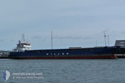
WILSON DUNDEE
General Cargo
Current Trip
| Time Travelled | 3 days |
|---|---|
| Remaining Time | --- |
| Distance Travelled | 134.39 nm |
| Remaining Distance | --- |
| AVG Speed | 8.6 Noeuds |
| MAX Speed | 11.4 Noeuds |
| AVG Wind | 21.4 knots |
| MAX Wind | 32.7 knots |
| MIN Temp | 9.1°C / 48.38°F |
| MAX Temp | 13.2°C / 55.76°F |
| Tirant d eau | 5.9 m |
| Position reçue | 1 m depuis |
Current Position
| Longitude | --- |
|---|---|
| Latitude | --- |
| Etat | Under way using engine |
| Vitesse | 9.4 Noeuds |
| Parcours | 227.4° |
| Zone | North Sea |
| Station | T-AIS |
| Position reçue | 1 m depuis |
Info
Information
The current position of WILSON DUNDEE is in North Sea with coordinates 51.17803° / 1.65181° as reported on 2025-12-09 11:47 by AIS to our vessel tracker app. The vessel's current speed is 9.4 Noeuds and is heading at the port of GAETA. The estimated time of arrival as calculated by MyShipTracking vessel tracking app is 2025-12-20 18:00 LT
The vessel WILSON DUNDEE (IMO: 9390159, MMSI: 314635000) is a General Cargo that was built in 2009 ( 16 Age ). It's sailing under the flag of [BB] Barbados.
In this page you can find informations about the vessels current position, last detected port calls, and current voyage information. If the vessels is not in coverage by AIS you will find the latest position.
The current position of WILSON DUNDEE is detected by our AIS receivers and we are not responsible for the reliability of the data. The last position was recorded while the vessel was in Coverage by the Ais receivers of our vessel tracking app.
The current draught of WILSON DUNDEE as reported by AIS is 5.9 meters
Weather
| Temperature | 13.1°C / 55.58°F |
|---|---|
| Wind Speed | 25 knots |
| Direction | 195° SSW |
| Pressure | 1006.5 hPa |
| Humidity | 76.8 % |
| Cloud Coverage | 100 % |
Featured Company
Last Port Calls
| Port | Arrival | Departure | Time In Port |
|---|---|---|---|
| 2025-12-04 13:42 | 2025-12-06 12:35 | 1 d | |
| 2025-12-02 11:16 | 2025-12-03 20:10 | 1 d | |
| 2025-11-29 13:02 | 2025-11-30 10:23 | 21 h | |
| 2025-11-28 18:23 | 2025-11-28 19:17 | 53 m | |
| 2025-11-27 20:42 | 2025-11-28 17:12 | 20 h | |
| 2025-11-21 09:18 | 2025-11-24 00:06 | 2 d | |
| 2025-11-11 19:12 | 2025-11-12 17:18 | 22 h | |
| 2025-11-11 10:25 | 2025-11-11 18:34 | 8 h | |
| 2025-11-07 06:32 | 2025-11-09 07:14 | 2 d | |
| 2025-11-01 13:27 | 2025-11-04 01:37 | 2 d |
Most Visited Ports (Last year)
| Port | Arrivals | |
|---|---|---|
| 4 | ||
| 3 | ||
| 3 | ||
| 3 | ||
| 3 | ||
| 2 |
Last Trips
| Origin | Departure | Destination | Arrival | Distance | |
|---|---|---|---|---|---|
| 2025-12-03 20:10 | 2025-12-04 13:42 | 169.04 nm | |||
| 2025-11-30 10:23 | 2025-12-02 11:16 | 319.72 nm | |||
| 2025-11-28 19:17 | 2025-11-29 13:02 | 171.48 nm | |||
| 2025-11-28 17:12 | 2025-11-28 18:23 | 7.82 nm | |||
| 2025-11-24 00:06 | 2025-11-27 20:42 | 849.55 nm | |||
| 2025-11-12 17:18 | 2025-11-21 09:18 | 827.57 nm | |||
| 2025-11-11 18:34 | 2025-11-11 19:12 | 6.04 nm | |||
| 2025-11-09 07:14 | 2025-11-11 10:25 | 456.67 nm | |||
| 2025-11-04 01:37 | 2025-11-07 06:32 | 706.49 nm | |||
| 2025-10-31 12:42 | 2025-11-01 13:27 | 111.58 nm |
Events
| Heure | Evenement | Détails | Position/ Destination | Info |
|---|---|---|---|---|
| 2025-12-09 09:23 | Changement d'ETA | 2025/12/20 17:00 2025/12/18 17:00 |
51.51805 / 2.00658
ITGAE
|
Vitesse: 9.5 kn Parcours: 222.6° |
| 2025-12-09 08:58 | Etat Changé | Under way using engine Default |
51.56613 / 2.07417
ITGAE
|
Vitesse: 9.3 kn Parcours: 221° |
| 2025-12-09 08:57 | Etat Changé | Default Under way using engine |
51.56866 / 2.07774
ITGAE
|
Vitesse: 9.2 kn Parcours: 220.5° |
| 2025-12-09 08:47 | Detecté en mer | United Kingdom part of the North Sea |
51.58823 / 2.10578
North Sea
ITGAE
|
Vitesse: 9.1 kn Parcours: 222.2° |
| 2025-12-09 08:47 | Etat Changé | Under way using engine Default |
51.58823 / 2.10578
ITGAE
|
Vitesse: 9.2 kn Parcours: 222° |
| 2025-12-09 08:45 | Dans la zone couverte |
51.58823 / 2.10578
North Sea
ITGAE
|
Vitesse: 9.1 kn Parcours: 222.2° |
|
| 2025-12-08 23:37 | Démarrage | 16.59 nm, North West of MAASVLAKTE - ROTTERDAM |
52.12495 / 3.70783
ITGAE
|
Vitesse: 4.3 kn Parcours: 232° |
| 2025-12-08 21:55 | Etat Changé | Default At anchor |
52.12440 / 3.70906
ITGAE
|
Vitesse: 0.4 kn Parcours: 329° |
| 2025-12-08 21:52 | Hors de la zone couverte |
52.12448 / 3.70940
North Sea
ITGAE
|
Vitesse: 0.4 kn Parcours: 281.2° |
|
| 2025-12-08 21:46 | Etat Changé | At anchor Default |
52.12440 / 3.71030
ITGAE
|
Vitesse: 0.1 kn Parcours: 316° |