
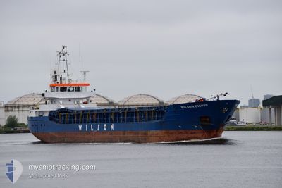
WILSON DIEPPE
General Cargo
Current Trip
| Time Travelled | 7 days |
|---|---|
| Remaining Time | 7 h, 50 mins |
| Distance Travelled | 1236.53 nm |
| Remaining Distance | 79.10 nm |
| AVG Speed | 6.1 Noeuds |
| MAX Speed | 11.2 Noeuds |
| AVG Wind | 18.5 knots |
| MAX Wind | 28 knots |
| MIN Temp | 4.3°C / 39.74°F |
| MAX Temp | 10.8°C / 51.44°F |
| Tirant d eau | 4.6 m |
| Position reçue | Maintenant |
Current Position
| Longitude | 7.45272° |
|---|---|
| Latitude | 63.23113° |
| Etat | Under way using engine |
| Vitesse | 8.6 Noeuds |
| Parcours | 66.2° |
| Zone | Norwegian Sea |
| Station | T-AIS |
| Position reçue | Maintenant |
Info
Information
The current position of WILSON DIEPPE is in Norwegian Sea with coordinates 63.23113° / 7.45272° as reported on 2024-04-25 21:17 by AIS to our vessel tracker app. The vessel's current speed is 8.6 Noeuds and is heading at the port of VALSNESET. The estimated time of arrival as calculated by MyShipTracking vessel tracking app is 2024-04-26 05:08 LT
The vessel WILSON DIEPPE (IMO: 9409625, MMSI: 305813000) is a General Cargo that was built in 2010 ( 14 Age ). It's sailing under the flag of [AG] Antigua Barbuda.
In this page you can find informations about the vessels current position, last detected port calls, and current voyage information. If the vessels is not in coverage by AIS you will find the latest position.
The current position of WILSON DIEPPE is detected by our AIS receivers and we are not responsible for the reliability of the data. The last position was recorded while the vessel was in Coverage by the Ais receivers of our vessel tracking app.
The current draught of WILSON DIEPPE as reported by AIS is 4.6 meters
Weather
| Temperature | 4.9°C / 40.82°F |
|---|---|
| Wind Speed | 6 knots |
| Direction | 214° SW |
| Pressure | 1006.1 hPa |
| Humidity | 63.2 % |
| Cloud Coverage | 100 % |
Featured Company
Last Port Calls
| Port | Arrival | Departure | Time In Port |
|---|---|---|---|
| 2024-04-17 20:13 | 2024-04-18 14:10 | 17 h | |
| 2024-04-17 10:24 | 2024-04-17 19:08 | 8 h | |
| 2024-04-15 03:52 | 2024-04-17 10:23 | 2 d | |
| 2024-04-06 10:35 | 2024-04-08 12:31 | 2 d | |
| 2024-04-04 18:04 | 2024-04-05 13:35 | 19 h | |
| 2024-03-29 19:12 | 2024-03-30 21:08 | 1 d | |
| 2024-03-22 09:22 | 2024-03-28 12:03 | 6 d | |
| 2024-03-22 00:03 | 2024-03-22 06:24 | 6 h | |
| 2024-03-18 21:46 | |||
| 2024-03-14 18:52 | 2024-03-15 19:51 | 1 d |
Last Trips
| Origin | Departure | Destination | Arrival | Distance | |
|---|---|---|---|---|---|
| 2024-04-17 21:08 | 2024-04-17 22:13 | 10.88 nm | |||
| 2024-04-17 12:23 | 2024-04-17 12:24 | 0.01 nm | |||
| 2024-04-08 14:31 | 2024-04-15 05:52 | 980.68 nm | |||
| 2024-04-05 15:35 | 2024-04-06 12:35 | 185.63 nm | |||
| 2024-03-30 21:08 | 2024-04-04 20:04 | 664.03 nm | |||
| 2024-03-28 12:03 | 2024-03-29 19:12 | 291.82 nm | |||
| 2024-03-18 22:46 | 2024-03-22 09:22 | 706.76 nm | |||
| 2024-03-18 22:46 | 2024-03-22 00:03 | 680.96 nm | |||
| 2024-03-12 12:10 | 2024-03-14 18:52 | 520.50 nm | |||
| 2024-03-07 14:31 | 2024-03-11 09:51 | 623.59 nm |
Events
| Heure | Evenement | Détails | Position/ Destination | Info |
|---|---|---|---|---|
| 2024-04-25 06:07 | Detecté en mer | Norwegian part of the Norwegian Sea |
62.19451 / 2.43789
Norwegian Sea
NOBJU
|
Vitesse: 8.9 kn Parcours: 90° |
| 2024-04-25 06:07 | Dans la zone couverte |
62.19451 / 2.43789
Norwegian Sea
NOBJU
|
Vitesse: 8.9 kn Parcours: 90° |
|
| 2024-04-23 11:31 | Etat Changé | Default Under way using engine |
57.60943 / -5.91661
NOBJU
|
Vitesse: 10 kn Parcours: 6.3° |
| 2024-04-23 11:23 | Hors de la zone couverte |
57.58798 / -5.91494
Inner Seas off the West Coast of Scotland
NOBJU
|
Vitesse: 10 kn Parcours: 6.3° |
|
| 2024-04-23 09:16 | Démarrage | 0.9 nm, West of KYLEAKIN |
57.27697 / -5.75025
NOBJU
|
Vitesse: 3.1 kn Parcours: 329° |
| 2024-04-23 09:03 | Etat Changé | Under way using engine Moored |
57.27459 / -5.75300
NOBJU
|
Vitesse: Parcours: 181° |
| 2024-04-23 08:55 | Tirant d'eau modifié | 4.6 5.8 |
57.27459 / -5.75299
NOBJU
|
Vitesse: Parcours: 181° |
| 2024-04-23 08:55 | Changement de destination | NOBJU GBKYL |
57.27459 / -5.75299
NOBJU
|
Vitesse: Parcours: 181° |
| 2024-04-23 08:55 | Changement d'ETA | 2024/04/26 03:00 2024/04/21 14:00 |
57.27459 / -5.75299
NOBJU
|
Vitesse: Parcours: 181° |
| 2024-04-22 21:39 | Etat Changé | Moored Default |
57.27459 / -5.75300
GBKYL
|
Vitesse: Parcours: 181° |