
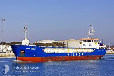
VERTOM MARJOLIJN
General Cargo
Current Trip
| Time Travelled | 1 day |
|---|---|
| Remaining Time | 16 h, 53 mins |
| Distance Travelled | 256.10 nm |
| Remaining Distance | 151.59 nm |
| AVG Speed | 9 Noeuds |
| MAX Speed | 10.2 Noeuds |
| AVG Wind | 23.3 knots |
| MAX Wind | 26.8 knots |
| MIN Temp | 5.8°C / 42.44°F |
| MAX Temp | 9.6°C / 49.28°F |
| Tirant d eau | 5 m |
| Position reçue | Maintenant |
Current Position
| Longitude | 1.08507° |
|---|---|
| Latitude | 53.03742° |
| Etat | Under way using engine |
| Vitesse | 8.8 Noeuds |
| Parcours | 109.6° |
| Zone | North Sea |
| Station | T-AIS |
| Position reçue | Maintenant |
Info
Information
The current position of VERTOM MARJOLIJN is in North Sea with coordinates 53.03742° / 1.08507° as reported on 2024-04-19 14:42 by AIS to our vessel tracker app. The vessel's current speed is 8.8 Noeuds and is heading at the port of ERITH. The estimated time of arrival as calculated by MyShipTracking vessel tracking app is 2024-04-20 07:35 LT
The vessel VERTOM MARJOLIJN (IMO: 9507350, MMSI: 253742000) is a General Cargo that was built in 2010 ( 14 Age ). It's sailing under the flag of [LU] Luxembourg.
In this page you can find informations about the vessels current position, last detected port calls, and current voyage information. If the vessels is not in coverage by AIS you will find the latest position.
The current position of VERTOM MARJOLIJN is detected by our AIS receivers and we are not responsible for the reliability of the data. The last position was recorded while the vessel was in Coverage by the Ais receivers of our vessel tracking app.
The current draught of VERTOM MARJOLIJN as reported by AIS is 5 meters
Weather
| Temperature | 7.7°C / 45.86°F |
|---|---|
| Wind Speed | 26 knots |
| Direction | 341° NNW |
| Pressure | 1016.9 hPa |
| Humidity | 67.1 % |
| Cloud Coverage | 9 % |
Featured Company
Last Port Calls
| Port | Arrival | Departure | Time In Port |
|---|---|---|---|
| 2024-04-13 18:09 | 2024-04-18 10:33 | 4 d | |
| 2024-04-09 10:43 | 2024-04-11 02:09 | 1 d | |
| 2024-03-31 22:54 | 2024-04-05 15:54 | 4 d | |
| 2024-03-26 13:31 | 2024-03-28 01:15 | 1 d | |
| 2024-03-25 18:50 | 2024-03-25 19:14 | 23 m | |
| 2024-03-24 22:24 | 2024-03-25 17:35 | 19 h | |
| 2024-03-21 23:03 | 2024-03-23 14:32 | 1 d | |
| 2024-03-12 22:42 | 2024-03-14 18:04 | 1 d | |
| 2024-03-11 20:36 | 2024-03-11 21:08 | 32 m | |
| 2024-03-10 21:00 | 2024-03-11 19:53 | 22 h |
Last Trips
| Origin | Departure | Destination | Arrival | Distance | |
|---|---|---|---|---|---|
| 2024-04-11 04:09 | 2024-04-13 19:09 | 432.51 nm | |||
| 2024-04-05 16:54 | 2024-04-09 12:43 | 621.83 nm | |||
| 2024-03-28 02:15 | 2024-03-31 23:54 | 617.82 nm | |||
| 2024-03-25 20:14 | 2024-03-26 14:31 | 147.55 nm | |||
| 2024-03-25 18:35 | 2024-03-25 19:50 | 10.65 nm | |||
| 2024-03-23 14:32 | 2024-03-24 23:24 | 277.58 nm | |||
| 2024-03-14 19:04 | 2024-03-21 23:03 | 543.31 nm | |||
| 2024-03-11 22:08 | 2024-03-12 23:42 | 244.43 nm | |||
| 2024-03-11 20:53 | 2024-03-11 21:36 | 3.18 nm | |||
| 2024-03-10 21:26 | 2024-03-10 22:00 | 3.12 nm |
Events
| Heure | Evenement | Détails | Position/ Destination | Info |
|---|---|---|---|---|
| 2024-04-19 13:42 | Dans la zone couverte |
53.13799 / .90958
North Sea
GBERI
|
Vitesse: 8.9 kn Parcours: 137.1° |
|
| 2024-04-19 08:27 | Hors de la zone couverte |
53.82733 / .40373
North Sea
GBERI
|
Vitesse: 8.6 kn Parcours: 148.8° |
|
| 2024-04-19 05:30 | Dans la zone couverte |
54.19321 / .01563
North Sea
GBERI
|
Vitesse: 9 kn Parcours: 148.5° |
|
| 2024-04-18 21:07 | Etat Changé | Default Under way using engine |
55.36990 / -1.22564
GBERI
|
Vitesse: 9.4 kn Parcours: 158.6° |
| 2024-04-18 20:44 | Hors de la zone couverte |
55.42751 / -1.27182
North Sea
GBERI
|
Vitesse: 9.4 kn Parcours: 158.6° |
|
| 2024-04-18 15:33 | Tirant d'eau modifié | 5 4.8 |
56.04939 / -2.08360
GBERI
|
Vitesse: 8.9 kn Parcours: 132.7° |
| 2024-04-18 15:33 | Changement de destination | GBERI GBMON |
56.04939 / -2.08360
GBERI
|
Vitesse: 8.9 kn Parcours: 132.7° |
| 2024-04-18 15:33 | Changement d'ETA | 2024/04/20 07:00 2024/04/13 04:00 |
56.04939 / -2.08360
GBERI
|
Vitesse: 8.9 kn Parcours: 132.7° |
| 2024-04-18 15:09 | Etat Changé | Under way using engine Default |
56.09142 / -2.16148
GBMON
|
Vitesse: 9 kn Parcours: 131° |
| 2024-04-18 15:09 | Dans la zone couverte |
56.08921 / -2.15744
North Sea
|
Vitesse: 9 kn Parcours: 134° |