
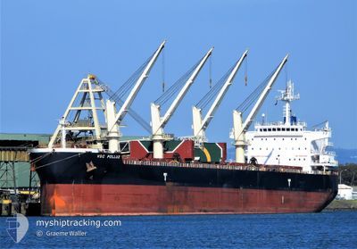
VSC POLLUX
Cargo
Current Trip
| Time Travelled | 11 days |
|---|---|
| Remaining Time | --- |
| Distance Travelled | 2759.94 nm |
| Remaining Distance | --- |
| AVG Speed | 12.2 Noeuds |
| MAX Speed | 12.2 Noeuds |
| AVG Wind | 12.2 knots |
| MAX Wind | 23 knots |
| MIN Temp | 15.6°C / 60.08°F |
| MAX Temp | 26.8°C / 80.24°F |
| Tirant d eau | 6.7 m |
| Position reçue | 1 h, 58 m depuis |
Current Position
| Longitude | 34.51566° |
|---|---|
| Latitude | 31.80099° |
| Etat | At anchor |
| Vitesse | 0.2 Noeuds |
| Parcours | 252° |
| Zone | Mediterranean Sea - Eastern Basin |
| Station | T-AIS |
| Position reçue | 1 h, 58 m depuis |
Info
Information
The current position of VSC POLLUX is in Mediterranean Sea - Eastern Basin with coordinates 31.80099° / 34.51566° as reported on 2024-04-19 02:33 by AIS to our vessel tracker app. The vessel's current speed is 0.2 Noeuds
The vessel VSC POLLUX (IMO: 9692650, MMSI: 636016353) is a Cargo It's sailing under the flag of [LR] Liberia.
In this page you can find informations about the vessels current position, last detected port calls, and current voyage information. If the vessels is not in coverage by AIS you will find the latest position.
The current position of VSC POLLUX is detected by our AIS receivers and we are not responsible for the reliability of the data. The last position was recorded while the vessel was in Coverage by the Ais receivers of our vessel tracking app.
The current draught of VSC POLLUX as reported by AIS is 6.7 meters
Weather
| Temperature | 18.8°C / 65.84°F |
|---|---|
| Wind Speed | 2 knots |
| Direction | 262° W |
| Pressure | 1013.3 hPa |
| Humidity | 86 % |
| Cloud Coverage | 2 % |
Featured Company
Last Port Calls
| Port | Arrival | Departure | Time In Port |
|---|---|---|---|
| 2024-04-10 06:32 | 2024-04-10 15:55 | 9 h | |
| 2024-04-03 04:42 | 2024-04-07 15:07 | 4 d | |
| 2024-03-31 04:29 | 2024-03-31 14:42 | 10 h | |
| 2024-03-02 11:03 | 2024-03-03 05:18 | 18 h | |
| 2024-02-03 17:39 | 2024-02-03 18:34 | 55 m | |
| 2024-02-02 06:09 | 2024-02-02 06:47 | 37 m |
Last Trips
| Origin | Departure | Destination | Arrival | Distance | |
|---|---|---|---|---|---|
| 2024-04-07 18:07 | 2024-04-10 08:32 | 636.37 nm | |||
| 2024-03-03 02:18 | 2024-04-03 07:42 | 7072.38 nm | |||
| 2024-03-03 02:18 | 2024-03-31 06:29 | 6343.48 nm | |||
| 2024-02-03 15:34 | 2024-03-02 08:03 | 29.91 nm | |||
| 2024-02-02 03:47 | 2024-02-03 14:39 | 9.75 nm | |||
| 2024-01-17 15:21 | 2024-02-02 03:09 | 3120.34 nm |
Events
| Heure | Evenement | Détails | Position/ Destination | Info |
|---|---|---|---|---|
| 2024-04-19 02:33 | Hors de la zone couverte |
31.80099 / 34.51566
Mediterranean Sea - Eastern Basin
|
Vitesse: 0.2 kn Parcours: 283.9° |
|
| 2024-04-19 00:34 | Dans la zone couverte |
31.80083 / 34.51559
Mediterranean Sea - Eastern Basin
|
Vitesse: 0.1 kn Parcours: 134.4° |
|
| 2024-04-18 20:58 | Hors de la zone couverte |
33.81826 / 35.49081
Mediterranean Sea - Eastern Basin
|
Vitesse: Parcours: 263° |
|
| 2024-04-18 19:37 | Arret | 6.14 nm, South of BEIRUT |
33.81828 / 35.49078
IL ASH
|
Vitesse: Parcours: 305° |
| 2024-04-18 19:32 | Dans la zone couverte |
33.82183 / 35.48533
Mediterranean Sea - Eastern Basin
|
Vitesse: 102.2 kn Parcours: 308.2° |
|
| 2024-04-18 17:38 | Hors de la zone couverte |
31.79922 / 34.51508
Mediterranean Sea - Eastern Basin
|
Vitesse: 0.1 kn Parcours: 327° |
|
| 2024-04-18 17:00 | Dans la zone couverte |
31.79910 / 34.51495
Mediterranean Sea - Eastern Basin
|
Vitesse: 0.1 kn Parcours: 335° |
|
| 2024-04-18 12:55 | Hors de la zone couverte |
33.81832 / 35.49066
Mediterranean Sea - Eastern Basin
|
Vitesse: 0.1 kn Parcours: 278.4° |
|
| 2024-04-18 08:28 | Arret | 6.14 nm, South of BEIRUT |
33.81827 / 35.49080
IL ASH
|
Vitesse: 0.1 kn Parcours: 268° |
| 2024-04-18 08:23 | Démarrage | 6.01 nm, South of BEIRUT |
33.82003 / 35.49245
IL ASH
|
Vitesse: 16.6 kn Parcours: 68.3° |