
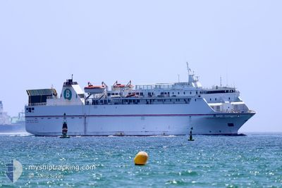
VOLCAN DE TAUCE
Ro-Ro/Passenger Ship
Current Trip
| Trip Time | 8 h, 11 mins |
|---|---|
| Trip Distance | 88.18 nm |
| AVG Speed | 11.5 Noeuds |
| MAX Speed | 15.7 Noeuds |
| Tirant d eau | 4.6 m |
| AVG Wind | 18.9 knots |
| MAX Wind | 23.1 knots |
| MIN Temp | 15.4°C / 59.72°F |
| MAX Temp | 17.1°C / 62.78°F |
| Position reçue | 1 m depuis |
Current Position
| Longitude | -5.51889° |
|---|---|
| Latitude | 35.88076° |
| Etat | Under way using engine |
| Vitesse | 1.8 Noeuds |
| Parcours | 256° |
| Zone | Strait of Gibraltar |
| Station | T-AIS |
| Position reçue | 1 m depuis |
Info
Information
The current position of VOLCAN DE TAUCE is in Strait of Gibraltar with coordinates 35.88076° / -5.51889° as reported on 2024-04-19 20:42 by AIS to our vessel tracker app. The vessel's current speed is 1.8 Noeuds and is currently inside the port of TANGER MED.
The vessel VOLCAN DE TAUCE (IMO: 9081588, MMSI: 224761000) is a Ro-Ro/Passenger Ship that was built in 1995 ( 29 Age ). It's sailing under the flag of [ES] Spain.
In this page you can find informations about the vessels current position, last detected port calls, and current voyage information. If the vessels is not in coverage by AIS you will find the latest position.
The current position of VOLCAN DE TAUCE is detected by our AIS receivers and we are not responsible for the reliability of the data. The last position was recorded while the vessel was in Coverage by the Ais receivers of our vessel tracking app.
The current draught of VOLCAN DE TAUCE as reported by AIS is 4.6 meters
Weather
| Temperature | 15.4°C / 59.72°F |
|---|---|
| Wind Speed | 19 knots |
| Direction | 87° E |
| Pressure | 1016.6 hPa |
| Humidity | 84.2 % |
| Cloud Coverage | 100 % |
Featured Company
Last Port Calls
| Port | Arrival | Departure | Time In Port |
|---|---|---|---|
| 2024-04-19 20:36 | |||
| 2024-04-19 08:01 | 2024-04-19 12:25 | 4 h | |
| 2024-04-18 19:02 | 2024-04-19 00:34 | 5 h | |
| 2024-04-18 07:07 | 2024-04-18 11:56 | 4 h | |
| 2024-04-17 19:19 | 2024-04-18 00:15 | 4 h | |
| 2024-04-17 07:01 | 2024-04-17 11:43 | 4 h | |
| 2024-04-16 20:09 | 2024-04-17 00:14 | 4 h | |
| 2024-04-16 06:55 | 2024-04-16 12:30 | 5 h | |
| 2024-04-15 19:35 | 2024-04-16 00:05 | 4 h | |
| 2024-04-15 07:28 | 2024-04-15 12:07 | 4 h |
Most Visited Ports (Last year)
| Port | Arrivals | |
|---|---|---|
| 507 | ||
| 327 | ||
| 200 | ||
| 1 |
Last Trips
| Origin | Departure | Destination | Arrival | Distance | |
|---|---|---|---|---|---|
| 2024-04-19 14:25 | 2024-04-19 21:36 | 88.18 nm | |||
| 2024-04-19 01:34 | 2024-04-19 10:01 | 109.75 nm | |||
| 2024-04-18 13:56 | 2024-04-18 20:02 | 110.92 nm | |||
| 2024-04-18 01:15 | 2024-04-18 09:07 | 109.91 nm | |||
| 2024-04-17 13:43 | 2024-04-17 20:19 | 113.08 nm | |||
| 2024-04-17 01:14 | 2024-04-17 09:01 | 109.97 nm | |||
| 2024-04-16 14:30 | 2024-04-16 21:09 | 111.22 nm | |||
| 2024-04-16 01:05 | 2024-04-16 08:55 | 110.66 nm | |||
| 2024-04-15 14:07 | 2024-04-15 20:35 | 111.33 nm | |||
| 2024-04-15 01:35 | 2024-04-15 09:28 | 109.50 nm |
Events
| Heure | Evenement | Détails | Position/ Destination | Info |
|---|---|---|---|---|
| 2024-04-19 20:36 | Port d'arrivée |
|
35.88341 / -5.52090
[MA] TANGER MED
|
Vitesse: 6.8 kn Parcours: 169.1° |
| 2024-04-19 20:18 | Etat Changé | Under way using engine Default |
35.90724 / -5.52539
MAPTM<>ESMOT
|
Vitesse: 1.6 kn Parcours: 184° |
| 2024-04-19 20:14 | Etat Changé | Default Under way using engine |
35.90737 / -5.52390
MAPTM<>ESMOT
|
Vitesse: 1.1 kn Parcours: 198° |
| 2024-04-19 19:36 | Etat Changé | Under way using engine Default |
35.93453 / -5.50856
MAPTM<>ESMOT
|
Vitesse: 15.3 kn Parcours: 214° |
| 2024-04-19 19:30 | Etat Changé | Default Under way using engine |
35.95430 / -5.49395
MAPTM<>ESMOT
|
Vitesse: 15.3 kn Parcours: 213.9° |
| 2024-04-19 19:30 | Changement de zone | Moroccan part of the Strait of Gibraltar Spanish part of the Strait of Gibraltar |
35.95465 / -5.49365
Strait of Gibraltar
MAPTM<>ESMOT
|
Vitesse: 15.3 kn Parcours: 213.9° |
| 2024-04-19 19:02 | Changement de zone | Spanish part of the Strait of Gibraltar Gibraltarian part of the Strait of Gibraltar |
36.01943 / -5.37297
Strait of Gibraltar
MAPTM<>ESMOT
|
Vitesse: 14.4 kn Parcours: 243.9° |
| 2024-04-19 18:55 | Detecté en mer | Gibraltarian part of the Strait of Gibraltar |
36.03157 / -5.34317
Strait of Gibraltar
MAPTM<>ESMOT
|
Vitesse: 14.8 kn Parcours: 244.7° |
| 2024-04-19 17:59 | Changement de zone | Gibraltarian part of the Alboran Sea Spanish part of the Alboran Sea |
36.12832 / -5.10062
Alboran Sea
MAPTM<>ESMOT
|
Vitesse: 14.7 kn Parcours: 244° |
| 2024-04-19 14:52 | Etat Changé | Under way using engine Default |
36.48704 / -4.23387
MAPTM<>ESMOT
|
Vitesse: 15.4 kn Parcours: 246° |