
VOGE SOPHIE
Cargo
Current Trip
| Time Travelled | 3 days |
|---|---|
| Remaining Time | 50 mins |
| Distance Travelled | 492.35 nm |
| Remaining Distance | 20.39 nm |
| AVG Speed | 12.3 Noeuds |
| MAX Speed | 15.7 Noeuds |
| AVG Wind | 8.3 knots |
| MAX Wind | 18.1 knots |
| MIN Temp | 8°C / 46.4°F |
| MAX Temp | 20.4°C / 68.72°F |
| Tirant d eau | 7.1 m |
| Position reçue | 1 m depuis |
Current Position
| Longitude | 23.05755° |
|---|---|
| Latitude | 39.07287° |
| Etat | Under way using engine |
| Vitesse | 8.9 Noeuds |
| Parcours | 282.8° |
| Zone | Sea of Marmara |
| Station | T-AIS |
| Position reçue | 1 m depuis |
Info
Information
The current position of VOGE SOPHIE is in Sea of Marmara with coordinates 39.07287° / 23.05755° as reported on 2024-04-20 01:31 by AIS to our vessel tracker app. The vessel's current speed is 8.9 Noeuds and is heading at the port of VOLOS. The estimated time of arrival as calculated by MyShipTracking vessel tracking app is 2024-04-20 02:23 LT
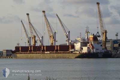
The vessel VOGE SOPHIE (IMO: 9830123, MMSI: 636092828) is a Cargo It's sailing under the flag of [LR] Liberia.
In this page you can find informations about the vessels current position, last detected port calls, and current voyage information. If the vessels is not in coverage by AIS you will find the latest position.
The current position of VOGE SOPHIE is detected by our AIS receivers and we are not responsible for the reliability of the data. The last position was recorded while the vessel was in Coverage by the Ais receivers of our vessel tracking app.
The current draught of VOGE SOPHIE as reported by AIS is 7.1 meters
Weather
| Temperature | 8.4°C / 47.12°F |
|---|---|
| Wind Speed | 10 knots |
| Direction | 261° W |
| Pressure | 1001 hPa |
| Humidity | 92.2 % |
| Cloud Coverage | 100 % |
Featured Company
Most Visited Ports (Last year)
| Port | Arrivals | |
|---|---|---|
| 2 | ||
| 2 | ||
| 2 | ||
| 1 | ||
| 1 | ||
| 1 |
Events
| Heure | Evenement | Détails | Position/ Destination | Info |
|---|---|---|---|---|
| 2024-04-20 01:31 | Changement de zone | Greek part of the Aegean Sea Turkish part of the Sea of Marmara |
39.07287 / 23.05755
Aegean Sea
GRVOL
|
Vitesse: 8.9 kn Parcours: 282.8° |
| 2024-04-20 01:31 | Etat Changé | Under way using engine Default |
39.07287 / 23.05755
GRVOL
|
Vitesse: 8.6 kn Parcours: 280° |
| 2024-04-20 01:23 | Dans la zone couverte |
39.07287 / 23.05755
Aegean Sea
GRVOL
|
Vitesse: 8.9 kn Parcours: 282.8° |
|
| 2024-04-19 11:15 | Hors de la zone couverte |
40.12484 / 26.36963
Sea of Marmara
GRVOL
|
Vitesse: 15.2 kn Parcours: 221° |
|
| 2024-04-19 10:44 | Changement d'ETA | 2024/04/20 04:00 2024/04/20 09:00 |
40.21448 / 26.42295
GRVOL
|
Vitesse: 14.1 kn Parcours: 245.2° |
| 2024-04-19 10:37 | Dans la zone couverte |
40.22472 / 26.44778
Sea of Marmara
GRVOL
|
Vitesse: 13.8 kn Parcours: 237.2° |
|
| 2024-04-19 01:57 | Hors de la zone couverte |
40.65914 / 27.34580
Sea of Marmara
GRVOL
|
Vitesse: 12.9 kn Parcours: 243.4° |
|
| 2024-04-18 23:40 | Dans la zone couverte |
40.79364 / 27.93543
Sea of Marmara
GRVOL
|
Vitesse: 12.8 kn Parcours: 263.6° |
|
| 2024-04-18 21:14 | Hors de la zone couverte |
40.88443 / 28.60454
Sea of Marmara
GRVOL
|
Vitesse: 12.3 kn Parcours: 262° |
|
| 2024-04-18 18:16 | Changement de zone | Turkish part of the Sea of Marmara Turkish part of the Black Sea |
41.22918 / 29.12819
Sea of Marmara
GRVOL
|
Vitesse: 8 kn Parcours: 187.4° |