
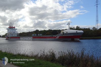
VICTORIABORG
General Cargo
Current Trip
| Time Travelled | 10 days |
|---|---|
| Remaining Time | --- |
| Distance Travelled | 2714.54 nm |
| Remaining Distance | --- |
| AVG Speed | 10.8 Noeuds |
| MAX Speed | 14.6 Noeuds |
| AVG Wind | 14.2 knots |
| MAX Wind | 33.5 knots |
| MIN Temp | 1.1°C / 33.98°F |
| MAX Temp | 17.3°C / 63.14°F |
| Tirant d eau | 7.8 m |
| Position reçue | 1 h, 8 m depuis |
Current Position
| Longitude | -6.84664° |
|---|---|
| Latitude | 36.03560° |
| Etat | Under way using engine |
| Vitesse | 10.3 Noeuds |
| Parcours | 105.8° |
| Zone | North Atlantic Ocean |
| Station | T-AIS |
| Position reçue | 1 h, 8 m depuis |
Info
Information
The current position of VICTORIABORG is in North Atlantic Ocean with coordinates 36.03560° / -6.84664° as reported on 2024-04-25 10:01 by AIS to our vessel tracker app. The vessel's current speed is 10.3 Noeuds and is heading at the port of MERSIN. The estimated time of arrival as calculated by MyShipTracking vessel tracking app is 2024-05-04 08:00 LT
The vessel VICTORIABORG (IMO: 9234276, MMSI: 246029000) is a General Cargo that was built in 2001 ( 23 Age ). It's sailing under the flag of [NL] Netherlands.
In this page you can find informations about the vessels current position, last detected port calls, and current voyage information. If the vessels is not in coverage by AIS you will find the latest position.
The current position of VICTORIABORG is detected by our AIS receivers and we are not responsible for the reliability of the data. The last position was recorded while the vessel was in Coverage by the Ais receivers of our vessel tracking app.
The current draught of VICTORIABORG as reported by AIS is 7.8 meters
Weather
| Temperature | 17°C / 62.6°F |
|---|---|
| Wind Speed | 11 knots |
| Direction | 337° NNW |
| Pressure | 1012.7 hPa |
| Humidity | 72.3 % |
| Cloud Coverage | 31 % |
Featured Company
Last Port Calls
| Port | Arrival | Departure | Time In Port |
|---|---|---|---|
| 2024-04-13 21:30 | 2024-04-14 16:18 | 18 h | |
| 2024-03-29 15:45 | 2024-04-12 21:22 | 14 d | |
| 2024-03-26 12:17 | 2024-03-29 06:03 | 2 d | |
| 2024-03-19 21:25 | 2024-03-21 10:40 | 1 d | |
| 2024-03-17 16:45 | 2024-03-19 20:53 | 2 d | |
| 2024-03-07 21:24 | |||
| 2024-02-14 01:25 | 2024-02-14 18:04 | 16 h | |
| 2024-02-05 13:12 | 2024-02-06 15:20 | 1 d | |
| 2024-02-03 14:01 |
Last Trips
| Origin | Departure | Destination | Arrival | Distance | |
|---|---|---|---|---|---|
| 2024-04-13 00:22 | 2024-04-13 23:30 | 257.14 nm | |||
| 2024-03-29 08:03 | 2024-03-29 17:45 | 73.10 nm | |||
| 2024-03-21 11:40 | 2024-03-26 14:17 | 1256.00 nm | |||
| 2024-03-19 21:53 | 2024-03-19 22:25 | 1.75 nm | |||
| 2024-03-07 22:24 | 2024-03-17 17:45 | 1199.29 nm | |||
| 2024-02-06 16:20 | 2024-02-14 01:25 | 1468.20 nm | |||
| 2024-02-03 15:01 | 2024-02-05 14:12 | 546.94 nm |
Events
| Heure | Evenement | Détails | Position/ Destination | Info |
|---|---|---|---|---|
| 2024-04-25 10:06 | Etat Changé | Default Under way using engine |
36.03085 / -6.82622
MERSIN
|
Vitesse: 10.3 kn Parcours: 105.8° |
| 2024-04-25 10:01 | Etat Changé | Under way using engine Default |
36.03560 / -6.84664
MERSIN
|
Vitesse: 10.3 kn Parcours: 107° |
| 2024-04-25 10:01 | Hors de la zone couverte |
36.03560 / -6.84664
North Atlantic Ocean
MERSIN
|
Vitesse: 10.3 kn Parcours: 105.8° |
|
| 2024-04-25 09:46 | Etat Changé | Default Under way using engine |
36.04628 / -6.89375
MERSIN
|
Vitesse: 10.2 kn Parcours: 105.1° |
| 2024-04-25 09:38 | Etat Changé | Under way using engine Default |
36.05282 / -6.92368
MERSIN
|
Vitesse: 10.3 kn Parcours: 106° |
| 2024-04-25 08:46 | Etat Changé | Default Under way using engine |
36.09064 / -7.09788
MERSIN
|
Vitesse: 10.4 kn Parcours: 105.2° |
| 2024-04-25 08:37 | Etat Changé | Under way using engine Default |
36.09786 / -7.13293
MERSIN
|
Vitesse: 10.3 kn Parcours: 105° |
| 2024-04-25 08:02 | Etat Changé | Default Under way using engine |
36.12571 / -7.25063
MERSIN
|
Vitesse: 10.4 kn Parcours: 107.7° |
| 2024-04-25 07:37 | Changement de zone | Spanish part of the North Atlantic Ocean Portuguese part of the North Atlantic Ocean |
36.14746 / -7.34058
North Atlantic Ocean
MERSIN
|
Vitesse: 10.5 kn Parcours: 106.2° |
| 2024-04-25 07:37 | Etat Changé | Under way using engine Default |
36.14746 / -7.34058
MERSIN
|
Vitesse: 10 kn Parcours: 105° |