
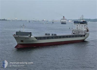
VEERSEBORG
General Cargo
Current Trip
| Time Travelled | --- |
|---|---|
| Remaining Time | --- |
| Distance Travelled | --- |
| Remaining Distance | --- |
| AVG Speed | --- |
| MAX Speed | --- |
| AVG Wind | --- |
| MAX Wind | --- |
| MIN Temp | --- |
| MAX Temp | --- |
| Tirant d eau | 5.5 m |
| Position reçue | 2 d depuis |
Current Position
| Longitude | 31.73802° |
|---|---|
| Latitude | 31.64136° |
| Etat | At anchor |
| Vitesse | 0.3 Noeuds |
| Parcours | --- |
| Zone | Mediterranean Sea - Eastern Basin |
| Station | T-AIS |
| Position reçue | 2 d depuis |
Info
Information
The current position of VEERSEBORG is in Mediterranean Sea - Eastern Basin with coordinates 31.64136° / 31.73802° as reported on 2024-04-17 19:53 by AIS to our vessel tracker app. The vessel's current speed is 0.3 Noeuds
The vessel VEERSEBORG (IMO: 9184653, MMSI: 341599000) is a General Cargo that was built in 1998 ( 26 Age ). It's sailing under the flag of [KN] St Kitts Nevis.
In this page you can find informations about the vessels current position, last detected port calls, and current voyage information. If the vessels is not in coverage by AIS you will find the latest position.
The current position of VEERSEBORG is detected by our AIS receivers and we are not responsible for the reliability of the data. The last position was recorded while the vessel was in Coverage by the Ais receivers of our vessel tracking app.
The current draught of VEERSEBORG as reported by AIS is 5.5 meters
Weather
| Temperature | 18.4°C / 65.12°F |
|---|---|
| Wind Speed | 4 knots |
| Direction | 58° ENE |
| Pressure | 1012.6 hPa |
| Humidity | 75.1 % |
| Cloud Coverage | 31 % |
Featured Company
Last Port Calls
| Port | Arrival | Departure | Time In Port |
|---|---|---|---|
| 2024-04-15 02:44 | |||
| 2024-04-11 20:39 | |||
| 2024-02-16 17:46 | 2024-02-16 18:41 | 54 m | |
| 2024-02-05 12:22 | 2024-02-13 12:27 | 8 d |
Most Visited Ports (Last year)
| Port | Arrivals | |
|---|---|---|
| 6 | ||
| 2 | ||
| 2 | ||
| 1 | ||
| 1 | ||
| 1 |
Last Trips
| Origin | Departure | Destination | Arrival | Distance | |
|---|---|---|---|---|---|
| 2024-02-16 19:41 | 2024-04-11 23:39 | 8273.43 nm | |||
| 2024-02-13 15:27 | 2024-02-16 18:46 | 792.42 nm | |||
| 2024-01-24 16:22 | 2024-02-05 15:22 | 1881.75 nm |
Events
| Heure | Evenement | Détails | Position/ Destination | Info |
|---|---|---|---|---|
| 2024-04-17 19:56 | Etat Changé | Default At anchor |
31.64137 / 31.73788
DAMIETTA
|
Vitesse: 0.3 kn Parcours: 511° |
| 2024-04-17 19:53 | Hors de la zone couverte |
31.64136 / 31.73802
Mediterranean Sea - Eastern Basin
DAMIETTA
|
Vitesse: 0.3 kn Parcours: 272.2° |
|
| 2024-04-17 19:51 | Etat Changé | At anchor Default |
31.64134 / 31.73818
DAMIETTA
|
Vitesse: 0.1 kn Parcours: -1° |
| 2024-04-17 19:48 | Etat Changé | Default At anchor |
31.64136 / 31.73823
DAMIETTA
|
Vitesse: Parcours: 511° |
| 2024-04-17 19:15 | Etat Changé | At anchor Default |
31.64085 / 31.73659
DAMIETTA
|
Vitesse: 0.1 kn Parcours: -1° |
| 2024-04-17 19:00 | Dans la zone couverte |
31.64085 / 31.73659
Mediterranean Sea - Eastern Basin
DAMIETTA
|
Vitesse: Parcours: 0° |
|
| 2024-04-17 16:51 | Etat Changé | Default At anchor |
31.64067 / 31.73650
DAMIETTA
|
Vitesse: 0.1 kn Parcours: 511° |
| 2024-04-17 16:45 | Hors de la zone couverte |
31.64053 / 31.73644
Mediterranean Sea - Eastern Basin
DAMIETTA
|
Vitesse: 0.1 kn Parcours: 511° |
|
| 2024-04-17 16:39 | Etat Changé | At anchor Default |
31.64051 / 31.73648
DAMIETTA
|
Vitesse: 0.1 kn Parcours: 141° |
| 2024-04-17 16:36 | Etat Changé | Default At anchor |
31.64060 / 31.73658
DAMIETTA
|
Vitesse: 0.3 kn Parcours: 114° |