
ULTRA ESTERHAZY
Cargo
Current Trip
| Time Travelled | 14 days |
|---|---|
| Remaining Time | 8 days |
| Distance Travelled | 4135.90 nm |
| Remaining Distance | 2446.40 nm |
| AVG Speed | 11.8 Noeuds |
| MAX Speed | 16 Noeuds |
| AVG Wind | 12.3 knots |
| MAX Wind | 31 knots |
| MIN Temp | 7.9°C / 46.22°F |
| MAX Temp | 28.7°C / 83.66°F |
| Tirant d eau | 10.2 m |
| Position reçue | 3 d depuis |
Current Position
| Longitude | -26.49472° |
|---|---|
| Latitude | 15.08742° |
| Etat | Under way using engine |
| Vitesse | 13 Noeuds |
| Parcours | 196.6° |
| Zone | North Atlantic Ocean |
| Station | T-AIS |
| Position reçue | 3 d depuis |
Info
Information
The current position of ULTRA ESTERHAZY is in North Atlantic Ocean with coordinates 15.08742° / -26.49472° as reported on 2024-04-20 12:49 by AIS to our vessel tracker app. The vessel's current speed is 13 Noeuds and is heading at the port of MONTEVIDEO. The estimated time of arrival as calculated by MyShipTracking vessel tracking app is 2024-05-02 10:24 LT
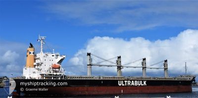
The vessel ULTRA ESTERHAZY (IMO: 9643946, MMSI: 373821000) is a Cargo It's sailing under the flag of [PA] Panama.
In this page you can find informations about the vessels current position, last detected port calls, and current voyage information. If the vessels is not in coverage by AIS you will find the latest position.
The current position of ULTRA ESTERHAZY is detected by our AIS receivers and we are not responsible for the reliability of the data. The last position was recorded while the vessel was in Coverage by the Ais receivers of our vessel tracking app.
The current draught of ULTRA ESTERHAZY as reported by AIS is 10.2 meters
Weather
| Temperature | 28.4°C / 83.12°F |
|---|---|
| Wind Speed | 13 knots |
| Direction | 119° ESE |
| Pressure | 1009.9 hPa |
| Humidity | 76.1 % |
| Cloud Coverage | 98 % |
Featured Company
Last Port Calls
| Port | Arrival | Departure | Time In Port |
|---|---|---|---|
| 2024-04-06 05:14 | 2024-04-09 22:23 | 3 d | |
| 2024-03-23 20:21 | 2024-03-28 23:48 | 5 d | |
| 2024-03-08 05:58 | |||
| 2024-03-02 00:16 | |||
| 2024-02-18 19:05 | 2024-02-21 22:13 | 3 d | |
| 2024-02-01 07:07 |
Most Visited Ports (Last year)
| Port | Arrivals | |
|---|---|---|
| 2 | ||
| 1 | ||
| 1 | ||
| 1 | ||
| 1 | ||
| 1 |
Last Trips
| Origin | Departure | Destination | Arrival | Distance | |
|---|---|---|---|---|---|
| 2024-03-28 23:48 | 2024-04-06 07:14 | 1428.38 nm | |||
| 2024-03-08 00:58 | 2024-03-23 20:21 | 3905.68 nm | |||
| 2024-02-01 01:07 | 2024-02-18 13:05 | 1170.86 nm |
Events
| Heure | Evenement | Détails | Position/ Destination | Info |
|---|---|---|---|---|
| 2024-04-20 12:52 | Etat Changé | Default Under way using engine |
15.07808 / -26.49776
UY MVD
|
Vitesse: 13 kn Parcours: 196.6° |
| 2024-04-20 12:49 | Hors de la zone couverte |
15.08742 / -26.49472
North Atlantic Ocean
UY MVD
|
Vitesse: 13 kn Parcours: 196.6° |
|
| 2024-04-20 12:14 | Etat Changé | Under way using engine Default |
15.20695 / -26.45537
UY MVD
|
Vitesse: 12.5 kn Parcours: 198° |
| 2024-04-20 11:57 | Etat Changé | Default Under way using engine |
15.26084 / -26.43681
UY MVD
|
Vitesse: 12.3 kn Parcours: 197.4° |
| 2024-04-20 11:10 | Etat Changé | Under way using engine Default |
15.41661 / -26.38435
UY MVD
|
Vitesse: 12.6 kn Parcours: 197° |
| 2024-04-20 10:57 | Etat Changé | Default Under way using engine |
15.46128 / -26.36963
UY MVD
|
Vitesse: 12.6 kn Parcours: 198.1° |
| 2024-04-20 10:15 | Etat Changé | Under way using engine Default |
15.60025 / -26.31644
UY MVD
|
Vitesse: 12.8 kn Parcours: 204° |
| 2024-04-20 09:57 | Dans la zone couverte |
15.59694 / -26.31791
North Atlantic Ocean
UY MVD
|
Vitesse: 12.8 kn Parcours: 203.3° |
|
| 2024-04-20 08:12 | Etat Changé | Default Under way using engine |
15.99776 / -26.14784
UY MVD
|
Vitesse: 12.7 kn Parcours: 201.6° |
| 2024-04-20 08:09 | Hors de la zone couverte |
16.00769 / -26.14409
North Atlantic Ocean
UY MVD
|
Vitesse: 12.7 kn Parcours: 201.6° |