
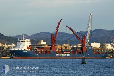
UHL FAST
Cargo
Current Trip
CHAGUARAMAS ANCH
| Time Travelled | 12 days |
|---|---|
| Remaining Time | --- |
| Distance Travelled | 2486.93 nm |
| Remaining Distance | --- |
| AVG Speed | 11.1 Noeuds |
| MAX Speed | 14.7 Noeuds |
| AVG Wind | 14 knots |
| MAX Wind | 30.6 knots |
| MIN Temp | -2.7°C / 27.14°F |
| MAX Temp | 31.7°C / 89.06°F |
| Tirant d eau | 6.1 m |
| Position reçue | 8 d depuis |
Current Position
| Longitude | -60.54682° |
|---|---|
| Latitude | 14.30728° |
| Etat | Under way using engine |
| Vitesse | 11.5 Noeuds |
| Parcours | 3.2° |
| Zone | Caribbean Sea |
| Station | T-AIS |
| Position reçue | 8 d depuis |
Info
Information
The current position of UHL FAST is in Caribbean Sea with coordinates 14.30728° / -60.54682° as reported on 2024-04-15 15:36 by AIS to our vessel tracker app. The vessel's current speed is 11.5 Noeuds
The vessel UHL FAST (IMO: 9785392, MMSI: 255806186) is a Cargo It's sailing under the flag of [PT] Portugal.
In this page you can find informations about the vessels current position, last detected port calls, and current voyage information. If the vessels is not in coverage by AIS you will find the latest position.
The current position of UHL FAST is detected by our AIS receivers and we are not responsible for the reliability of the data. The last position was recorded while the vessel was in Coverage by the Ais receivers of our vessel tracking app.
The current draught of UHL FAST as reported by AIS is 6.1 meters
Weather
| Temperature | 8.3°C / 46.94°F |
|---|---|
| Wind Speed | 20 knots |
| Direction | 171° S |
| Pressure | 1009.9 hPa |
| Humidity | 60.7 % |
| Cloud Coverage | 100 % |
Featured Company
Last Port Calls
| Port | Arrival | Departure | Time In Port |
|---|---|---|---|
| 2024-04-01 14:12 | 2024-04-11 18:30 | 10 d | |
| 2024-03-12 11:21 | 2024-03-13 14:25 | 1 d | |
| 2024-03-02 08:02 | 2024-03-04 10:27 | 2 d | |
| 2024-02-27 20:55 | |||
| 2024-02-17 17:09 | |||
| 2024-02-11 16:17 | 2024-02-12 13:21 | 21 h | |
| 2024-02-07 05:52 | 2024-02-08 12:22 | 1 d |
Most Visited Ports (Last year)
| Port | Arrivals | |
|---|---|---|
| 3 | ||
| 2 | ||
| 1 | ||
| 1 | ||
| 1 | ||
| 1 |
Last Trips
| Origin | Departure | Destination | Arrival | Distance | |
|---|---|---|---|---|---|
| 2024-03-04 11:27 | 2024-03-12 11:21 | 2173.63 nm | |||
| 2024-02-27 22:55 | 2024-03-02 09:02 | 965.17 nm | |||
| 2024-02-08 13:22 | 2024-02-11 18:17 | 760.54 nm | |||
| 2024-01-22 00:30 | 2024-02-07 06:52 | 5507.78 nm |
Events
| Heure | Evenement | Détails | Position/ Destination | Info |
|---|---|---|---|---|
| 2024-04-15 15:38 | Etat Changé | Default Under way using engine |
14.31413 / -60.54621
CHAGUARAMAS ANCH
|
Vitesse: 11.5 kn Parcours: 3.2° |
| 2024-04-15 15:36 | Hors de la zone couverte |
14.30728 / -60.54682
Caribbean Sea
|
Vitesse: 11.5 kn Parcours: 3.2° |
|
| 2024-04-15 15:36 | Changement de zone | Guadeloupe and Martinique part of the Caribbean Sea Trinidad and Tobago part of the Caribbean Sea |
14.30728 / -60.54682
Caribbean Sea
|
Vitesse: 11.5 kn Parcours: 3.2° |
| 2024-04-15 15:35 | Etat Changé | Under way using engine Default |
14.30560 / -60.54694
CHAGUARAMAS ANCH
|
Vitesse: 11.2 kn Parcours: 4° |
| 2024-04-15 15:35 | Dans la zone couverte |
14.30728 / -60.54682
Caribbean Sea
|
Vitesse: 11.5 kn Parcours: 3.2° |
|
| 2024-04-14 17:32 | Démarrage | 2.82 nm, South East of CHAGUARAMAS |
10.63205 / -61.62088
CHAGUARAMAS ANCH
|
Vitesse: 3.9 kn Parcours: 275° |