
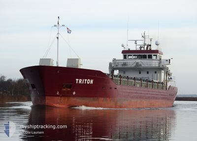
TRITON
Cargo D
Current Trip
SRSMA
| Time Travelled | 14 days |
|---|---|
| Remaining Time | --- |
| Distance Travelled | 3109.27 nm |
| Remaining Distance | --- |
| AVG Speed | 8.5 Noeuds |
| MAX Speed | 10.7 Noeuds |
| AVG Wind | 13.6 knots |
| MAX Wind | 22 knots |
| MIN Temp | 16°C / 60.8°F |
| MAX Temp | 28.2°C / 82.76°F |
| Tirant d eau | 5.1 m |
| Position reçue | 4 m depuis |
Current Position
| Longitude | -12.27448° |
|---|---|
| Latitude | 37.02999° |
| Etat | Under way using engine |
| Vitesse | 10.1 Noeuds |
| Parcours | 54° |
| Zone | North Atlantic Ocean |
| Station | T-AIS |
| Position reçue | 4 m depuis |
Info
Information
The current position of TRITON is in North Atlantic Ocean with coordinates 37.02999° / -12.27448° as reported on 2024-04-23 11:23 by AIS to our vessel tracker app. The vessel's current speed is 10.1 Noeuds
The vessel TRITON (IMO: 9749099, MMSI: 236673000) is a Cargo D It's sailing under the flag of [GI] Gibraltar.
In this page you can find informations about the vessels current position, last detected port calls, and current voyage information. If the vessels is not in coverage by AIS you will find the latest position.
The current position of TRITON is detected by our AIS receivers and we are not responsible for the reliability of the data. The last position was recorded while the vessel was in Coverage by the Ais receivers of our vessel tracking app.
The current draught of TRITON as reported by AIS is 5.1 meters
Weather
| Temperature | 17.1°C / 62.78°F |
|---|---|
| Wind Speed | 12 knots |
| Direction | 21° NNE |
| Pressure | 1018.7 hPa |
| Humidity | 82.5 % |
| Cloud Coverage | 4 % |
Featured Company
Last Port Calls
| Port | Arrival | Departure | Time In Port |
|---|---|---|---|
| 2024-04-07 06:18 | 2024-04-09 07:35 | 2 d | |
| 2024-03-25 09:42 | 2024-04-06 02:29 | 11 d | |
| 2024-03-05 00:09 | 2024-03-05 00:57 | 47 m | |
| 2024-03-01 14:17 | 2024-03-04 17:24 | 3 d | |
| 2024-03-01 07:19 | 2024-03-01 07:49 | 30 m | |
| 2024-02-25 10:23 | 2024-02-29 06:22 | 3 d | |
| 2024-02-19 16:39 | 2024-02-20 17:43 | 1 d | |
| 2024-02-15 19:47 |
Last Trips
| Origin | Departure | Destination | Arrival | Distance | |
|---|---|---|---|---|---|
| 2024-04-05 23:29 | 2024-04-07 02:18 | 240.75 nm | |||
| 2024-03-05 01:57 | 2024-03-25 06:42 | 5016.96 nm | |||
| 2024-03-04 18:24 | 2024-03-05 01:09 | 56.53 nm | |||
| 2024-03-01 08:49 | 2024-03-01 15:17 | 61.91 nm | |||
| 2024-02-29 08:22 | 2024-03-01 08:19 | 248.81 nm | |||
| 2024-02-20 18:43 | 2024-02-25 12:23 | 952.92 nm | |||
| 2024-02-15 20:47 | 2024-02-19 17:39 | 574.80 nm |
Events
| Heure | Evenement | Détails | Position/ Destination | Info |
|---|---|---|---|---|
| 2024-04-23 11:08 | Etat Changé | Under way using engine Default |
37.00676 / -12.31683
SRSMA
|
Vitesse: 10 kn Parcours: 58° |
| 2024-04-23 10:56 | Dans la zone couverte |
37.00676 / -12.31683
North Atlantic Ocean
|
Vitesse: 10.1 kn Parcours: 54.9° |
|
| 2024-04-23 09:59 | Etat Changé | Default Under way using engine |
36.89834 / -12.51833
SRSMA
|
Vitesse: 9.8 kn Parcours: 55.5° |
| 2024-04-23 09:55 | Hors de la zone couverte |
36.89452 / -12.52805
North Atlantic Ocean
|
Vitesse: 9.8 kn Parcours: 55.5° |
|
| 2024-04-23 09:43 | Etat Changé | Under way using engine Default |
36.87537 / -12.56407
SRSMA
|
Vitesse: 9 kn Parcours: 56° |
| 2024-04-23 09:38 | Etat Changé | Default Under way using engine |
36.86666 / -12.57667
SRSMA
|
Vitesse: 9.7 kn Parcours: 56.7° |
| 2024-04-23 08:44 | Changement de zone | Portuguese part of the North Atlantic Ocean High seas of the North Atlantic Ocean |
36.78900 / -12.72923
North Atlantic Ocean
|
Vitesse: 9.7 kn Parcours: 57.5° |
| 2024-04-23 08:43 | Etat Changé | Under way using engine Default |
36.78681 / -12.73347
SRSMA
|
Vitesse: 9 kn Parcours: 55° |
| 2024-04-23 08:38 | Dans la zone couverte |
36.78900 / -12.72923
North Atlantic Ocean
|
Vitesse: 9.7 kn Parcours: 57.5° |
|
| 2024-04-23 02:22 | Hors de la zone couverte |
36.23763 / -13.76310
North Atlantic Ocean
|
Vitesse: 9.4 kn Parcours: 55.8° |