
TORTUGAS
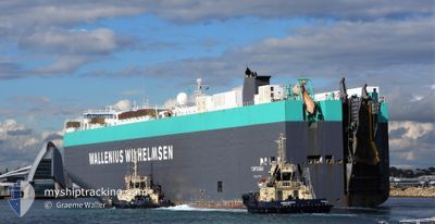
Vehicles Carrier
Current Trip
| Time Travelled | 13 days |
|---|---|
| Remaining Time | --- |
| Distance Travelled | 5060.46 nm |
| Remaining Distance | --- |
| AVG Speed | 15.6 Noeuds |
| MAX Speed | 17.8 Noeuds |
| AVG Wind | 15.8 knots |
| MAX Wind | 29.9 knots |
| MIN Temp | 6°C / 42.8°F |
| MAX Temp | 15.1°C / 59.18°F |
| Tirant d eau | 10.1 m |
| Position reçue | 2 h, 27 m depuis |
Current Position
| Longitude | -127.12312° |
|---|---|
| Latitude | 31.60528° |
| Etat | Under way using engine |
| Vitesse | 15.5 Noeuds |
| Parcours | 122° |
| Zone | North Pacific Ocean |
| Station | T-AIS |
| Position reçue | 2 h, 27 m depuis |
Info
Information
The current position of TORTUGAS is in North Pacific Ocean with coordinates 31.60528° / -127.12312° as reported on 2024-04-17 23:19 by AIS to our vessel tracker app. The vessel's current speed is 15.5 Noeuds and is heading at the port of BALBOA. The estimated time of arrival as calculated by MyShipTracking vessel tracking app is 2024-04-26 23:00 LT
The vessel TORTUGAS (IMO: 9319765, MMSI: 249757000) is a Vehicles Carrier that was built in 2006 ( 18 Age ). It's sailing under the flag of [MT] Malta.
In this page you can find informations about the vessels current position, last detected port calls, and current voyage information. If the vessels is not in coverage by AIS you will find the latest position.
The current position of TORTUGAS is detected by our AIS receivers and we are not responsible for the reliability of the data. The last position was recorded while the vessel was in Coverage by the Ais receivers of our vessel tracking app.
The current draught of TORTUGAS as reported by AIS is 10.1 meters
Weather
| Temperature | 15°C / 59°F |
|---|---|
| Wind Speed | 11 knots |
| Direction | 12° NNE |
| Pressure | 1019.3 hPa |
| Humidity | 79.4 % |
| Cloud Coverage | 100 % |
Featured Company
Last Port Calls
| Port | Arrival | Departure | Time In Port |
|---|---|---|---|
| 2024-04-01 05:41 | 2024-04-04 13:55 | 3 d | |
| 2024-03-05 19:42 | |||
| 2024-03-03 07:20 | 2024-03-03 23:01 | 15 h | |
| 2024-02-29 20:29 | 2024-03-01 03:17 | 6 h | |
| 2024-02-25 11:05 | 2024-02-25 20:48 | 9 h | |
| 2024-02-23 20:43 | 2024-02-24 05:54 | 9 h | |
| 2024-02-21 02:41 | 2024-02-22 01:41 | 23 h | |
| 2024-02-19 11:08 | 2024-02-20 04:51 | 17 h |
Most Visited Ports (Last year)
| Port | Arrivals | |
|---|---|---|
| 5 | ||
| 3 | ||
| 2 | ||
| 2 | ||
| 2 | ||
| 2 |
Last Trips
| Origin | Departure | Destination | Arrival | Distance | |
|---|---|---|---|---|---|
| 2024-03-05 14:42 | 2024-04-01 14:41 | 9599.48 nm | |||
| 2024-02-29 21:17 | 2024-03-03 02:20 | 740.20 nm | |||
| 2024-02-25 14:48 | 2024-02-29 14:29 | 179.94 nm | |||
| 2024-02-23 23:54 | 2024-02-25 05:05 | 222.77 nm | |||
| 2024-02-21 19:41 | 2024-02-23 14:43 | 734.60 nm | |||
| 2024-02-19 22:51 | 2024-02-20 20:41 | 181.99 nm | |||
| 2024-02-01 05:23 | 2024-02-19 05:08 | 7314.66 nm |
Events
| Heure | Evenement | Détails | Position/ Destination | Info |
|---|---|---|---|---|
| 2024-04-17 23:26 | Etat Changé | Default Under way using engine |
31.58830 / -127.09177
PA BLB
|
Vitesse: 15.5 kn Parcours: 122° |
| 2024-04-17 23:19 | Hors de la zone couverte |
31.60528 / -127.12312
North Pacific Ocean
PA BLB
|
Vitesse: 15.5 kn Parcours: 122° |
|
| 2024-04-17 23:12 | Etat Changé | Under way using engine Default |
31.62170 / -127.15300
PA BLB
|
Vitesse: 15.6 kn Parcours: 120° |
| 2024-04-17 23:08 | Etat Changé | Default Under way using engine |
31.62923 / -127.16703
PA BLB
|
Vitesse: 15.6 kn Parcours: 121° |
| 2024-04-17 23:02 | Etat Changé | Under way using engine Default |
31.64302 / -127.19403
PA BLB
|
Vitesse: 15.5 kn Parcours: 120° |
| 2024-04-17 22:58 | Etat Changé | Default Under way using engine |
31.65262 / -127.21257
PA BLB
|
Vitesse: 15.6 kn Parcours: 121° |
| 2024-04-17 22:50 | Etat Changé | Under way using engine Default |
31.67060 / -127.24697
PA BLB
|
Vitesse: 15.7 kn Parcours: 122° |
| 2024-04-17 22:40 | Etat Changé | Default Under way using engine |
31.69340 / -127.28958
PA BLB
|
Vitesse: 15.6 kn Parcours: 123° |
| 2024-04-17 22:19 | Etat Changé | Under way using engine Default |
31.74267 / -127.37983
PA BLB
|
Vitesse: 15.8 kn Parcours: 122° |
| 2024-04-17 22:10 | Dans la zone couverte |
31.74267 / -127.37983
North Pacific Ocean
PA BLB
|
Vitesse: 15.8 kn Parcours: 122° |