
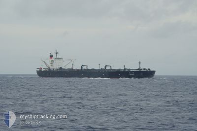
TOHSHI
Crude Oil Tanker
Current Trip
JP YKK OFF
| Time Travelled | --- |
|---|---|
| Remaining Time | --- |
| Distance Travelled | 9618.26 nm |
| Remaining Distance | --- |
| AVG Speed | 11.1 Noeuds |
| MAX Speed | 16.4 Noeuds |
| AVG Wind | 8.8 knots |
| MAX Wind | 27 knots |
| MIN Temp | 7.5°C / 45.5°F |
| MAX Temp | 29.9°C / 85.82°F |
| Tirant d eau | 10.5 m |
| Position reçue | 5 d depuis |
Current Position
| Longitude | 136.68661° |
|---|---|
| Latitude | 34.90719° |
| Etat | At anchor |
| Vitesse | 0.2 Noeuds |
| Parcours | 291° |
| Zone | Philippine Sea |
| Station | T-AIS |
| Position reçue | 5 d depuis |
Info
Information
The current position of TOHSHI is in Philippine Sea with coordinates 34.90719° / 136.68661° as reported on 2024-04-18 08:57 by AIS to our vessel tracker app. The vessel's current speed is 0.2 Noeuds
The vessel TOHSHI (IMO: 9320843, MMSI: 636019490) is a Crude Oil Tanker that was built in 2007 ( 17 Age ). It's sailing under the flag of [LR] Liberia.
In this page you can find informations about the vessels current position, last detected port calls, and current voyage information. If the vessels is not in coverage by AIS you will find the latest position.
The current position of TOHSHI is detected by our AIS receivers and we are not responsible for the reliability of the data. The last position was recorded while the vessel was in Coverage by the Ais receivers of our vessel tracking app.
The current draught of TOHSHI as reported by AIS is 10.5 meters
Weather
| Temperature | 14.8°C / 58.64°F |
|---|---|
| Wind Speed | 9 knots |
| Direction | 317° NW |
| Pressure | 1003.7 hPa |
| Humidity | 66.1 % |
| Cloud Coverage | 100 % |
Featured Company
Most Visited Ports (Last year)
| Port | Arrivals | |
|---|---|---|
| 4 | ||
| 1 | ||
| 1 |
Last Trips
| Origin | Departure | Destination | Arrival | Distance | |
|---|---|---|---|---|---|
| 2024-01-21 11:10 | 2024-02-16 09:56 | 7172.50 nm |
Events
| Heure | Evenement | Détails | Position/ Destination | Info |
|---|---|---|---|---|
| 2024-04-18 08:57 | Hors de la zone couverte |
34.90719 / 136.68661
Philippine Sea
|
Vitesse: 0.2 kn Parcours: 193.6° |
|
| 2024-04-18 04:40 | Etat Changé | At anchor Default |
34.90860 / 136.68040
JP YKK OFF
|
Vitesse: Parcours: 91° |
| 2024-04-18 04:03 | Etat Changé | Default At anchor |
34.90809 / 136.68041
JP YKK OFF
|
Vitesse: Parcours: 84° |
| 2024-04-18 04:01 | Etat Changé | At anchor Default |
34.90804 / 136.68043
JP YKK OFF
|
Vitesse: Parcours: 83° |
| 2024-04-18 03:32 | Etat Changé | Default At anchor |
34.90756 / 136.68042
JP YKK OFF
|
Vitesse: 0.1 kn Parcours: 70° |
| 2024-04-18 02:58 | Etat Changé | At anchor Under way using engine |
34.90700 / 136.68093
JP YKK OFF
|
Vitesse: 0.1 kn Parcours: 59° |
| 2024-04-18 02:57 | Etat Changé | Under way using engine At anchor |
34.90698 / 136.68094
JP YKK OFF
|
Vitesse: 0.1 kn Parcours: 59° |
| 2024-04-18 02:41 | Etat Changé | At anchor Default |
34.90683 / 136.68112
JP YKK OFF
|
Vitesse: Parcours: 54° |
| 2024-04-18 02:41 | Dans la zone couverte |
34.90683 / 136.68112
Philippine Sea
|
Vitesse: Parcours: 69.2° |
|
| 2024-04-17 21:32 | Hors de la zone couverte |
34.90606 / 136.68519
Philippine Sea
|
Vitesse: Parcours: 69.2° |