
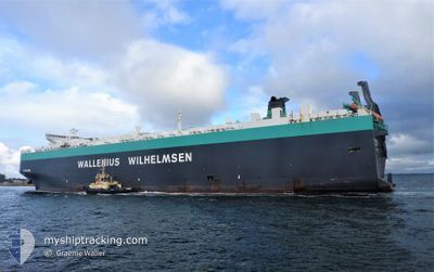
TIRRANNA
Vehicles Carrier
Current Trip
PA PCN
| Time Travelled | 1 day |
|---|---|
| Remaining Time | --- |
| Distance Travelled | 174.34 nm |
| Remaining Distance | --- |
| AVG Speed | 12.1 Noeuds |
| MAX Speed | 18 Noeuds |
| AVG Wind | 11.1 knots |
| MAX Wind | 22.9 knots |
| MIN Temp | 25.5°C / 77.9°F |
| MAX Temp | 34.5°C / 94.1°F |
| Tirant d eau | 10.4 m |
| Position reçue | 5 h, 7 m depuis |
Current Position
| Longitude | -79.45883° |
|---|---|
| Latitude | 8.69900° |
| Etat | Under way using engine |
| Vitesse | 16.6 Noeuds |
| Parcours | 177.9° |
| Zone | North Pacific Ocean |
| Station | T-AIS |
| Position reçue | 5 h, 7 m depuis |
Info
Information
The current position of TIRRANNA is in North Pacific Ocean with coordinates 8.69900° / -79.45883° as reported on 2024-04-23 22:43 by AIS to our vessel tracker app. The vessel's current speed is 16.6 Noeuds
The vessel TIRRANNA (IMO: 9377523, MMSI: 259895000) is a Vehicles Carrier that was built in 2009 ( 15 Age ). It's sailing under the flag of [NO] Norway.
In this page you can find informations about the vessels current position, last detected port calls, and current voyage information. If the vessels is not in coverage by AIS you will find the latest position.
The current position of TIRRANNA is detected by our AIS receivers and we are not responsible for the reliability of the data. The last position was recorded while the vessel was in Coverage by the Ais receivers of our vessel tracking app.
The current draught of TIRRANNA as reported by AIS is 10.4 meters
Weather
| Temperature | 27.9°C / 82.22°F |
|---|---|
| Wind Speed | 20 knots |
| Direction | 8° N |
| Pressure | 1011 hPa |
| Humidity | 84.6 % |
| Cloud Coverage | 64 % |
Featured Company
Last Port Calls
| Port | Arrival | Departure | Time In Port |
|---|---|---|---|
| 2024-04-22 10:29 | 2024-04-22 22:23 | 11 h | |
| 2024-04-17 08:15 | 2024-04-18 07:40 | 23 h | |
| 2024-04-03 14:49 | 2024-04-04 17:39 | 1 d | |
| 2024-03-31 21:05 | 2024-04-02 21:12 | 2 d | |
| 2024-03-29 04:09 | 2024-03-29 20:00 | 15 h | |
| 2024-03-26 01:16 | 2024-03-28 00:25 | 1 d | |
| 2024-03-12 20:02 | 2024-03-13 21:58 | 1 d | |
| 2024-03-11 08:46 | 2024-03-12 05:11 | 20 h | |
| 2024-03-08 09:11 | 2024-03-09 05:33 | 20 h | |
| 2024-03-04 16:07 | 2024-03-06 16:20 | 2 d |
Most Visited Ports (Last year)
| Port | Arrivals | |
|---|---|---|
| 5 | ||
| 4 | ||
| 4 | ||
| 3 | ||
| 3 | ||
| 3 |
Last Trips
| Origin | Departure | Destination | Arrival | Distance | |
|---|---|---|---|---|---|
| 2024-04-18 03:40 | 2024-04-22 05:29 | 1613.87 nm | |||
| 2024-04-04 18:39 | 2024-04-17 04:15 | 4342.61 nm | |||
| 2024-04-02 23:12 | 2024-04-03 15:49 | 208.10 nm | |||
| 2024-03-29 21:00 | 2024-03-31 23:05 | 586.20 nm | |||
| 2024-03-28 01:25 | 2024-03-29 05:09 | 405.31 nm | |||
| 2024-03-13 17:58 | 2024-03-26 02:16 | 4076.80 nm | |||
| 2024-03-12 01:11 | 2024-03-12 16:02 | 171.34 nm | |||
| 2024-03-09 00:33 | 2024-03-11 04:46 | 755.25 nm | |||
| 2024-03-06 12:20 | 2024-03-08 04:11 | 592.67 nm | |||
| 2024-02-25 00:44 | 2024-03-04 12:07 | 2918.26 nm |
Events
| Heure | Evenement | Détails | Position/ Destination | Info |
|---|---|---|---|---|
| 2024-04-23 22:50 | Etat Changé | Default Under way using engine |
8.66700 / -79.45800
PA PCN
|
Vitesse: 16.6 kn Parcours: 177.9° |
| 2024-04-23 22:43 | Etat Changé | Under way using engine Default |
8.69900 / -79.45883
PA PCN
|
Vitesse: 16.7 kn Parcours: 179° |
| 2024-04-23 22:43 | Hors de la zone couverte |
8.69900 / -79.45883
North Pacific Ocean
|
Vitesse: 16.6 kn Parcours: 177.9° |
|
| 2024-04-23 22:39 | Etat Changé | Default Under way using engine |
8.72183 / -79.45933
PA PCN
|
Vitesse: 16.4 kn Parcours: 175.6° |
| 2024-04-23 21:46 | Detecté en mer | Panamanian part of the North Pacific Ocean |
8.90467 / -79.53500
North Pacific Ocean
|
Vitesse: 7.1 kn Parcours: 142.5° |
| 2024-04-23 21:27 | Etat Changé | Under way using engine Default |
8.94117 / -79.56333
PA PCN
|
Vitesse: 10 kn Parcours: 143° |
| 2024-04-23 21:26 | Etat Changé | Default Under way using engine |
8.94266 / -79.56450
PA PCN
|
Vitesse: 8.3 kn Parcours: 159.4° |
| 2024-04-23 21:17 | Etat Changé | Under way using engine Default |
8.96183 / -79.57383
PA PCN
|
Vitesse: 8.2 kn Parcours: 160° |
| 2024-04-23 21:17 | Dans la zone couverte |
8.95750 / -79.57217
Caribbean Sea
|
Vitesse: 8.7 kn Parcours: 159.2° |
|
| 2024-04-23 20:11 | Hors de la zone couverte |
8.99767 / -79.59233
Caribbean Sea
|
Vitesse: 1.5 kn Parcours: 136.1° |