
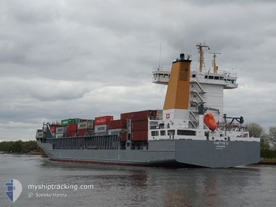
THETIS D
Container Ship
Current Trip
| Time Travelled | 1 day |
|---|---|
| Remaining Time | --- |
| Distance Travelled | 358.24 nm |
| Remaining Distance | 277.89 nm |
| AVG Speed | 13.4 Noeuds |
| MAX Speed | 17.8 Noeuds |
| AVG Wind | 12.4 knots |
| MAX Wind | 19.8 knots |
| MIN Temp | 2.7°C / 36.86°F |
| MAX Temp | 7.8°C / 46.04°F |
| Tirant d eau | 8.1 m |
| Position reçue | 5 h, 16 m depuis |
Current Position
| Longitude | 16.99012° |
|---|---|
| Latitude | 56.31098° |
| Etat | Under way using engine |
| Vitesse | 14.5 Noeuds |
| Parcours | 21° |
| Zone | Baltic Sea |
| Station | T-AIS |
| Position reçue | 5 h, 16 m depuis |
Info
Information
The current position of THETIS D is in Baltic Sea with coordinates 56.31098° / 16.99012° as reported on 2024-04-25 08:27 by AIS to our vessel tracker app. The vessel's current speed is 14.5 Noeuds and is heading at the port of RAUMA. The estimated time of arrival as calculated by MyShipTracking vessel tracking app is 2024-04-26 09:00 LT
The vessel THETIS D (IMO: 9372274, MMSI: 209543000) is a Container Ship that was built in 2009 ( 15 Age ). It's sailing under the flag of [CY] Cyprus.
In this page you can find informations about the vessels current position, last detected port calls, and current voyage information. If the vessels is not in coverage by AIS you will find the latest position.
The current position of THETIS D is detected by our AIS receivers and we are not responsible for the reliability of the data. The last position was recorded while the vessel was in Coverage by the Ais receivers of our vessel tracking app.
The current draught of THETIS D as reported by AIS is 8.1 meters
Weather
| Temperature | 2.8°C / 37.04°F |
|---|---|
| Wind Speed | 12 knots |
| Direction | 348° NNW |
| Pressure | 1005.9 hPa |
| Humidity | 92.1 % |
| Cloud Coverage | 100 % |
Featured Company
Last Port Calls
| Port | Arrival | Departure | Time In Port |
|---|---|---|---|
| 2024-04-24 12:53 | 2024-04-24 12:57 | 3 m | |
| 2024-04-22 20:52 | 2024-04-23 21:24 | 1 d | |
| 2024-04-21 05:36 | 2024-04-22 11:45 | 1 d | |
| 2024-04-20 13:24 | 2024-04-20 14:10 | 46 m | |
| 2024-04-16 20:03 | 2024-04-18 22:01 | 2 d | |
| 2024-04-13 16:58 | 2024-04-13 17:02 | 3 m | |
| 2024-04-11 12:01 | 2024-04-13 03:26 | 1 d | |
| 2024-04-09 19:58 | 2024-04-11 03:13 | 1 d | |
| 2024-04-03 04:22 | 2024-04-03 11:44 | 7 h | |
| 2024-04-02 04:27 | 2024-04-02 21:12 | 16 h |
Most Visited Ports (Last year)
| Port | Arrivals | |
|---|---|---|
| 35 | ||
| 31 | ||
| 18 | ||
| 13 | ||
| 9 | ||
| 7 |
Last Trips
| Origin | Departure | Destination | Arrival | Distance | |
|---|---|---|---|---|---|
| 2024-04-23 23:24 | 2024-04-24 14:53 | 89.54 nm | |||
| 2024-04-22 13:45 | 2024-04-22 22:52 | 117.06 nm | |||
| 2024-04-20 16:10 | 2024-04-21 07:36 | 135.48 nm | |||
| 2024-04-19 01:01 | 2024-04-20 15:24 | 646.41 nm | |||
| 2024-04-13 19:02 | 2024-04-16 23:03 | 650.89 nm | |||
| 2024-04-13 05:26 | 2024-04-13 18:58 | 92.61 nm | |||
| 2024-04-11 05:13 | 2024-04-11 14:01 | 116.26 nm | |||
| 2024-04-03 13:44 | 2024-04-09 21:58 | 1395.57 nm | |||
| 2024-04-02 23:12 | 2024-04-03 06:22 | 64.82 nm | |||
| 2024-04-01 09:32 | 2024-04-02 06:27 | 238.01 nm |
Events
| Heure | Evenement | Détails | Position/ Destination | Info |
|---|---|---|---|---|
| 2024-04-25 08:33 | Etat Changé | Default Under way using engine |
56.33131 / 17.00476
FIRAU
|
Vitesse: 14.5 kn Parcours: 21° |
| 2024-04-25 08:27 | Hors de la zone couverte |
56.31098 / 16.99012
Baltic Sea
FIRAU
|
Vitesse: 14.5 kn Parcours: 21° |
|
| 2024-04-25 07:45 | Etat Changé | Under way using engine Default |
56.14453 / 16.86641
FIRAU
|
Vitesse: 17.6 kn Parcours: 26° |
| 2024-04-25 07:44 | Etat Changé | Default Under way using engine |
56.14192 / 16.86399
FIRAU
|
Vitesse: 17.6 kn Parcours: 31° |
| 2024-04-25 07:39 | Etat Changé | Under way using engine Default |
56.11759 / 16.83971
FIRAU
|
Vitesse: 17.7 kn Parcours: 30° |
| 2024-04-25 07:36 | Etat Changé | Default Under way using engine |
56.10788 / 16.82958
FIRAU
|
Vitesse: 17.7 kn Parcours: 35° |
| 2024-04-25 03:50 | Changement de zone | Swedish part of the Baltic Sea Danish part of the Kattegat |
55.62230 / 15.37866
Baltic Sea
FIRAU
|
Vitesse: 14.9 kn Parcours: 61° |
| 2024-04-24 23:50 | Changement de zone | Danish part of the Kattegat Swedish part of the Baltic Sea |
55.00554 / 14.05927
Kattegat
FIRAU
|
Vitesse: 14.7 kn Parcours: 72° |
| 2024-04-24 23:32 | Changement de zone | Swedish part of the Baltic Sea German part of the Baltic Sea |
54.98417 / 13.93717
Baltic Sea
FIRAU
|
Vitesse: 14.6 kn Parcours: 74° |
| 2024-04-24 18:26 | Changement de zone | German part of the Baltic Sea Danish part of the Baltic Sea |
54.41474 / 12.12335
Baltic Sea
FIRAU
|
Vitesse: 14.1 kn Parcours: 87° |