
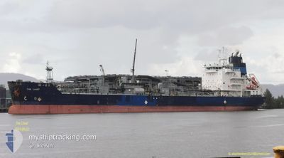
THE CHIEF
Asphalt/Bitumen Tanker
Current Trip
| Time Travelled | 2 days |
|---|---|
| Remaining Time | --- |
| Distance Travelled | 519.87 nm |
| Remaining Distance | --- |
| AVG Speed | 9.4 Noeuds |
| MAX Speed | 12.9 Noeuds |
| AVG Wind | 15 knots |
| MAX Wind | 35.3 knots |
| MIN Temp | 9.5°C / 49.1°F |
| MAX Temp | 16.4°C / 61.52°F |
| Tirant d eau | 9.3 m |
| Position reçue | 1 d depuis |
Current Position
| Longitude | -74.92372° |
|---|---|
| Latitude | 38.66069° |
| Etat | Under way using engine |
| Vitesse | 10.2 Noeuds |
| Parcours | 147° |
| Zone | North Atlantic Ocean |
| Station | T-AIS |
| Position reçue | 1 d depuis |
Info
Information
The current position of THE CHIEF is in North Atlantic Ocean with coordinates 38.66069° / -74.92372° as reported on 2024-04-21 23:45 by AIS to our vessel tracker app. The vessel's current speed is 10.2 Noeuds and is heading at the port of BELEM. The estimated time of arrival as calculated by MyShipTracking vessel tracking app is 2024-05-02 20:00 LT
The vessel THE CHIEF (IMO: 9492361, MMSI: 538005036) is a Asphalt/Bitumen Tanker that was built in 2013 ( 11 Age ). It's sailing under the flag of [MH] Marshall Is.
In this page you can find informations about the vessels current position, last detected port calls, and current voyage information. If the vessels is not in coverage by AIS you will find the latest position.
The current position of THE CHIEF is detected by our AIS receivers and we are not responsible for the reliability of the data. The last position was recorded while the vessel was in Coverage by the Ais receivers of our vessel tracking app.
The current draught of THE CHIEF as reported by AIS is 9.3 meters
Weather
| Temperature | 16.5°C / 61.7°F |
|---|---|
| Wind Speed | 23 knots |
| Direction | 316° NW |
| Pressure | 1016.3 hPa |
| Humidity | 61.5 % |
| Cloud Coverage | 90 % |
Featured Company
Last Port Calls
| Port | Arrival | Departure | Time In Port |
|---|---|---|---|
| 2024-04-19 11:26 | 2024-04-21 15:04 | 2 d | |
| 2024-04-14 12:14 | 2024-04-16 01:13 | 1 d | |
| 2024-04-02 19:19 | 2024-04-04 22:35 | 2 d | |
| 2024-03-16 15:33 | 2024-03-18 05:37 | 1 d | |
| 2024-03-03 18:31 | 2024-03-07 11:48 | 3 d | |
| 2024-02-12 16:20 | 2024-02-13 21:45 | 1 d | |
| 2024-02-08 00:39 | 2024-02-09 07:27 | 1 d | |
| 2024-02-01 11:27 | 2024-02-05 15:48 | 4 d |
Last Trips
| Origin | Departure | Destination | Arrival | Distance | |
|---|---|---|---|---|---|
| 2024-04-15 21:13 | 2024-04-19 07:26 | 412.77 nm | |||
| 2024-04-04 18:35 | 2024-04-14 08:14 | 1889.17 nm | |||
| 2024-03-18 01:37 | 2024-04-02 15:19 | 2221.53 nm | |||
| 2024-03-07 07:48 | 2024-03-16 11:33 | 1772.86 nm | |||
| 2024-02-13 18:45 | 2024-03-03 14:31 | 2806.77 nm | |||
| 2024-02-09 04:27 | 2024-02-12 13:20 | 892.39 nm | |||
| 2024-02-05 12:48 | 2024-02-07 21:39 | 614.09 nm | |||
| 2024-01-16 05:48 | 2024-02-01 08:27 | 3651.31 nm |
Events
| Heure | Evenement | Détails | Position/ Destination | Info |
|---|---|---|---|---|
| 2024-04-21 23:50 | Etat Changé | Default Under way using engine |
38.64901 / -74.91366
BRBEL
|
Vitesse: 10.2 kn Parcours: 147° |
| 2024-04-21 23:45 | Hors de la zone couverte |
38.66069 / -74.92372
North Atlantic Ocean
BRBEL
|
Vitesse: 10.2 kn Parcours: 147° |
|
| 2024-04-21 23:38 | Etat Changé | Under way using engine Default |
38.67834 / -74.93903
BRBEL
|
Vitesse: 10 kn Parcours: 144° |
| 2024-04-21 23:14 | Etat Changé | Default Under way using engine |
38.73131 / -74.98795
BRBEL
|
Vitesse: 9.8 kn Parcours: 143.1° |
| 2024-04-21 19:50 | Tirant d'eau modifié | 9.3 6 |
39.20311 / -75.28463
BRBEL
|
Vitesse: 11.3 kn Parcours: 155.8° |
| 2024-04-21 19:50 | Changement de destination | BRBEL USPAU |
39.20311 / -75.28463
BRBEL
|
Vitesse: 11.3 kn Parcours: 155.8° |
| 2024-04-21 19:50 | Changement d'ETA | 2024/05/02 20:00 2024/04/17 07:00 |
39.20311 / -75.28463
BRBEL
|
Vitesse: 11.3 kn Parcours: 155.8° |
| 2024-04-21 19:43 | Etat Changé | Under way using engine Default |
39.22291 / -75.29643
USPAU
|
Vitesse: 11.8 kn Parcours: 154° |
| 2024-04-21 19:38 | Etat Changé | Default Under way using engine |
39.23655 / -75.30716
USPAU
|
Vitesse: 12.1 kn Parcours: 137.3° |
| 2024-04-21 19:24 | Etat Changé | Under way using engine Default |
39.27170 / -75.34859
USPAU
|
Vitesse: 12.8 kn Parcours: 136° |