
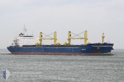
TANZANITE
Bulk Carrier
Current Trip
| Time Travelled | --- |
|---|---|
| Remaining Time | 3 days |
| Distance Travelled | --- |
| Remaining Distance | 918.42 nm |
| AVG Speed | --- |
| MAX Speed | --- |
| AVG Wind | --- |
| MAX Wind | --- |
| MIN Temp | --- |
| MAX Temp | --- |
| Tirant d eau | 11.1 m |
| Position reçue | 11 h, 22 m depuis |
Current Position
| Longitude | -13.24280° |
|---|---|
| Latitude | 28.58978° |
| Etat | Under way using engine |
| Vitesse | 10.7 Noeuds |
| Parcours | 29.5° |
| Zone | North Atlantic Ocean |
| Station | T-AIS |
| Position reçue | 11 h, 22 m depuis |
Info
Information
The current position of TANZANITE is in North Atlantic Ocean with coordinates 28.58978° / -13.24280° as reported on 2024-04-24 13:16 by AIS to our vessel tracker app. The vessel's current speed is 10.7 Noeuds and is heading at the port of SAGUNTO. The estimated time of arrival as calculated by MyShipTracking vessel tracking app is 2024-04-28 15:41 LT
The vessel TANZANITE (IMO: 9456147, MMSI: 636019478) is a Bulk Carrier that was built in 2010 ( 14 Age ). It's sailing under the flag of [LR] Liberia.
In this page you can find informations about the vessels current position, last detected port calls, and current voyage information. If the vessels is not in coverage by AIS you will find the latest position.
The current position of TANZANITE is detected by our AIS receivers and we are not responsible for the reliability of the data. The last position was recorded while the vessel was in Coverage by the Ais receivers of our vessel tracking app.
The current draught of TANZANITE as reported by AIS is 11.1 meters
Weather
| Temperature | 19.1°C / 66.38°F |
|---|---|
| Wind Speed | 18 knots |
| Direction | 11° N |
| Pressure | 1015.2 hPa |
| Humidity | 76 % |
| Cloud Coverage | --- |
Featured Company
Most Visited Ports (Last year)
| Port | Arrivals | |
|---|---|---|
| 2 | ||
| 2 | ||
| 1 | ||
| 1 | ||
| 1 | ||
| 1 |
Events
| Heure | Evenement | Détails | Position/ Destination | Info |
|---|---|---|---|---|
| 2024-04-24 13:22 | Etat Changé | Default Under way using engine |
28.60764 / -13.23140
ES SAG
|
Vitesse: 10.7 kn Parcours: 29.5° |
| 2024-04-24 13:16 | Etat Changé | Under way using engine Default |
28.58978 / -13.24280
ES SAG
|
Vitesse: 10.7 kn Parcours: 29° |
| 2024-04-24 13:16 | Hors de la zone couverte |
28.58978 / -13.24280
North Atlantic Ocean
ES SAG
|
Vitesse: 10.7 kn Parcours: 29.5° |
|
| 2024-04-24 13:14 | Etat Changé | Default Under way using engine |
28.58697 / -13.24464
ES SAG
|
Vitesse: 10.8 kn Parcours: 29.7° |
| 2024-04-24 12:55 | Etat Changé | Under way using engine Default |
28.53752 / -13.27602
ES SAG
|
Vitesse: 10.7 kn Parcours: 35° |
| 2024-04-24 12:06 | Etat Changé | Default Under way using engine |
28.42209 / -13.38168
ES SAG
|
Vitesse: 10.8 kn Parcours: 38.5° |
| 2024-04-24 11:58 | Etat Changé | Under way using engine Default |
28.40358 / -13.39903
ES SAG
|
Vitesse: 10.8 kn Parcours: 33° |
| 2024-04-24 11:46 | Dans la zone couverte |
28.40358 / -13.39903
North Atlantic Ocean
ES SAG
|
Vitesse: 10.8 kn Parcours: 34.4° |
|
| 2024-04-24 10:25 | Etat Changé | Default Under way using engine |
28.16657 / -13.58173
ES SAG
|
Vitesse: 11.2 kn Parcours: 35.8° |
| 2024-04-24 10:21 | Hors de la zone couverte |
28.15567 / -13.59069
North Atlantic Ocean
ES SAG
|
Vitesse: 11.2 kn Parcours: 35.8° |