
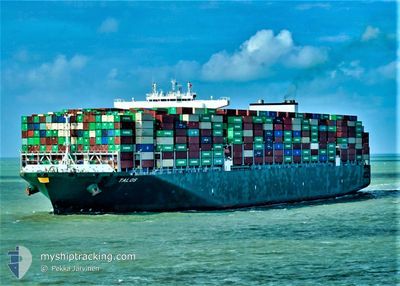
TALOS
Other Type
Current Trip
| Time Travelled | 8 days |
|---|---|
| Remaining Time | --- |
| Distance Travelled | 3820.27 nm |
| Remaining Distance | --- |
| AVG Speed | 19.4 Noeuds |
| MAX Speed | 22.4 Noeuds |
| AVG Wind | 15 knots |
| MAX Wind | 23 knots |
| MIN Temp | 8°C / 46.4°F |
| MAX Temp | 29.4°C / 84.92°F |
| Tirant d eau | 13 m |
| Position reçue | 1 d depuis |
Current Position
| Longitude | -25.41321° |
|---|---|
| Latitude | 5.71422° |
| Etat | Under way using engine |
| Vitesse | 20.5 Noeuds |
| Parcours | 133.6° |
| Zone | North Atlantic Ocean |
| Station | T-AIS |
| Position reçue | 1 d depuis |
Info
Information
The current position of TALOS is in North Atlantic Ocean with coordinates 5.71422° / -25.41321° as reported on 2024-04-17 11:24 by AIS to our vessel tracker app. The vessel's current speed is 20.5 Noeuds and is heading at the port of PORT KLANG. The estimated time of arrival as calculated by MyShipTracking vessel tracking app is 2024-05-02 00:00 LT
The vessel TALOS (IMO: 9728930, MMSI: 249769000) is a Other Type It's sailing under the flag of [MT] Malta.
In this page you can find informations about the vessels current position, last detected port calls, and current voyage information. If the vessels is not in coverage by AIS you will find the latest position.
The current position of TALOS is detected by our AIS receivers and we are not responsible for the reliability of the data. The last position was recorded while the vessel was in Coverage by the Ais receivers of our vessel tracking app.
The current draught of TALOS as reported by AIS is 13 meters
Weather
| Temperature | 28.9°C / 84.02°F |
|---|---|
| Wind Speed | 11 knots |
| Direction | 81° E |
| Pressure | 1010.4 hPa |
| Humidity | 76.2 % |
| Cloud Coverage | 45 % |
Featured Company
Last Port Calls
| Port | Arrival | Departure | Time In Port |
|---|---|---|---|
| 2024-04-07 10:46 | 2024-04-10 08:52 | 2 d | |
| 2024-04-04 01:18 | 2024-04-06 00:00 | 1 d | |
| 2024-03-29 14:05 | 2024-03-31 11:39 | 1 d | |
| 2024-03-22 07:59 | 2024-03-23 11:41 | 1 d | |
| 2024-03-16 18:52 | 2024-03-18 02:24 | 1 d | |
| 2024-03-12 07:42 | 2024-03-12 14:22 | 6 h | |
| 2024-02-13 01:06 | 2024-02-14 12:36 | 1 d | |
| 2024-02-11 16:42 | 2024-02-12 12:40 | 19 h | |
| 2024-02-07 16:10 | 2024-02-10 19:28 | 3 d |
Last Trips
| Origin | Departure | Destination | Arrival | Distance | |
|---|---|---|---|---|---|
| 2024-04-05 20:00 | 2024-04-07 06:46 | 296.83 nm | |||
| 2024-03-31 07:39 | 2024-04-03 21:18 | 536.38 nm | |||
| 2024-03-23 06:41 | 2024-03-29 10:05 | 1595.94 nm | |||
| 2024-03-17 21:24 | 2024-03-22 02:59 | 77.25 nm | |||
| 2024-03-12 09:22 | 2024-03-16 13:52 | 22.60 nm | |||
| 2024-02-14 20:36 | 2024-03-12 02:42 | 9346.76 nm | |||
| 2024-02-12 20:40 | 2024-02-13 09:06 | 63.54 nm | |||
| 2024-02-11 03:28 | 2024-02-12 00:42 | 352.44 nm | |||
| 2024-01-27 17:06 | 2024-02-08 00:10 | 2076.51 nm |
Events
| Heure | Evenement | Détails | Position/ Destination | Info |
|---|---|---|---|---|
| 2024-04-17 11:30 | Etat Changé | Default Under way using engine |
5.68986 / -25.38905
PORT KLANG
|
Vitesse: 20.5 kn Parcours: 133.6° |
| 2024-04-17 11:24 | Etat Changé | Under way using engine Default |
5.71422 / -25.41321
PORT KLANG
|
Vitesse: 20.5 kn Parcours: 135° |
| 2024-04-17 11:24 | Hors de la zone couverte |
5.71422 / -25.41321
North Atlantic Ocean
PORT KLANG
|
Vitesse: 20.5 kn Parcours: 133.6° |
|
| 2024-04-17 11:21 | Etat Changé | Default Under way using engine |
5.72553 / -25.42470
PORT KLANG
|
Vitesse: 20.5 kn Parcours: 134.8° |
| 2024-04-17 11:16 | Etat Changé | Under way using engine Default |
5.74563 / -25.44491
PORT KLANG
|
Vitesse: 20.4 kn Parcours: 136° |
| 2024-04-17 11:14 | Etat Changé | Default Under way using engine |
5.75576 / -25.45485
PORT KLANG
|
Vitesse: 20.3 kn Parcours: 136.2° |
| 2024-04-17 10:24 | Etat Changé | Under way using engine Default |
5.96138 / -25.65474
PORT KLANG
|
Vitesse: 20.3 kn Parcours: 134° |
| 2024-04-17 10:17 | Etat Changé | Default Under way using engine |
5.98926 / -25.68237
PORT KLANG
|
Vitesse: 20.4 kn Parcours: 135.1° |
| 2024-04-17 08:53 | Etat Changé | Under way using engine Default |
6.32446 / -26.02948
PORT KLANG
|
Vitesse: 20.2 kn Parcours: 134° |
| 2024-04-17 08:46 | Etat Changé | Default Under way using engine |
6.35174 / -26.05980
PORT KLANG
|
Vitesse: 20.2 kn Parcours: 131° |