
SY LOGOFF
Sailing
Current Trip
Unknown
| Time Travelled | 5 days |
|---|---|
| Remaining Time | --- |
| Distance Travelled | 146.43 nm |
| Remaining Distance | --- |
| AVG Speed | 5.1 Noeuds |
| MAX Speed | 7.9 Noeuds |
| AVG Wind | 8.3 knots |
| MAX Wind | 12.4 knots |
| MIN Temp | 8.2°C / 46.76°F |
| MAX Temp | 15.7°C / 60.26°F |
| Tirant d eau | --- |
| Position reçue | 2 d depuis |
Current Position
| Longitude | -10.51567° |
|---|---|
| Latitude | 52.11652° |
| Etat | Default |
| Vitesse | 5.2 Noeuds |
| Parcours | 52.3° |
| Zone | North Atlantic Ocean |
| Station | T-AIS |
| Position reçue | 2 d depuis |
Info
Information
The current position of SY LOGOFF is in North Atlantic Ocean with coordinates 52.11652° / -10.51567° as reported on 2024-04-22 13:32 by AIS to our vessel tracker app. The vessel's current speed is 5.2 Noeuds
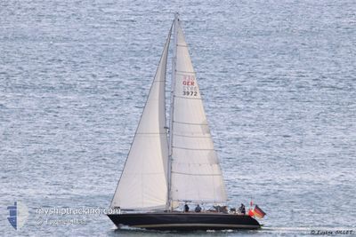
The vessel SY LOGOFF (MMSI: 211661220) is a Sailing It's sailing under the flag of [DE] Germany.
In this page you can find informations about the vessels current position, last detected port calls, and current voyage information. If the vessels is not in coverage by AIS you will find the latest position.
The current position of SY LOGOFF is detected by our AIS receivers and we are not responsible for the reliability of the data. The last position was recorded while the vessel was in Coverage by the Ais receivers of our vessel tracking app.
Weather
| Temperature | 11.3°C / 52.34°F |
|---|---|
| Wind Speed | 12 knots |
| Direction | 339° NNW |
| Pressure | 1032.1 hPa |
| Humidity | 86.9 % |
| Cloud Coverage | 76 % |
Featured Company
Events
| Heure | Evenement | Détails | Position/ Destination | Info |
|---|---|---|---|---|
| 2024-04-22 13:32 | Hors de la zone couverte |
52.11652 / -10.51567
North Atlantic Ocean
|
Vitesse: 5.2 kn Parcours: 52.3° |
|
| 2024-04-22 11:09 | Dans la zone couverte |
52.11375 / -10.26137
North Atlantic Ocean
|
Vitesse: 4.4 kn Parcours: 188.2° |
|
| 2024-04-21 21:15 | Hors de la zone couverte |
52.11001 / -10.26348
North Atlantic Ocean
|
Vitesse: 5.7 kn Parcours: 32.1° |
|
| 2024-04-21 16:33 | Dans la zone couverte |
51.73507 / -10.36552
North Atlantic Ocean
|
Vitesse: 5.2 kn Parcours: 344.2° |
|
| 2024-04-21 12:41 | Hors de la zone couverte |
51.55926 / -10.11640
North Atlantic Ocean
|
Vitesse: 5.5 kn Parcours: 9.4° |
|
| 2024-04-21 12:19 | Dans la zone couverte |
51.53137 / -10.11576
North Atlantic Ocean
|
Vitesse: 4.6 kn Parcours: 353.1° |
|
| 2024-04-21 11:12 | Hors de la zone couverte |
51.46867 / -10.06218
North Atlantic Ocean
|
Vitesse: 4.4 kn Parcours: 261.9° |
|
| 2024-04-21 08:38 | Changement de zone | Irish part of the North Atlantic Ocean Irish part of the Celtic Sea |
51.44464 / -9.83902
North Atlantic Ocean
|
Vitesse: 3.8 kn Parcours: 302.3° |
| 2024-04-21 04:18 | Démarrage | 12.25 nm, South of BANTRY |
51.48317 / -9.37876
|
Vitesse: 5.8 kn Parcours: 252.7° |
| 2024-04-21 03:39 | Dans la zone couverte |
51.48404 / -9.37526
Celtic Sea
|
Vitesse: 0.1 kn Parcours: 511° |