
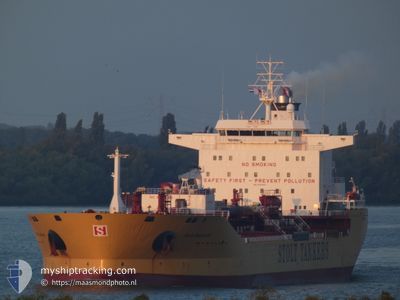
STOLT SAGALAND
Oil/Chemical Tanker
Current Trip
| Time Travelled | 38 days |
|---|---|
| Remaining Time | 5 days |
| Distance Travelled | 11687.11 nm |
| Remaining Distance | 1635.85 nm |
| AVG Speed | 12.4 Noeuds |
| MAX Speed | 15.3 Noeuds |
| AVG Wind | 14.4 knots |
| MAX Wind | 31.8 knots |
| MIN Temp | 15.2°C / 59.36°F |
| MAX Temp | 29.5°C / 85.1°F |
| Tirant d eau | 12.1 m |
| Position reçue | 5 d depuis |
Current Position
| Longitude | 55.60688° |
|---|---|
| Latitude | -20.32925° |
| Etat | Under way using engine |
| Vitesse | 13.8 Noeuds |
| Parcours | 61.1° |
| Zone | Indian Ocean |
| Station | T-AIS |
| Position reçue | 5 d depuis |
Info
Information
The current position of STOLT SAGALAND is in Indian Ocean with coordinates -20.32925° / 55.60688° as reported on 2024-04-14 05:35 by AIS to our vessel tracker app. The vessel's current speed is 13.8 Noeuds and is heading at the port of SINGAPORE. The estimated time of arrival as calculated by MyShipTracking vessel tracking app is 2024-04-25 09:33 LT
The vessel STOLT SAGALAND (IMO: 9352200, MMSI: 319282000) is a Oil/Chemical Tanker that was built in 2007 ( 17 Age ). It's sailing under the flag of [KY] Cayman Is.
In this page you can find informations about the vessels current position, last detected port calls, and current voyage information. If the vessels is not in coverage by AIS you will find the latest position.
The current position of STOLT SAGALAND is detected by our AIS receivers and we are not responsible for the reliability of the data. The last position was recorded while the vessel was in Coverage by the Ais receivers of our vessel tracking app.
The current draught of STOLT SAGALAND as reported by AIS is 12.1 meters
Weather
| Temperature | 28.6°C / 83.48°F |
|---|---|
| Wind Speed | 3 knots |
| Direction | 10° N |
| Pressure | 1008.7 hPa |
| Humidity | 75.7 % |
| Cloud Coverage | 100 % |
Featured Company
Last Port Calls
| Port | Arrival | Departure | Time In Port |
|---|---|---|---|
| 2024-03-11 00:08 | 2024-03-12 12:18 | 1 d | |
| 2024-03-07 07:36 | 2024-03-10 15:56 | 3 d | |
| 2024-03-02 04:01 | 2024-03-03 12:30 | 1 d | |
| 2024-02-29 00:36 | 2024-03-01 00:25 | 23 h | |
| 2024-02-12 15:10 | 2024-02-13 23:52 | 1 d | |
| 2024-02-06 21:37 | 2024-02-07 14:49 | 17 h | |
| 2024-02-05 14:57 | 2024-02-06 17:39 | 1 d | |
| 2024-02-01 14:17 | 2024-02-04 02:23 | 2 d |
Most Visited Ports (Last year)
| Port | Arrivals | |
|---|---|---|
| 7 | ||
| 5 | ||
| 5 | ||
| 2 | ||
| 2 | ||
| 2 |
Last Trips
| Origin | Departure | Destination | Arrival | Distance | |
|---|---|---|---|---|---|
| 2024-03-10 10:56 | 2024-03-10 19:08 | 95.24 nm | |||
| 2024-03-03 06:30 | 2024-03-07 01:36 | 48.86 nm | |||
| 2024-02-29 18:25 | 2024-03-01 22:01 | 234.67 nm | |||
| 2024-02-13 17:52 | 2024-02-28 18:36 | 538.02 nm | |||
| 2024-02-07 08:49 | 2024-02-12 09:10 | 62.67 nm | |||
| 2024-02-06 11:39 | 2024-02-06 15:37 | 33.87 nm | |||
| 2024-02-03 20:23 | 2024-02-05 08:57 | 66.69 nm | |||
| 2024-01-30 21:40 | 2024-02-01 08:17 | 437.19 nm |
Events
| Heure | Evenement | Détails | Position/ Destination | Info |
|---|---|---|---|---|
| 2024-04-14 05:40 | Etat Changé | Default Under way using engine |
-20.31833 / 55.62333
SGSIN PWBG B
|
Vitesse: 13.8 kn Parcours: 61.1° |
| 2024-04-14 05:35 | Etat Changé | Under way using engine Default |
-20.32925 / 55.60688
SGSIN PWBG B
|
Vitesse: 13.6 kn Parcours: 61° |
| 2024-04-14 05:35 | Hors de la zone couverte |
-20.32925 / 55.60688
Indian Ocean
SGSIN PWBG B
|
Vitesse: 13.8 kn Parcours: 61.1° |
|
| 2024-04-14 05:32 | Etat Changé | Default Under way using engine |
-20.33549 / 55.59488
SGSIN PWBG B
|
Vitesse: 13.5 kn Parcours: 61.7° |
| 2024-04-14 05:21 | Etat Changé | Under way using engine Default |
-20.35441 / 55.55757
SGSIN PWBG B
|
Vitesse: 13 kn Parcours: 62° |
| 2024-04-14 05:10 | Etat Changé | Default Under way using engine |
-20.37333 / 55.51667
SGSIN PWBG B
|
Vitesse: 13.4 kn Parcours: 62° |
| 2024-04-14 01:42 | Tirant d'eau modifié | 12.1 12 |
-20.84178 / 54.85511
SGSIN PWBG B
|
Vitesse: 13.2 kn Parcours: 53° |
| 2024-04-14 01:42 | Changement de destination | SGSIN PWBG B SGSIN |
-20.84178 / 54.85511
SGSIN PWBG B
|
Vitesse: 13.2 kn Parcours: 53° |
| 2024-04-14 01:42 | Changement d'ETA | 2024/04/25 07:00 2024/04/22 10:00 |
-20.84178 / 54.85511
SGSIN PWBG B
|
Vitesse: 13.2 kn Parcours: 53° |
| 2024-04-14 00:10 | Etat Changé | Under way using engine Default |
-21.04946 / 54.55070
SGSIN
|
Vitesse: 13.4 kn Parcours: 48° |