
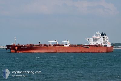
STI SLOANE
Tanker
Current Trip
| Time Travelled | --- |
|---|---|
| Remaining Time | --- |
| Distance Travelled | 11177.34 nm |
| Remaining Distance | --- |
| AVG Speed | 11.4 Noeuds |
| MAX Speed | 15.7 Noeuds |
| AVG Wind | 10 knots |
| MAX Wind | 28 knots |
| MIN Temp | 17.7°C / 63.86°F |
| MAX Temp | 29.9°C / 85.82°F |
| Tirant d eau | 14.8 m |
| Position reçue | 4 d depuis |
Current Position
| Longitude | 17.98908° |
|---|---|
| Latitude | -34.59750° |
| Etat | Under way using engine |
| Vitesse | 13.7 Noeuds |
| Parcours | 290.6° |
| Zone | South Atlantic Ocean |
| Station | T-AIS |
| Position reçue | 4 d depuis |
Info
Information
The current position of STI SLOANE is in South Atlantic Ocean with coordinates -34.59750° / 17.98908° as reported on 2024-04-16 01:57 by AIS to our vessel tracker app. The vessel's current speed is 13.7 Noeuds and is heading at the port of LE HAVRE. The estimated time of arrival as calculated by MyShipTracking vessel tracking app is 2024-05-05 10:00 LT
The vessel STI SLOANE (IMO: 9690808, MMSI: 538005387) is a Tanker It's sailing under the flag of [MH] Marshall Is.
In this page you can find informations about the vessels current position, last detected port calls, and current voyage information. If the vessels is not in coverage by AIS you will find the latest position.
The current position of STI SLOANE is detected by our AIS receivers and we are not responsible for the reliability of the data. The last position was recorded while the vessel was in Coverage by the Ais receivers of our vessel tracking app.
The current draught of STI SLOANE as reported by AIS is 14.8 meters
Weather
| Temperature | 22.7°C / 72.86°F |
|---|---|
| Wind Speed | 14 knots |
| Direction | 158° SSE |
| Pressure | 1013.8 hPa |
| Humidity | 86.4 % |
| Cloud Coverage | 7 % |
Featured Company
Events
| Heure | Evenement | Détails | Position/ Destination | Info |
|---|---|---|---|---|
| 2024-04-16 02:01 | Etat Changé | Default Under way using engine |
-34.59253 / 17.97327
FR LEH
|
Vitesse: 13.7 kn Parcours: 290.6° |
| 2024-04-16 01:57 | Hors de la zone couverte |
-34.59750 / 17.98908
South Atlantic Ocean
FR LEH
|
Vitesse: 13.7 kn Parcours: 290.6° |
|
| 2024-04-16 01:50 | Etat Changé | Under way using engine Default |
-34.60616 / 18.01727
FR LEH
|
Vitesse: 13.6 kn Parcours: 297° |
| 2024-04-16 01:16 | Etat Changé | Default Under way using engine |
-34.66500 / 18.15667
FR LEH
|
Vitesse: 13.4 kn Parcours: 298.3° |
| 2024-04-16 01:12 | Etat Changé | Under way using engine Default |
-34.67347 / 18.17576
FR LEH
|
Vitesse: 13.4 kn Parcours: 298° |
| 2024-04-16 01:09 | Etat Changé | Default Under way using engine |
-34.67788 / 18.18575
FR LEH
|
Vitesse: 13.4 kn Parcours: 298.1° |
| 2024-04-15 23:36 | Etat Changé | Under way using engine Default |
-34.87562 / 18.50720
FR LEH
|
Vitesse: 13.2 kn Parcours: 303° |
| 2024-04-15 23:29 | Dans la zone couverte |
-34.87528 / 18.50658
South Atlantic Ocean
FR LEH
|
Vitesse: 13.2 kn Parcours: 303.9° |
|
| 2024-04-15 22:13 | Etat Changé | Default Under way using engine |
-34.94333 / 18.86167
FR LEH
|
Vitesse: 12.9 kn Parcours: 279.8° |
| 2024-04-15 22:05 | Hors de la zone couverte |
-34.94900 / 18.89573
South Atlantic Ocean
FR LEH
|
Vitesse: 12.9 kn Parcours: 279.8° |