
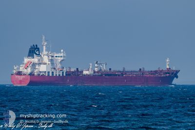
STI HAMMERSMITH
Tanker
Current Trip
| Time Travelled | 12 days |
|---|---|
| Remaining Time | 3 h, 42 mins |
| Distance Travelled | 1151.34 nm |
| Remaining Distance | 21.86 nm |
| AVG Speed | 5.9 Noeuds |
| MAX Speed | 13.3 Noeuds |
| AVG Wind | 23.3 knots |
| MAX Wind | 44 knots |
| MIN Temp | 8.7°C / 47.66°F |
| MAX Temp | 13.5°C / 56.3°F |
| Tirant d eau | 10.4 m |
| Position reçue | 1 h, 8 m depuis |
Current Position
| Longitude | --- |
|---|---|
| Latitude | --- |
| Etat | Under way using engine |
| Vitesse | 5.7 Noeuds |
| Parcours | 74° |
| Zone | Celtic Sea |
| Station | T-AIS |
| Position reçue | 1 h, 8 m depuis |
Info
Information
The current position of STI HAMMERSMITH is in Celtic Sea with coordinates 51.35983° / -5.10295° as reported on 2025-12-09 03:08 by AIS to our vessel tracker app. The vessel's current speed is 5.7 Noeuds and is heading at the port of PEMBROKE. The estimated time of arrival as calculated by MyShipTracking vessel tracking app is 2025-12-09 07:59 LT
The vessel STI HAMMERSMITH (IMO: 9706463, MMSI: 538005410) is a Tanker It's sailing under the flag of [MH] Marshall Is.
In this page you can find informations about the vessels current position, last detected port calls, and current voyage information. If the vessels is not in coverage by AIS you will find the latest position.
The current position of STI HAMMERSMITH is detected by our AIS receivers and we are not responsible for the reliability of the data. The last position was recorded while the vessel was in Coverage by the Ais receivers of our vessel tracking app.
The current draught of STI HAMMERSMITH as reported by AIS is 10.4 meters
Weather
| Temperature | 13.1°C / 55.58°F |
|---|---|
| Wind Speed | 39 knots |
| Direction | 190° S |
| Pressure | 994.6 hPa |
| Humidity | 91.8 % |
| Cloud Coverage | 100 % |
Featured Company
Last Port Calls
| Port | Arrival | Departure | Time In Port |
|---|---|---|---|
| 2025-11-24 20:15 | 2025-11-26 19:03 | 1 d | |
| 2025-11-24 19:53 | 2025-11-24 20:09 | 15 m | |
| 2025-11-16 06:45 | 2025-11-17 17:42 | 1 d | |
| 2025-11-03 10:02 | 2025-11-05 14:48 | 2 d | |
| 2025-10-24 20:57 | 2025-10-26 05:45 | 1 d | |
| 2025-10-19 03:37 | 2025-10-20 17:30 | 1 d | |
| 2025-10-12 04:24 | 2025-10-13 16:31 | 1 d | |
| 2025-10-06 06:57 | 2025-10-08 05:38 | 1 d | |
| 2025-10-03 02:28 |
Last Trips
| Origin | Departure | Destination | Arrival | Distance | |
|---|---|---|---|---|---|
| 2025-11-24 20:09 | 2025-11-24 20:15 | 0.12 nm | |||
| 2025-11-17 17:42 | 2025-11-24 19:53 | 820.15 nm | |||
| 2025-11-05 14:48 | 2025-11-16 06:45 | 704.69 nm | |||
| 2025-10-26 05:45 | 2025-11-03 10:02 | 549.60 nm | |||
| 2025-10-20 17:30 | 2025-10-24 20:57 | 815.97 nm | |||
| 2025-10-13 16:31 | 2025-10-19 03:37 | 1311.90 nm | |||
| 2025-10-08 05:38 | 2025-10-12 04:24 | 806.06 nm | |||
| 2025-10-03 02:28 | 2025-10-06 06:57 | 434.09 nm |
Events
| Heure | Evenement | Détails | Position/ Destination | Info |
|---|---|---|---|---|
| 2025-12-09 03:15 | Etat Changé | Default Under way using engine |
51.36316 / -5.08576
GBMLF
|
Vitesse: 5.7 kn Parcours: 74° |
| 2025-12-09 03:08 | Etat Changé | Under way using engine Default |
51.35983 / -5.10295
GBMLF
|
Vitesse: 5.7 kn Parcours: 73° |
| 2025-12-09 03:08 | Hors de la zone couverte |
51.35983 / -5.10295
Celtic Sea
|
Vitesse: 5.7 kn Parcours: 74° |
|
| 2025-12-09 03:07 | Etat Changé | Default Under way using engine |
51.35934 / -5.10543
GBMLF
|
Vitesse: 5.8 kn Parcours: 73° |
| 2025-12-09 03:07 | Etat Changé | Under way using engine Default |
51.35918 / -5.10630
GBMLF
|
Vitesse: 5.9 kn Parcours: 74° |
| 2025-12-09 03:04 | Dans la zone couverte |
51.35918 / -5.10630
Celtic Sea
|
Vitesse: 5.8 kn Parcours: 73° |
|
| 2025-12-08 14:07 | Etat Changé | Default Under way using engine |
51.40324 / -5.26096
GBMLF
|
Vitesse: 2.6 kn Parcours: 237° |
| 2025-12-08 14:01 | Etat Changé | Under way using engine Default |
51.40554 / -5.25502
GBMLF
|
Vitesse: 2.5 kn Parcours: 234° |
| 2025-12-08 14:01 | Hors de la zone couverte |
51.40554 / -5.25502
Celtic Sea
|
Vitesse: 2.6 kn Parcours: 236.1° |
|
| 2025-12-08 13:31 | Etat Changé | Default Under way using engine |
51.41852 / -5.22614
GBMLF
|
Vitesse: 2.9 kn Parcours: 234° |