
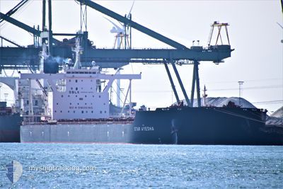
STAR AYESHA
Cargo
Current Trip
| Time Travelled | --- |
|---|---|
| Remaining Time | 3 days |
| Distance Travelled | 10377.66 nm |
| Remaining Distance | 952.39 nm |
| AVG Speed | 11.4 Noeuds |
| MAX Speed | 14.8 Noeuds |
| AVG Wind | 10.6 knots |
| MAX Wind | 31 knots |
| MIN Temp | 18.9°C / 66.02°F |
| MAX Temp | 29.8°C / 85.64°F |
| Tirant d eau | 11.5 m |
| Position reçue | 7 d depuis |
Current Position
| Longitude | --- |
|---|---|
| Latitude | --- |
| Etat | Under way using engine |
| Vitesse | 10.3 Noeuds |
| Parcours | 284.2° |
| Zone | South Atlantic Ocean |
| Station | T-AIS |
| Position reçue | 7 d depuis |
Info
Information
The current position of STAR AYESHA is in South Atlantic Ocean with coordinates -34.51282° / 16.31187° as reported on 2025-12-01 07:44 by AIS to our vessel tracker app. The vessel's current speed is 10.3 Noeuds and is heading at the port of ITAGUAI. The estimated time of arrival as calculated by MyShipTracking vessel tracking app is 2025-12-12 10:05 LT
The vessel STAR AYESHA (IMO: 9796315, MMSI: 636019359) is a Cargo It's sailing under the flag of [LR] Liberia.
In this page you can find informations about the vessels current position, last detected port calls, and current voyage information. If the vessels is not in coverage by AIS you will find the latest position.
The current position of STAR AYESHA is detected by our AIS receivers and we are not responsible for the reliability of the data. The last position was recorded while the vessel was in Coverage by the Ais receivers of our vessel tracking app.
The current draught of STAR AYESHA as reported by AIS is 11.5 meters
Weather
| Temperature | 21.5°C / 70.7°F |
|---|---|
| Wind Speed | 2 knots |
| Direction | 264° W |
| Pressure | 1016.9 hPa |
| Humidity | 63.2 % |
| Cloud Coverage | 89 % |
Featured Company
Last Port Calls
| Port | Arrival | Departure | Time In Port |
|---|---|---|---|
| 2025-10-04 13:02 | 2025-10-05 22:06 | 1 d |
Most Visited Ports (Last year)
| Port | Arrivals | |
|---|---|---|
| 3 | ||
| 2 | ||
| 1 | ||
| 1 |
Last Trips
| Origin | Departure | Destination | Arrival | Distance | |
|---|---|---|---|---|---|
| 2025-09-20 07:20 | 2025-10-04 13:02 | 3739.62 nm |
Events
| Heure | Evenement | Détails | Position/ Destination | Info |
|---|---|---|---|---|
| 2025-12-01 07:52 | Etat Changé | Default Under way using engine |
-34.50759 / 16.28608
BR SPB
|
Vitesse: 10.3 kn Parcours: 284.2° |
| 2025-12-01 07:44 | Hors de la zone couverte |
-34.51282 / 16.31187
South Atlantic Ocean
BR SPB
|
Vitesse: 10.3 kn Parcours: 284.2° |
|
| 2025-12-01 07:39 | Etat Changé | Under way using engine Default |
-34.51612 / 16.32876
BR SPB
|
Vitesse: 10.2 kn Parcours: 280° |
| 2025-12-01 07:12 | Etat Changé | Default Under way using engine |
-34.53448 / 16.42196
BR SPB
|
Vitesse: 10.7 kn Parcours: 286.9° |
| 2025-12-01 06:28 | Etat Changé | Under way using engine Default |
-34.56603 / 16.57035
BR SPB
|
Vitesse: 10.2 kn Parcours: 282° |
| 2025-12-01 06:16 | Etat Changé | Default Under way using engine |
-34.57492 / 16.61117
BR SPB
|
Vitesse: 10.4 kn Parcours: 285.4° |
| 2025-12-01 06:06 | Etat Changé | Under way using engine Default |
-34.58183 / 16.64362
BR SPB
|
Vitesse: 10.3 kn Parcours: 284° |
| 2025-12-01 05:59 | Etat Changé | Default Under way using engine |
-34.58673 / 16.66696
BR SPB
|
Vitesse: 10.6 kn Parcours: 285.7° |
| 2025-12-01 05:27 | Changement de destination | BR SPB ZA SDB |
-34.60869 / 16.77795
BR SPB
|
Vitesse: 10.4 kn Parcours: 278.6° |
| 2025-12-01 05:27 | Changement d'ETA | 2025/12/12 17:00 2025/12/02 02:00 |
-34.60869 / 16.77795
BR SPB
|
Vitesse: 10.4 kn Parcours: 278.6° |