
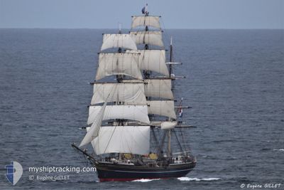
STAD AMSTERDAM
Passengers Ship
Current Trip
US HNL
| Time Travelled | 9 days |
|---|---|
| Remaining Time | --- |
| Distance Travelled | 1738.02 nm |
| Remaining Distance | --- |
| AVG Speed | 7.1 Noeuds |
| MAX Speed | 11.6 Noeuds |
| AVG Wind | 13.5 knots |
| MAX Wind | 21 knots |
| MIN Temp | 22.3°C / 72.14°F |
| MAX Temp | 24.9°C / 76.82°F |
| Tirant d eau | 4.8 m |
| Position reçue | 9 d depuis |
Current Position
| Longitude | -158.11419° |
|---|---|
| Latitude | 21.25570° |
| Etat | Under way sailing |
| Vitesse | 6.4 Noeuds |
| Parcours | 289.8° |
| Zone | North Pacific Ocean |
| Station | T-AIS |
| Position reçue | 9 d depuis |
Info
Information
The current position of STAD AMSTERDAM is in North Pacific Ocean with coordinates 21.25570° / -158.11419° as reported on 2024-04-10 02:17 by AIS to our vessel tracker app. The vessel's current speed is 6.4 Noeuds
The vessel STAD AMSTERDAM (IMO: 9185554, MMSI: 246494000) is a Passengers Ship that was built in 2000 ( 24 Age ). It's sailing under the flag of [NL] Netherlands.
In this page you can find informations about the vessels current position, last detected port calls, and current voyage information. If the vessels is not in coverage by AIS you will find the latest position.
The current position of STAD AMSTERDAM is detected by our AIS receivers and we are not responsible for the reliability of the data. The last position was recorded while the vessel was in Coverage by the Ais receivers of our vessel tracking app.
The current draught of STAD AMSTERDAM as reported by AIS is 4.8 meters
Weather
| Temperature | 23°C / 73.4°F |
|---|---|
| Wind Speed | 13 knots |
| Direction | 94° E |
| Pressure | 1019.3 hPa |
| Humidity | 76.7 % |
| Cloud Coverage | 30 % |
Featured Company
Last Port Calls
| Port | Arrival | Departure | Time In Port |
|---|---|---|---|
| 2024-04-07 18:43 | 2024-04-09 23:48 | 2 d | |
| 2024-03-06 16:15 | 2024-03-24 17:10 | 18 d | |
| 2024-02-06 20:31 | 2024-02-11 16:33 | 4 d | |
| 2024-02-01 04:15 |
Last Trips
| Origin | Departure | Destination | Arrival | Distance | |
|---|---|---|---|---|---|
| 2024-03-24 10:10 | 2024-04-07 08:43 | 2518.69 nm | |||
| 2024-02-11 11:33 | 2024-03-06 08:15 | 3737.24 nm | |||
| 2024-01-31 23:15 | 2024-02-06 15:31 | 371.70 nm |
Events
| Heure | Evenement | Détails | Position/ Destination | Info |
|---|---|---|---|---|
| 2024-04-10 02:22 | Etat Changé | Default Under way sailing |
21.25667 / -158.12167
US HNL
|
Vitesse: 6.4 kn Parcours: 289.8° |
| 2024-04-10 02:17 | Hors de la zone couverte |
21.25570 / -158.11419
North Pacific Ocean
|
Vitesse: 6.4 kn Parcours: 289.8° |
|
| 2024-04-10 02:11 | Etat Changé | Under way sailing Default |
21.25205 / -158.10260
US HNL
|
Vitesse: 6.6 kn Parcours: 286° |
| 2024-04-10 02:07 | Etat Changé | Default Under way sailing |
21.25007 / -158.09570
US HNL
|
Vitesse: 5.8 kn Parcours: 289.7° |
| 2024-04-10 01:57 | Etat Changé | Under way sailing Default |
21.24529 / -158.07869
US HNL
|
Vitesse: 5.4 kn Parcours: 269° |
| 2024-04-10 01:50 | Etat Changé | Default Under way sailing |
21.24504 / -158.06772
US HNL
|
Vitesse: 5.2 kn Parcours: 267.6° |
| 2024-04-10 01:38 | Etat Changé | Under way sailing Default |
21.24568 / -158.04950
US HNL
|
Vitesse: 4.7 kn Parcours: 260° |
| 2024-04-10 01:35 | Etat Changé | Default Under way sailing |
21.24566 / -158.04450
US HNL
|
Vitesse: 4.9 kn Parcours: 258° |
| 2024-04-10 01:26 | Etat Changé | Under way sailing Default |
21.24595 / -158.03243
US HNL
|
Vitesse: 4 kn Parcours: -1° |
| 2024-04-10 01:22 | Etat Changé | Default Under way sailing |
21.24500 / -158.02499
US HNL
|
Vitesse: 4.9 kn Parcours: 259° |