
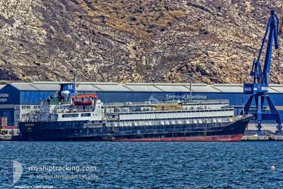
SPIRIDON II
General Cargo
Current Trip
| Time Travelled | 20 h, 34 mins |
|---|---|
| Remaining Time | --- |
| Distance Travelled | 236.78 nm |
| Remaining Distance | --- |
| AVG Speed | 11.5 Noeuds |
| MAX Speed | 12.5 Noeuds |
| AVG Wind | 9.7 knots |
| MAX Wind | 20.6 knots |
| MIN Temp | 18.9°C / 66.02°F |
| MAX Temp | 21.4°C / 70.52°F |
| Tirant d eau | 7.1 m |
| Position reçue | Maintenant |
Current Position
| Longitude | 29.35124° |
|---|---|
| Latitude | 35.26135° |
| Etat | Under way using engine |
| Vitesse | 11.6 Noeuds |
| Parcours | 267.6° |
| Zone | Mediterranean Sea - Eastern Basin |
| Station | T-AIS |
| Position reçue | Maintenant |
Info
Information
The current position of SPIRIDON II is in Mediterranean Sea - Eastern Basin with coordinates 35.26135° / 29.35124° as reported on 2024-04-24 03:45 by AIS to our vessel tracker app. The vessel's current speed is 11.6 Noeuds and is heading at the port of VALLETTA. The estimated time of arrival as calculated by MyShipTracking vessel tracking app is 2024-04-26 13:00 LT
The vessel SPIRIDON II (IMO: 7311329, MMSI: 671114100) is a General Cargo that was built in 1973 ( 51 Age ). It's sailing under the flag of [TG] Togo.
In this page you can find informations about the vessels current position, last detected port calls, and current voyage information. If the vessels is not in coverage by AIS you will find the latest position.
The current position of SPIRIDON II is detected by our AIS receivers and we are not responsible for the reliability of the data. The last position was recorded while the vessel was in Coverage by the Ais receivers of our vessel tracking app.
The current draught of SPIRIDON II as reported by AIS is 7.1 meters
Weather
| Temperature | 19.3°C / 66.74°F |
|---|---|
| Wind Speed | 21 knots |
| Direction | 102° ESE |
| Pressure | 1009.2 hPa |
| Humidity | 81.3 % |
| Cloud Coverage | 69 % |
Featured Company
Most Visited Ports (Last year)
| Port | Arrivals | |
|---|---|---|
| 5 | ||
| 4 | ||
| 2 | ||
| 2 | ||
| 2 | ||
| 2 |
Last Trips
| Origin | Departure | Destination | Arrival | Distance | |
|---|---|---|---|---|---|
| 2024-03-29 10:38 | 2024-04-21 09:58 | 5407.53 nm | |||
| 2024-02-22 18:20 | 2024-03-26 11:35 | 5703.28 nm | |||
| 2024-02-16 21:24 | 2024-02-17 10:13 | 109.92 nm |
Events
| Heure | Evenement | Détails | Position/ Destination | Info |
|---|---|---|---|---|
| 2024-04-24 00:31 | Changement de zone | Greek part of the Mediterranean Sea - Eastern Basin Turkish part of the Mediterranean Sea - Eastern Basin |
35.33672 / 30.09642
Mediterranean Sea - Eastern Basin
MALTA
|
Vitesse: 11.4 kn Parcours: 255.8° |
| 2024-04-24 00:09 | Etat Changé | Under way using engine Default |
35.36034 / 30.17876
MALTA
|
Vitesse: 11.4 kn Parcours: 259° |
| 2024-04-24 00:01 | Etat Changé | Default Under way using engine |
35.36465 / 30.20902
MALTA
|
Vitesse: 11.5 kn Parcours: 264.6° |
| 2024-04-23 22:03 | Etat Changé | Under way using engine Default |
35.47996 / 30.66287
MALTA
|
Vitesse: 12.3 kn Parcours: 258° |
| 2024-04-23 21:52 | Etat Changé | Default Under way using engine |
35.48725 / 30.70797
MALTA
|
Vitesse: 12.2 kn Parcours: 257° |
| 2024-04-23 21:11 | Etat Changé | Under way using engine Default |
35.52795 / 30.87180
MALTA
|
Vitesse: 12 kn Parcours: 250° |
| 2024-04-23 20:47 | Etat Changé | Default Under way using engine |
35.54611 / 30.96781
MALTA
|
Vitesse: 11.9 kn Parcours: 264.3° |
| 2024-04-23 20:42 | Etat Changé | Under way using engine Default |
35.54832 / 30.98601
MALTA
|
Vitesse: 11.9 kn Parcours: 258° |
| 2024-04-23 20:15 | Etat Changé | Default Under way using engine |
35.56613 / 31.09515
MALTA
|
Vitesse: 11.6 kn Parcours: 259° |
| 2024-04-23 19:44 | Etat Changé | Under way using engine Default |
35.58456 / 31.21366
MALTA
|
Vitesse: 11.5 kn Parcours: 256° |