
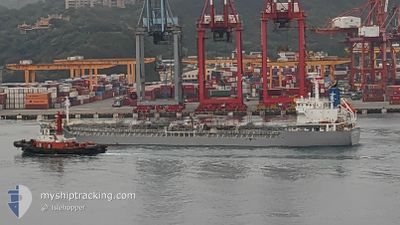
SOUTHERN MERMAID
Tanker B
Current Trip
| Trip Time | 7 days |
|---|---|
| Trip Distance | 1839.12 nm |
| AVG Speed | 10.8 Noeuds |
| MAX Speed | 14.4 Noeuds |
| Tirant d eau | 9.7 m |
| AVG Wind | 9.3 knots |
| MAX Wind | 18 knots |
| MIN Temp | 13.8°C / 56.84°F |
| MAX Temp | 29.2°C / 84.56°F |
| Position reçue | 6 d depuis |
Current Position
| Longitude | 128.98114° |
|---|---|
| Latitude | 34.48224° |
| Etat | Under way using engine |
| Vitesse | 11.2 Noeuds |
| Parcours | 193.7° |
| Zone | Japan Sea |
| Station | T-AIS |
| Position reçue | 6 d depuis |
Info
Information
The current position of SOUTHERN MERMAID is in Japan Sea with coordinates 34.48224° / 128.98114° as reported on 2024-04-18 13:57 by AIS to our vessel tracker app. The vessel's current speed is 11.2 Noeuds and is currently inside the port of TAGANITO.
The vessel SOUTHERN MERMAID (IMO: 9724166, MMSI: 636018879) is a Tanker B It's sailing under the flag of [LR] Liberia.
In this page you can find informations about the vessels current position, last detected port calls, and current voyage information. If the vessels is not in coverage by AIS you will find the latest position.
The current position of SOUTHERN MERMAID is detected by our AIS receivers and we are not responsible for the reliability of the data. The last position was recorded while the vessel was in Coverage by the Ais receivers of our vessel tracking app.
The current draught of SOUTHERN MERMAID as reported by AIS is 9.7 meters
Weather
| Temperature | 25.7°C / 78.26°F |
|---|---|
| Wind Speed | 6 knots |
| Direction | 98° E |
| Pressure | 1009 hPa |
| Humidity | 81.6 % |
| Cloud Coverage | 100 % |
Featured Company
Last Port Calls
| Port | Arrival | Departure | Time In Port |
|---|---|---|---|
| 2024-04-24 09:22 | |||
| 2024-04-16 06:27 | 2024-04-17 02:31 | 20 h | |
| 2024-03-19 00:37 | 2024-03-20 06:00 | 1 d | |
| 2024-03-18 08:04 | 2024-03-18 16:52 | 8 h | |
| 2024-03-11 12:16 | 2024-03-14 20:50 | 3 d | |
| 2024-02-20 05:15 | 2024-02-22 00:15 | 1 d | |
| 2024-02-13 02:43 | 2024-02-13 22:06 | 19 h |
Last Trips
| Origin | Departure | Destination | Arrival | Distance | |
|---|---|---|---|---|---|
| 2024-04-17 11:31 | 2024-04-24 17:22 | 1839.12 nm | |||
| 2024-03-20 15:00 | 2024-04-16 15:27 | 5563.46 nm | |||
| 2024-03-19 01:52 | 2024-03-19 09:37 | 5.76 nm | |||
| 2024-03-15 04:50 | 2024-03-18 17:04 | 870.87 nm | |||
| 2024-02-22 08:15 | 2024-03-11 20:16 | 3523.92 nm | |||
| 2024-02-14 07:06 | 2024-02-20 13:15 | 1601.07 nm | |||
| 2024-01-14 18:21 | 2024-02-13 11:43 | 5790.35 nm |
Events
| Heure | Evenement | Détails | Position/ Destination | Info |
|---|---|---|---|---|
| 2024-04-24 09:22 | Arret |
9.54972 / 125.81559
[PH] TAGANITO
|
Vitesse: 0.2 kn Parcours: 141° |
|
| 2024-04-24 09:22 | Port d'arrivée |
|
9.54972 / 125.81559
[PH] TAGANITO
|
Vitesse: 1 kn Parcours: 150° |
| 2024-04-24 06:25 | Démarrage | 2.9 nm, North of SURIGAO |
9.82512 / 125.52026
SURIGAO PHILIPPINES
|
Vitesse: 7.7 kn Parcours: 119° |
| 2024-04-18 13:57 | Hors de la zone couverte |
34.48224 / 128.98114
Japan Sea
SURIGAO PHILIPPINES
|
Vitesse: 11.2 kn Parcours: 193.7° |
|
| 2024-04-18 13:45 | Etat Changé | Under way using engine Default |
34.52032 / 128.99165
SURIGAO PHILIPPINES
|
Vitesse: 11.2 kn Parcours: 193° |
| 2024-04-18 13:45 | Dans la zone couverte |
34.52032 / 128.99165
Japan Sea
SURIGAO PHILIPPINES
|
Vitesse: 11.1 kn Parcours: 192° |
|
| 2024-04-18 12:09 | Etat Changé | Default Under way using engine |
34.80653 / 129.07867
SURIGAO PHILIPPINES
|
Vitesse: 11.3 kn Parcours: 192.6° |
| 2024-04-18 12:06 | Hors de la zone couverte |
34.81562 / 129.08201
Japan Sea
SURIGAO PHILIPPINES
|
Vitesse: 11.3 kn Parcours: 192.6° |
|
| 2024-04-18 10:43 | Démarrage | 3.21 nm, South of BUSAN |
35.04945 / 129.05863
SURIGAO PHILIPPINES
|
Vitesse: 3.1 kn Parcours: 185° |
| 2024-04-18 10:36 | Tirant d'eau modifié | 9.7 10.1 |
35.05121 / 129.05869
SURIGAO PHILIPPINES
|
Vitesse: Parcours: 190° |