
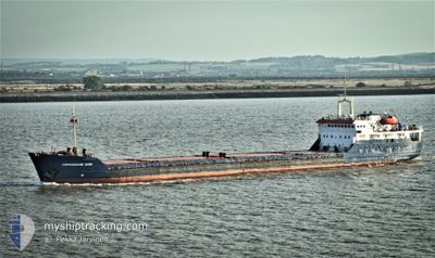
SORMOVSKIY 3056
General Cargo
Current Trip
| Trip Time | 24 days |
|---|---|
| Trip Distance | 1889.19 nm |
| AVG Speed | 13.1 Noeuds |
| MAX Speed | 13.1 Noeuds |
| Tirant d eau | 4.1 m |
| AVG Wind | 8.4 knots |
| MAX Wind | 23 knots |
| MIN Temp | 6.5°C / 43.7°F |
| MAX Temp | 26.8°C / 80.24°F |
| Position reçue | 19 m depuis |
Current Position
| Longitude | 27.93272° |
|---|---|
| Latitude | 40.96377° |
| Etat | Moored |
| Vitesse | |
| Parcours | 184° |
| Zone | Sea of Marmara |
| Station | T-AIS |
| Position reçue | 19 m depuis |
Info
Information
The current position of SORMOVSKIY 3056 is in Sea of Marmara with coordinates 40.96377° / 27.93272° as reported on 2024-04-18 21:13 by AIS to our vessel tracker app. The vessel's current speed is 0 Noeuds and is currently inside the port of MARTAS.
The vessel SORMOVSKIY 3056 (IMO: 8419623, MMSI: 273316200) is a General Cargo that was built in 1986 ( 38 Age ). It's sailing under the flag of [RU] Russia.
In this page you can find informations about the vessels current position, last detected port calls, and current voyage information. If the vessels is not in coverage by AIS you will find the latest position.
The current position of SORMOVSKIY 3056 is detected by our AIS receivers and we are not responsible for the reliability of the data. The last position was recorded while the vessel was in Coverage by the Ais receivers of our vessel tracking app.
The current draught of SORMOVSKIY 3056 as reported by AIS is 4.1 meters
Weather
| Temperature | 10.5°C / 50.9°F |
|---|---|
| Wind Speed | 6 knots |
| Direction | 354° N |
| Pressure | 1010.8 hPa |
| Humidity | 83.8 % |
| Cloud Coverage | 32 % |
Featured Company
Last Port Calls
| Port | Arrival | Departure | Time In Port |
|---|---|---|---|
| 2024-04-18 11:36 | |||
| 2024-03-21 05:28 | 2024-03-25 07:04 | 4 d | |
| 2024-03-08 05:47 | 2024-03-11 00:56 | 2 d | |
| 2024-02-20 11:24 | 2024-02-22 12:59 | 2 d | |
| 2024-02-08 04:10 | 2024-02-09 20:01 | 1 d |
Most Visited Ports (Last year)
| Port | Arrivals | |
|---|---|---|
| 7 | ||
| 6 | ||
| 2 | ||
| 2 | ||
| 1 | ||
| 1 |
Last Trips
| Origin | Departure | Destination | Arrival | Distance | |
|---|---|---|---|---|---|
| 2024-03-25 10:04 | 2024-04-18 14:36 | 1889.19 nm | |||
| 2024-03-11 03:56 | 2024-03-21 08:28 | 1334.80 nm | |||
| 2024-02-22 15:59 | 2024-03-08 08:47 | 1766.33 nm | |||
| 2024-02-09 23:01 | 2024-02-20 14:24 | 774.08 nm |
Events
| Heure | Evenement | Détails | Position/ Destination | Info |
|---|---|---|---|---|
| 2024-04-18 19:37 | Dans la zone couverte |
40.96377 / 27.93279
Sea of Marmara
[TR] MARTAS
|
Vitesse: Parcours: 273.1° |
|
| 2024-04-18 18:19 | Hors de la zone couverte |
40.96382 / 27.93281
Sea of Marmara
[TR] MARTAS
|
Vitesse: Parcours: 273.1° |
|
| 2024-04-18 12:14 | Etat Changé | Moored Under way using engine |
40.96378 / 27.93279
[TR] MARTAS
|
Vitesse: Parcours: 185° |
| 2024-04-18 11:55 | Arret |
40.96377 / 27.93296
[TR] MARTAS
|
Vitesse: 0.3 kn Parcours: 166° |
|
| 2024-04-18 11:36 | Port d'arrivée |
|
40.96050 / 27.93020
[TR] MARTAS
|
Vitesse: 2.7 kn Parcours: 61° |
| 2024-04-18 11:18 | Démarrage | 1.23 nm, South West of MARTAS |
40.95109 / 27.91070
TRTEK
|
Vitesse: 3.1 kn Parcours: 49° |
| 2024-04-18 11:09 | Etat Changé | Under way using engine At anchor |
40.94853 / 27.90653
TRTEK
|
Vitesse: 0.3 kn Parcours: 13° |
| 2024-04-18 03:44 | Etat Changé | At anchor Default |
40.94989 / 27.90381
TRTEK
|
Vitesse: Parcours: 114° |
| 2024-04-18 03:35 | Etat Changé | Default At anchor |
40.94992 / 27.90373
TRTEK
|
Vitesse: 0.1 kn Parcours: 113° |
| 2024-04-18 03:26 | Etat Changé | At anchor Default |
40.94995 / 27.90375
TRTEK
|
Vitesse: 0.1 kn Parcours: 113° |