
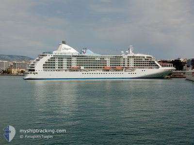
SEVEN SEAS VOYAGER
Passengers Ship
Current Trip
ES ACE
| Time Travelled | 19 h, 41 mins |
|---|---|
| Remaining Time | --- |
| Distance Travelled | 281.98 nm |
| Remaining Distance | --- |
| AVG Speed | 14.5 Noeuds |
| MAX Speed | 15.1 Noeuds |
| AVG Wind | 7.4 knots |
| MAX Wind | 10 knots |
| MIN Temp | 18.6°C / 65.48°F |
| MAX Temp | 20.2°C / 68.36°F |
| Tirant d eau | 7 m |
| Position reçue | 7 h, 34 m depuis |
Current Position
| Longitude | --- |
|---|---|
| Latitude | --- |
| Etat | Under way using engine |
| Vitesse | 14.5 Noeuds |
| Parcours | 26.9° |
| Zone | North Atlantic Ocean |
| Station | T-AIS |
| Position reçue | 7 h, 34 m depuis |
Info
Information
The current position of SEVEN SEAS VOYAGER is in North Atlantic Ocean with coordinates 31.45034° / -11.89230° as reported on 2025-12-07 05:01 by AIS to our vessel tracker app. The vessel's current speed is 14.5 Noeuds
The vessel SEVEN SEAS VOYAGER (IMO: 9247144, MMSI: 311513000) is a Passengers Ship that was built in 2003 ( 22 Age ). It's sailing under the flag of [BS] Bahamas.
In this page you can find informations about the vessels current position, last detected port calls, and current voyage information. If the vessels is not in coverage by AIS you will find the latest position.
The current position of SEVEN SEAS VOYAGER is detected by our AIS receivers and we are not responsible for the reliability of the data. The last position was recorded while the vessel was in Coverage by the Ais receivers of our vessel tracking app.
The current draught of SEVEN SEAS VOYAGER as reported by AIS is 7 meters
Weather
| Temperature | 18.6°C / 65.48°F |
|---|---|
| Wind Speed | 7 knots |
| Direction | 102° ESE |
| Pressure | 1023.3 hPa |
| Humidity | 75.9 % |
| Cloud Coverage | 72 % |
Featured Company
Last Port Calls
| Port | Arrival | Departure | Time In Port |
|---|---|---|---|
| 2025-12-06 05:52 | 2025-12-06 16:55 | 11 h | |
| 2025-12-05 06:28 | 2025-12-05 17:28 | 11 h | |
| 2025-12-04 08:46 | 2025-12-04 17:59 | 9 h | |
| 2025-12-03 06:33 | 2025-12-03 16:08 | 9 h | |
| 2025-12-01 06:26 | 2025-12-01 19:20 | 12 h | |
| 2025-11-29 06:10 | 2025-11-29 17:30 | 11 h | |
| 2025-11-27 05:33 | 2025-11-28 17:31 | 1 d | |
| 2025-11-26 06:06 | 2025-11-26 11:58 | 5 h | |
| 2025-11-25 06:27 | 2025-11-25 17:21 | 10 h | |
| 2025-11-24 06:14 | 2025-11-24 17:07 | 10 h |
Last Trips
| Origin | Departure | Destination | Arrival | Distance | |
|---|---|---|---|---|---|
| 2025-12-05 17:28 | 2025-12-06 05:52 | 113.94 nm | |||
| 2025-12-04 17:59 | 2025-12-05 06:28 | 168.85 nm | |||
| 2025-12-03 16:08 | 2025-12-04 08:46 | 243.39 nm | |||
| 2025-12-01 19:20 | 2025-12-03 06:33 | 577.92 nm | |||
| 2025-11-29 17:30 | 2025-12-01 06:26 | 599.81 nm | |||
| 2025-11-28 17:31 | 2025-11-29 06:10 | 193.59 nm | |||
| 2025-11-26 11:58 | 2025-11-27 05:33 | 224.57 nm | |||
| 2025-11-25 17:21 | 2025-11-26 06:06 | 162.83 nm | |||
| 2025-11-24 17:07 | 2025-11-25 06:27 | 111.27 nm | |||
| 2025-11-23 17:54 | 2025-11-24 06:14 | 170.20 nm |
Events
| Heure | Evenement | Détails | Position/ Destination | Info |
|---|---|---|---|---|
| 2025-12-07 05:07 | Etat Changé | Default Under way using engine |
31.47252 / -11.88082
ES ACE
|
Vitesse: 14.5 kn Parcours: 26.9° |
| 2025-12-07 05:01 | Hors de la zone couverte |
31.45034 / -11.89230
North Atlantic Ocean
|
Vitesse: 14.5 kn Parcours: 26.9° |
|
| 2025-12-07 05:00 | Etat Changé | Under way using engine Default |
31.44519 / -11.89502
ES ACE
|
Vitesse: 14.6 kn Parcours: 23° |
| 2025-12-07 04:47 | Etat Changé | Default Under way using engine |
31.39970 / -11.92161
ES ACE
|
Vitesse: 14.6 kn Parcours: 28.4° |
| 2025-12-07 04:47 | Etat Changé | Under way using engine Default |
31.39864 / -11.92229
ES ACE
|
Vitesse: 14.7 kn Parcours: 30° |
| 2025-12-07 04:23 | Etat Changé | Default Under way using engine |
31.31272 / -11.97453
ES ACE
|
Vitesse: 15 kn Parcours: 20.9° |
| 2025-12-07 04:13 | Etat Changé | Under way using engine Default |
31.27598 / -11.99529
ES ACE
|
Vitesse: 14.7 kn Parcours: 23° |
| 2025-12-07 03:51 | Etat Changé | Default Under way using engine |
31.19245 / -12.03846
ES ACE
|
Vitesse: 14.9 kn Parcours: 22.6° |
| 2025-12-07 03:44 | Detecté en mer | Moroccan part of the North Atlantic Ocean |
31.16741 / -12.05137
North Atlantic Ocean
|
Vitesse: 14.9 kn Parcours: 22.6° |
| 2025-12-07 03:44 | Etat Changé | Under way using engine Default |
31.16741 / -12.05137
ES ACE
|
Vitesse: 14.9 kn Parcours: 20° |