
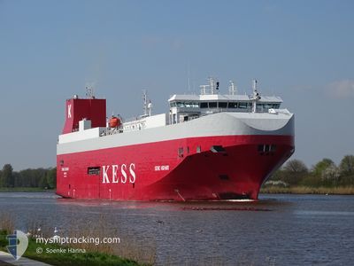
SEINE HIGHWAY
Ro-Ro/Passenger Ship
Current Trip
| Time Travelled | 1 day |
|---|---|
| Remaining Time | 10 h, 33 mins |
| Distance Travelled | 477.13 nm |
| Remaining Distance | 192.78 nm |
| AVG Speed | 17.3 Noeuds |
| MAX Speed | 19.2 Noeuds |
| AVG Wind | 12 knots |
| MAX Wind | 18.2 knots |
| MIN Temp | 5.2°C / 41.36°F |
| MAX Temp | 8.8°C / 47.84°F |
| Tirant d eau | 7.5 m |
| Position reçue | Maintenant |
Current Position
| Longitude | 9.67623° |
|---|---|
| Latitude | 57.61881° |
| Etat | Under way using engine |
| Vitesse | 18.6 Noeuds |
| Parcours | 57.6° |
| Zone | Skaggerak |
| Station | T-AIS |
| Position reçue | Maintenant |
Info
Information
The current position of SEINE HIGHWAY is in Skaggerak with coordinates 57.61881° / 9.67623° as reported on 2024-04-18 17:56 by AIS to our vessel tracker app. The vessel's current speed is 18.6 Noeuds and is heading at the port of MALMO. The estimated time of arrival as calculated by MyShipTracking vessel tracking app is 2024-04-19 04:30 LT
The vessel SEINE HIGHWAY (IMO: 9316311, MMSI: 308654000) is a Ro-Ro/Passenger Ship that was built in 2007 ( 17 Age ). It's sailing under the flag of [BS] Bahamas.
In this page you can find informations about the vessels current position, last detected port calls, and current voyage information. If the vessels is not in coverage by AIS you will find the latest position.
The current position of SEINE HIGHWAY is detected by our AIS receivers and we are not responsible for the reliability of the data. The last position was recorded while the vessel was in Coverage by the Ais receivers of our vessel tracking app.
The current draught of SEINE HIGHWAY as reported by AIS is 7.5 meters
Weather
| Temperature | 5.4°C / 41.72°F |
|---|---|
| Wind Speed | 9 knots |
| Direction | 68° ENE |
| Pressure | 1011.8 hPa |
| Humidity | 63 % |
| Cloud Coverage | 100 % |
Featured Company
Last Port Calls
| Port | Arrival | Departure | Time In Port |
|---|---|---|---|
| 2024-04-16 20:12 | 2024-04-17 15:22 | 19 h | |
| 2024-04-14 13:39 | 2024-04-15 22:26 | 1 d | |
| 2024-04-10 10:37 | 2024-04-11 14:02 | 1 d | |
| 2024-04-08 23:20 | 2024-04-09 21:04 | 21 h | |
| 2024-04-04 15:39 | 2024-04-05 21:32 | 1 d | |
| 2024-03-30 04:08 | 2024-03-30 14:04 | 9 h | |
| 2024-03-27 17:57 | 2024-03-29 02:31 | 1 d | |
| 2024-03-25 05:55 | 2024-03-25 15:43 | 9 h | |
| 2024-03-23 01:49 | 2024-03-23 12:18 | 10 h | |
| 2024-03-22 06:44 | 2024-03-22 15:39 | 8 h |
Last Trips
| Origin | Departure | Destination | Arrival | Distance | |
|---|---|---|---|---|---|
| 2024-04-16 00:26 | 2024-04-16 22:12 | 360.74 nm | |||
| 2024-04-11 17:02 | 2024-04-14 15:39 | 1041.91 nm | |||
| 2024-04-10 00:04 | 2024-04-10 13:37 | 238.65 nm | |||
| 2024-04-05 23:32 | 2024-04-09 02:20 | 1163.89 nm | |||
| 2024-03-30 14:04 | 2024-04-04 17:39 | 116.12 nm | |||
| 2024-03-29 03:31 | 2024-03-30 04:08 | 105.04 nm | |||
| 2024-03-25 16:43 | 2024-03-27 18:57 | 491.82 nm | |||
| 2024-03-23 13:18 | 2024-03-25 06:55 | 660.09 nm | |||
| 2024-03-22 16:39 | 2024-03-23 02:49 | 144.09 nm | |||
| 2024-03-20 17:04 | 2024-03-22 07:44 | 672.74 nm |
Events
| Heure | Evenement | Détails | Position/ Destination | Info |
|---|---|---|---|---|
| 2024-04-18 15:23 | Changement de zone | Danish part of the Skaggerak Danish part of the North Sea |
57.21193 / 8.46658
Skaggerak
MALMO
|
Vitesse: 18.1 kn Parcours: 57.7° |
| 2024-04-18 11:03 | Etat Changé | Under way using engine Default |
56.16317 / 7.04573
MALMO
|
Vitesse: 18 kn Parcours: 39° |
| 2024-04-18 10:51 | Etat Changé | Default Under way using engine |
56.11500 / 6.97833
MALMO
|
Vitesse: 18.1 kn Parcours: 39.6° |
| 2024-04-18 08:55 | Detecté en mer | Danish part of the North Sea |
55.64303 / 6.36752
North Sea
MALMO
|
Vitesse: 18.2 kn Parcours: 23.6° |
| 2024-04-18 07:57 | Changement d'ETA | 2024/04/19 05:00 2024/04/19 03:00 |
55.38448 / 6.16836
MALMO
|
Vitesse: 18 kn Parcours: 23.7° |
| 2024-04-18 07:28 | Detecté en mer | German part of the North Sea |
55.25613 / 6.06956
North Sea
MALMO
|
Vitesse: 18.1 kn Parcours: 24.2° |
| 2024-04-18 07:28 | Etat Changé | Under way using engine Default |
55.25431 / 6.06813
MALMO
|
Vitesse: 18 kn Parcours: 24° |
| 2024-04-18 07:28 | Dans la zone couverte |
55.25613 / 6.06956
North Sea
MALMO
|
Vitesse: 18.1 kn Parcours: 24.2° |
|
| 2024-04-18 01:50 | Etat Changé | Default Under way using engine |
53.71667 / 4.91167
MALMO
|
Vitesse: 18.2 kn Parcours: 20.8° |
| 2024-04-18 01:45 | Hors de la zone couverte |
53.69498 / 4.89730
North Sea
MALMO
|
Vitesse: 18.2 kn Parcours: 20.8° |