
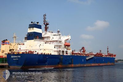
SEASALVIA
Oil/Chemical Tanker
Current Trip
| Time Travelled | 5 days |
|---|---|
| Remaining Time | 3 h, 38 mins |
| Distance Travelled | 972.71 nm |
| Remaining Distance | 104.34 nm |
| AVG Speed | 10.3 Noeuds |
| MAX Speed | 14.3 Noeuds |
| AVG Wind | 12.3 knots |
| MAX Wind | 34.7 knots |
| MIN Temp | 10.1°C / 50.18°F |
| MAX Temp | 22°C / 71.6°F |
| Tirant d eau | 12 m |
| Position reçue | 12 h, 48 m depuis |
Current Position
| Longitude | 18.34187° |
|---|---|
| Latitude | 36.06521° |
| Etat | Under way using engine |
| Vitesse | 11.7 Noeuds |
| Parcours | 267.3° |
| Zone | Mediterranean Sea - Eastern Basin |
| Station | T-AIS |
| Position reçue | 12 h, 48 m depuis |
Info
Information
The current position of SEASALVIA is in Mediterranean Sea - Eastern Basin with coordinates 36.06521° / 18.34187° as reported on 2024-04-24 19:40 by AIS to our vessel tracker app. The vessel's current speed is 11.7 Noeuds and is heading at the port of MARSAXLOKK. The estimated time of arrival as calculated by MyShipTracking vessel tracking app is 2024-04-25 12:06 LT
The vessel SEASALVIA (IMO: 9629550, MMSI: 229319000) is a Oil/Chemical Tanker that was built in 2013 ( 11 Age ). It's sailing under the flag of [MT] Malta.
In this page you can find informations about the vessels current position, last detected port calls, and current voyage information. If the vessels is not in coverage by AIS you will find the latest position.
The current position of SEASALVIA is detected by our AIS receivers and we are not responsible for the reliability of the data. The last position was recorded while the vessel was in Coverage by the Ais receivers of our vessel tracking app.
The current draught of SEASALVIA as reported by AIS is 12 meters
Weather
| Temperature | 14.7°C / 58.46°F |
|---|---|
| Wind Speed | 19 knots |
| Direction | 300° WNW |
| Pressure | 1013.3 hPa |
| Humidity | 60.6 % |
| Cloud Coverage | 2 % |
Featured Company
Last Port Calls
| Port | Arrival | Departure | Time In Port |
|---|---|---|---|
| 2024-04-18 11:27 | 2024-04-20 06:32 | 1 d | |
| 2024-04-14 11:14 | 2024-04-14 12:50 | 1 h | |
| 2024-04-11 05:23 | 2024-04-12 17:29 | 1 d | |
| 2024-04-09 16:18 | 2024-04-10 16:02 | 23 h | |
| 2024-04-07 15:04 | 2024-04-09 09:23 | 1 d | |
| 2024-03-30 14:32 | 2024-04-02 03:17 | 2 d | |
| 2024-03-15 03:59 | 2024-03-15 05:10 | 1 h | |
| 2024-03-11 08:09 | 2024-03-13 03:04 | 1 d | |
| 2024-03-05 19:27 | 2024-03-07 09:01 | 1 d | |
| 2024-02-25 09:59 | 2024-02-27 21:28 | 2 d |
Last Trips
| Origin | Departure | Destination | Arrival | Distance | |
|---|---|---|---|---|---|
| 2024-04-14 15:50 | 2024-04-18 14:27 | 128.94 nm | |||
| 2024-04-12 20:29 | 2024-04-14 14:14 | 85.20 nm | |||
| 2024-04-10 19:02 | 2024-04-11 08:23 | 104.45 nm | |||
| 2024-04-09 12:23 | 2024-04-09 19:18 | 17.75 nm | |||
| 2024-04-02 07:17 | 2024-04-07 18:04 | 749.44 nm | |||
| 2024-03-15 08:10 | 2024-03-30 18:32 | 1800.48 nm | |||
| 2024-03-13 05:04 | 2024-03-15 06:59 | 133.35 nm | |||
| 2024-03-07 11:01 | 2024-03-11 10:09 | 611.44 nm | |||
| 2024-02-27 22:28 | 2024-03-05 21:27 | 1536.85 nm | |||
| 2024-02-24 01:53 | 2024-02-25 10:59 | 7.26 nm |
Events
| Heure | Evenement | Détails | Position/ Destination | Info |
|---|---|---|---|---|
| 2024-04-24 19:42 | Etat Changé | Default Under way using engine |
36.06333 / 18.33167
MTMAR
|
Vitesse: 11.7 kn Parcours: 267.3° |
| 2024-04-24 19:40 | Hors de la zone couverte |
36.06521 / 18.34187
Mediterranean Sea - Eastern Basin
MTMAR
|
Vitesse: 11.7 kn Parcours: 267.3° |
|
| 2024-04-24 19:38 | Etat Changé | Under way using engine Default |
36.06543 / 18.34858
MTMAR
|
Vitesse: 11 kn Parcours: 263° |
| 2024-04-24 19:38 | Dans la zone couverte |
36.06521 / 18.34187
Mediterranean Sea - Eastern Basin
MTMAR
|
Vitesse: 11.7 kn Parcours: 267.3° |
|
| 2024-04-24 16:28 | Etat Changé | Default Under way using engine |
36.12018 / 19.13362
MTMAR
|
Vitesse: 12.8 kn Parcours: 267.7° |
| 2024-04-24 16:19 | Etat Changé | Under way using engine Default |
36.12118 / 19.17378
MTMAR
|
Vitesse: 12.8 kn Parcours: 267° |
| 2024-04-24 16:19 | Hors de la zone couverte |
36.12118 / 19.17378
Mediterranean Sea - Eastern Basin
MTMAR
|
Vitesse: 12.8 kn Parcours: 267.7° |
|
| 2024-04-24 15:45 | Etat Changé | Default Under way using engine |
36.12833 / 19.32333
MTMAR
|
Vitesse: 12.8 kn Parcours: 264.6° |
| 2024-04-24 15:42 | Etat Changé | Under way using engine Default |
36.12946 / 19.33657
MTMAR
|
Vitesse: 12 kn Parcours: 265° |
| 2024-04-24 15:33 | Etat Changé | Default Under way using engine |
36.13167 / 19.37667
MTMAR
|
Vitesse: 12.8 kn Parcours: 264.7° |