
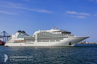
SEABOURN ENCORE
Passenger
Current Trip
| Time Travelled | 6 days |
|---|---|
| Remaining Time | 4 h, 15 mins |
| Distance Travelled | 2171.28 nm |
| Remaining Distance | 67.15 nm |
| AVG Speed | 15.4 Noeuds |
| MAX Speed | 17.7 Noeuds |
| AVG Wind | 11 knots |
| MAX Wind | 26 knots |
| MIN Temp | 14.9°C / 58.82°F |
| MAX Temp | 25.2°C / 77.36°F |
| Tirant d eau | 6.8 m |
| Position reçue | 4 m depuis |
Current Position
| Longitude | 23.59630° |
|---|---|
| Latitude | 36.89418° |
| Etat | Under way using engine |
| Vitesse | 9.1 Noeuds |
| Parcours | 29.4° |
| Zone | Aegean Sea |
| Station | T-AIS |
| Position reçue | 4 m depuis |
Info
Information
The current position of SEABOURN ENCORE is in Aegean Sea with coordinates 36.89418° / 23.59630° as reported on 2024-04-19 18:07 by AIS to our vessel tracker app. The vessel's current speed is 9.1 Noeuds and is heading at the port of PIRAEUS. The estimated time of arrival as calculated by MyShipTracking vessel tracking app is 2024-04-19 22:27 LT
The vessel SEABOURN ENCORE (IMO: 9731171, MMSI: 311000464) is a Passenger It's sailing under the flag of [BS] Bahamas.
In this page you can find informations about the vessels current position, last detected port calls, and current voyage information. If the vessels is not in coverage by AIS you will find the latest position.
The current position of SEABOURN ENCORE is detected by our AIS receivers and we are not responsible for the reliability of the data. The last position was recorded while the vessel was in Coverage by the Ais receivers of our vessel tracking app.
The current draught of SEABOURN ENCORE as reported by AIS is 6.8 meters
Weather
| Temperature | 16.1°C / 60.98°F |
|---|---|
| Wind Speed | 24 knots |
| Direction | 233° SW |
| Pressure | 1004.8 hPa |
| Humidity | 79.7 % |
| Cloud Coverage | 70 % |
Featured Company
Last Port Calls
| Port | Arrival | Departure | Time In Port |
|---|---|---|---|
| 2024-04-13 05:01 | 2024-04-13 17:42 | 12 h | |
| 2024-04-02 05:28 | 2024-04-02 16:44 | 11 h | |
| 2024-03-25 04:22 | 2024-03-25 13:58 | 9 h | |
| 2024-03-15 21:28 | 2024-03-16 10:35 | 13 h | |
| 2024-03-12 22:39 | 2024-03-13 11:46 | 13 h | |
| 2024-03-10 23:20 | 2024-03-11 12:57 | 13 h | |
| 2024-03-01 21:16 | 2024-03-02 13:24 | 16 h | |
| 2024-02-27 00:07 | 2024-02-27 11:36 | 11 h | |
| 2024-02-19 22:47 | 2024-02-20 11:47 | 12 h | |
| 2024-02-16 21:38 | 2024-02-17 15:05 | 17 h |
Last Trips
| Origin | Departure | Destination | Arrival | Distance | |
|---|---|---|---|---|---|
| 2024-04-02 18:44 | 2024-04-13 06:01 | 3826.28 nm | |||
| 2024-03-25 17:58 | 2024-04-02 07:28 | 3040.00 nm | |||
| 2024-03-16 18:35 | 2024-03-25 08:22 | 3337.09 nm | |||
| 2024-03-13 18:46 | 2024-03-16 05:28 | 815.46 nm | |||
| 2024-03-11 19:57 | 2024-03-13 05:39 | 282.80 nm | |||
| 2024-03-02 21:24 | 2024-03-11 06:20 | 1716.94 nm | |||
| 2024-02-27 18:36 | 2024-03-02 05:16 | 777.40 nm | |||
| 2024-02-20 18:47 | 2024-02-27 07:07 | 1142.87 nm | |||
| 2024-02-17 23:05 | 2024-02-20 05:47 | 815.79 nm | |||
| 2024-02-16 17:03 | 2024-02-17 05:38 | 138.06 nm |
Events
| Heure | Evenement | Détails | Position/ Destination | Info |
|---|---|---|---|---|
| 2024-04-19 17:25 | Etat Changé | Under way using engine Default |
36.78598 / 23.52153
GR PIR
|
Vitesse: 15 kn Parcours: 3° |
| 2024-04-19 16:57 | Etat Changé | Default Under way using engine |
36.67455 / 23.50244
GR PIR
|
Vitesse: 15.2 kn Parcours: 23.8° |
| 2024-04-19 16:43 | Changement de zone | Greek part of the Aegean Sea Italian part of the Mediterranean Sea - Eastern Basin |
36.61795 / 23.47125
Aegean Sea
GR PIR
|
Vitesse: 15.1 kn Parcours: 26.1° |
| 2024-04-19 16:43 | Etat Changé | Under way using engine Default |
36.61795 / 23.47125
GR PIR
|
Vitesse: 15 kn Parcours: 26° |
| 2024-04-19 16:32 | Dans la zone couverte |
36.61795 / 23.47125
Aegean Sea
GR PIR
|
Vitesse: 15.1 kn Parcours: 26.1° |
|
| 2024-04-18 10:52 | Hors de la zone couverte |
36.35609 / 14.63417
Mediterranean Sea - Eastern Basin
GR PIR
|
Vitesse: 14.9 kn Parcours: 112.8° |
|
| 2024-04-18 10:19 | Tirant d'eau modifié | 6.8 6 |
36.41140 / 14.48056
GR PIR
|
Vitesse: 14.8 kn Parcours: 115.1° |
| 2024-04-18 10:19 | Changement d'ETA | 2024/04/20 02:00 |
36.41140 / 14.48056
GR PIR
|
Vitesse: 14.8 kn Parcours: 115.1° |
| 2024-04-18 09:03 | Detecté en mer | Italian part of the Mediterranean Sea - Eastern Basin |
36.53916 / 14.12969
Mediterranean Sea - Eastern Basin
|
Vitesse: 14.4 kn Parcours: 115.3° |
| 2024-04-18 09:03 | Dans la zone couverte |
36.53916 / 14.12969
Mediterranean Sea - Eastern Basin
|
Vitesse: 14.4 kn Parcours: 115.3° |