
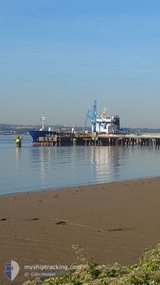
SARNIA CHERIE
Oil Products Tanker
Current Trip
| Time Travelled | 1 day |
|---|---|
| Remaining Time | 18 h, 30 mins |
| Distance Travelled | 281.57 nm |
| Remaining Distance | 168.95 nm |
| AVG Speed | 10.5 Noeuds |
| MAX Speed | 12.3 Noeuds |
| AVG Wind | 18.9 knots |
| MAX Wind | 22 knots |
| MIN Temp | 5.5°C / 41.9°F |
| MAX Temp | 10.1°C / 50.18°F |
| Tirant d eau | 4.7 m |
| Position reçue | Maintenant |
Current Position
| Longitude | -1.73135° |
|---|---|
| Latitude | 55.75950° |
| Etat | Under way using engine |
| Vitesse | 8.6 Noeuds |
| Parcours | 127.6° |
| Zone | North Sea |
| Station | T-AIS |
| Position reçue | Maintenant |
Info
Information
The current position of SARNIA CHERIE is in North Sea with coordinates 55.75950° / -1.73135° as reported on 2024-04-23 21:01 by AIS to our vessel tracker app. The vessel's current speed is 8.6 Noeuds and is heading at the port of IMMINGHAM. The estimated time of arrival as calculated by MyShipTracking vessel tracking app is 2024-04-24 15:32 LT
The vessel SARNIA CHERIE (IMO: 9322164, MMSI: 236401000) is a Oil Products Tanker that was built in 2007 ( 17 Age ). It's sailing under the flag of [GI] Gibraltar.
In this page you can find informations about the vessels current position, last detected port calls, and current voyage information. If the vessels is not in coverage by AIS you will find the latest position.
The current position of SARNIA CHERIE is detected by our AIS receivers and we are not responsible for the reliability of the data. The last position was recorded while the vessel was in Coverage by the Ais receivers of our vessel tracking app.
The current draught of SARNIA CHERIE as reported by AIS is 4.7 meters
Weather
| Temperature | 6.5°C / 43.7°F |
|---|---|
| Wind Speed | 19 knots |
| Direction | 352° N |
| Pressure | 1023.3 hPa |
| Humidity | 71.6 % |
| Cloud Coverage | 12 % |
Featured Company
Last Port Calls
| Port | Arrival | Departure | Time In Port |
|---|---|---|---|
| 2024-04-21 10:54 | 2024-04-22 18:22 | 1 d | |
| 2024-04-16 17:22 | 2024-04-17 07:41 | 14 h | |
| 2024-04-11 08:15 | 2024-04-11 18:44 | 10 h | |
| 2024-04-10 06:57 | 2024-04-10 19:10 | 12 h | |
| 2024-04-07 19:59 | 2024-04-07 20:36 | 36 m | |
| 2024-04-07 00:52 | 2024-04-07 19:37 | 18 h | |
| 2024-04-06 23:55 | 2024-04-07 00:32 | 37 m | |
| 2024-04-01 19:10 | 2024-04-02 17:32 | 22 h | |
| 2024-03-28 21:39 | 2024-03-30 06:32 | 1 d | |
| 2024-03-24 06:55 | 2024-03-24 17:47 | 10 h |
Last Trips
| Origin | Departure | Destination | Arrival | Distance | |
|---|---|---|---|---|---|
| 2024-04-17 08:41 | 2024-04-21 11:54 | 635.70 nm | |||
| 2024-04-11 19:44 | 2024-04-16 18:22 | 286.23 nm | |||
| 2024-04-10 20:10 | 2024-04-11 09:15 | 29.22 nm | |||
| 2024-04-07 21:36 | 2024-04-10 07:57 | 447.41 nm | |||
| 2024-04-07 20:37 | 2024-04-07 20:59 | 1.87 nm | |||
| 2024-04-07 01:32 | 2024-04-07 01:52 | 1.83 nm | |||
| 2024-04-02 18:32 | 2024-04-07 00:55 | 797.82 nm | |||
| 2024-03-30 07:32 | 2024-04-01 20:10 | 211.71 nm | |||
| 2024-03-24 17:47 | 2024-03-28 22:39 | 565.74 nm | |||
| 2024-03-22 21:23 | 2024-03-24 06:55 | 99.68 nm |
Events
| Heure | Evenement | Détails | Position/ Destination | Info |
|---|---|---|---|---|
| 2024-04-23 18:54 | Etat Changé | Under way using engine Default |
55.96939 / -2.15439
GBIMM
|
Vitesse: 10.3 kn Parcours: 144° |
| 2024-04-23 18:54 | Dans la zone couverte |
55.96788 / -2.15240
North Sea
GBIMM
|
Vitesse: 9.8 kn Parcours: 141.9° |
|
| 2024-04-23 17:43 | Etat Changé | Default Under way using engine |
56.13421 / -2.37059
GBIMM
|
Vitesse: 10.1 kn Parcours: 145° |
| 2024-04-23 17:39 | Hors de la zone couverte |
56.14395 / -2.38239
North Sea
GBIMM
|
Vitesse: 10.1 kn Parcours: 145° |
|
| 2024-04-23 17:13 | Etat Changé | Under way using engine Default |
56.20283 / -2.46156
GBIMM
|
Vitesse: 10.3 kn Parcours: 178° |
| 2024-04-23 17:06 | Etat Changé | Default Under way using engine |
56.22403 / -2.46336
GBIMM
|
Vitesse: 10.1 kn Parcours: 180.4° |
| 2024-04-23 16:20 | Etat Changé | Under way using engine Default |
56.35487 / -2.46191
GBIMM
|
Vitesse: 10.5 kn Parcours: 182° |
| 2024-04-23 15:40 | Etat Changé | Default Under way using engine |
56.47189 / -2.45775
GBIMM
|
Vitesse: 10.5 kn Parcours: 184.5° |
| 2024-04-23 15:37 | Etat Changé | Under way using engine Default |
56.47965 / -2.45723
GBIMM
|
Vitesse: 10.6 kn Parcours: 191° |
| 2024-04-23 15:37 | Dans la zone couverte |
56.47819 / -2.45745
North Sea
GBIMM
|
Vitesse: 10.5 kn Parcours: 184.5° |