
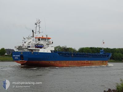
SANTA HELENA 1
General Cargo
Current Trip
| Time Travelled | 1 day |
|---|---|
| Remaining Time | 7 h, 1 mins |
| Distance Travelled | 329.89 nm |
| Remaining Distance | 73.23 nm |
| AVG Speed | 9.2 Noeuds |
| MAX Speed | 10.5 Noeuds |
| AVG Wind | 12.9 knots |
| MAX Wind | 23.8 knots |
| MIN Temp | 3.4°C / 38.12°F |
| MAX Temp | 5.5°C / 41.9°F |
| Tirant d eau | 3.5 m |
| Position reçue | 1 h, 59 m depuis |
Current Position
| Longitude | 18.44101° |
|---|---|
| Latitude | 55.58914° |
| Etat | Under way using engine |
| Vitesse | 10.1 Noeuds |
| Parcours | 84.1° |
| Zone | Baltic Sea |
| Station | T-AIS |
| Position reçue | 1 h, 59 m depuis |
Info
Information
The current position of SANTA HELENA 1 is in Baltic Sea with coordinates 55.58914° / 18.44101° as reported on 2024-04-25 02:13 by AIS to our vessel tracker app. The vessel's current speed is 10.1 Noeuds and is heading at the port of KLAIPEDA. The estimated time of arrival as calculated by MyShipTracking vessel tracking app is 2024-04-25 11:13 LT
The vessel SANTA HELENA 1 (IMO: 9617325, MMSI: 210075000) is a General Cargo that was built in 2012 ( 12 Age ). It's sailing under the flag of [CY] Cyprus.
In this page you can find informations about the vessels current position, last detected port calls, and current voyage information. If the vessels is not in coverage by AIS you will find the latest position.
The current position of SANTA HELENA 1 is detected by our AIS receivers and we are not responsible for the reliability of the data. The last position was recorded while the vessel was in Coverage by the Ais receivers of our vessel tracking app.
The current draught of SANTA HELENA 1 as reported by AIS is 3.5 meters
Weather
| Temperature | 3.9°C / 39.02°F |
|---|---|
| Wind Speed | 10 knots |
| Direction | 346° NNW |
| Pressure | 1004.5 hPa |
| Humidity | 89.3 % |
| Cloud Coverage | 49 % |
Featured Company
Last Port Calls
| Port | Arrival | Departure | Time In Port |
|---|---|---|---|
| 2024-04-23 00:00 | 2024-04-23 18:10 | 18 h | |
| 2024-04-21 16:35 | 2024-04-22 17:28 | 1 d | |
| 2024-04-09 18:41 | 2024-04-18 02:54 | 8 d | |
| 2024-04-05 02:53 | 2024-04-08 10:28 | 3 d | |
| 2024-04-03 06:20 | 2024-04-04 15:19 | 1 d | |
| 2024-04-01 10:18 | 2024-04-01 22:09 | 11 h | |
| 2024-03-28 18:44 | 2024-03-29 20:09 | 1 d | |
| 2024-03-24 05:25 | 2024-03-26 18:33 | 2 d | |
| 2024-03-21 16:21 | 2024-03-23 16:52 | 2 d | |
| 2024-03-19 05:55 | 2024-03-20 12:43 | 1 d |
Most Visited Ports (Last year)
| Port | Arrivals | |
|---|---|---|
| 10 | ||
| 6 | ||
| 4 | ||
| 4 | ||
| 4 | ||
| 3 |
Last Trips
| Origin | Departure | Destination | Arrival | Distance | |
|---|---|---|---|---|---|
| 2024-04-22 19:28 | 2024-04-23 02:00 | 64.75 nm | |||
| 2024-04-18 04:54 | 2024-04-21 18:35 | 368.22 nm | |||
| 2024-04-08 12:28 | 2024-04-09 20:41 | 241.76 nm | |||
| 2024-04-04 17:19 | 2024-04-05 04:53 | 96.65 nm | |||
| 2024-04-02 00:09 | 2024-04-03 08:20 | 233.13 nm | |||
| 2024-03-29 21:09 | 2024-04-01 12:18 | 190.11 nm | |||
| 2024-03-26 18:33 | 2024-03-28 19:44 | 287.54 nm | |||
| 2024-03-23 16:52 | 2024-03-24 05:25 | 105.79 nm | |||
| 2024-03-20 12:43 | 2024-03-21 16:21 | 235.32 nm | |||
| 2024-03-15 16:43 | 2024-03-19 05:55 | 709.16 nm |
Events
| Heure | Evenement | Détails | Position/ Destination | Info |
|---|---|---|---|---|
| 2024-04-25 02:21 | Etat Changé | Default Under way using engine |
55.59146 / 18.48153
LTKLJ
|
Vitesse: 10.1 kn Parcours: 84.1° |
| 2024-04-25 02:13 | Hors de la zone couverte |
55.58914 / 18.44101
Baltic Sea
LTKLJ
|
Vitesse: 10.1 kn Parcours: 84.1° |
|
| 2024-04-25 01:58 | Etat Changé | Under way using engine Default |
55.58479 / 18.36880
LTKLJ
|
Vitesse: 9.9 kn Parcours: 83° |
| 2024-04-25 01:39 | Dans la zone couverte |
55.58499 / 18.37214
Baltic Sea
LTKLJ
|
Vitesse: 9.9 kn Parcours: 83.8° |
|
| 2024-04-25 01:04 | Etat Changé | Default Under way using engine |
55.56873 / 18.10740
LTKLJ
|
Vitesse: 10 kn Parcours: 85.5° |
| 2024-04-25 00:56 | Hors de la zone couverte |
55.56632 / 18.06396
Baltic Sea
LTKLJ
|
Vitesse: 10 kn Parcours: 85.5° |
|
| 2024-04-25 00:41 | Etat Changé | Under way using engine Default |
55.56314 / 17.99314
LTKLJ
|
Vitesse: 10.2 kn Parcours: 86° |
| 2024-04-25 00:40 | Etat Changé | Default Under way using engine |
55.56299 / 17.98905
LTKLJ
|
Vitesse: 10.2 kn Parcours: 85.4° |
| 2024-04-24 21:32 | Detecté en mer | Polish part of the Baltic Sea |
55.51122 / 17.05784
Baltic Sea
LTKLJ
|
Vitesse: 10 kn Parcours: 85.1° |
| 2024-04-24 18:11 | Detecté en mer | Swedish part of the Baltic Sea |
55.45719 / 16.07437
Baltic Sea
LTKLJ
|
Vitesse: 10 kn Parcours: 84.3° |