
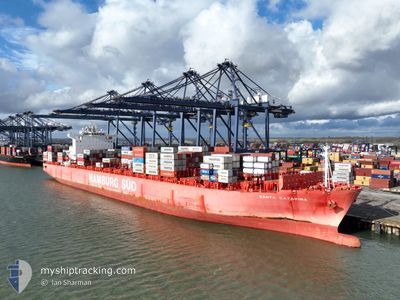
SANTA CATARINA
Container Ship
Current Trip
| Time Travelled | 1 day |
|---|---|
| Remaining Time | 1 day |
| Distance Travelled | 260.32 nm |
| Remaining Distance | 367.86 nm |
| AVG Speed | 10.8 Noeuds |
| MAX Speed | 14 Noeuds |
| AVG Wind | 8.8 knots |
| MAX Wind | 15.9 knots |
| MIN Temp | 26.5°C / 79.7°F |
| MAX Temp | 28.4°C / 83.12°F |
| Tirant d eau | 10.8 m |
| Position reçue | 19 h, 50 m depuis |
Current Position
| Longitude | 38.63748° |
|---|---|
| Latitude | 22.45323° |
| Etat | Under way using engine |
| Vitesse | 11.6 Noeuds |
| Parcours | 318.4° |
| Zone | Red Sea |
| Station | T-AIS |
| Position reçue | 19 h, 50 m depuis |
Info
Information
The current position of SANTA CATARINA is in Red Sea with coordinates 22.45323° / 38.63748° as reported on 2024-04-24 15:42 by AIS to our vessel tracker app. The vessel's current speed is 11.6 Noeuds and is heading at the port of SUEZ CANAL. The estimated time of arrival as calculated by MyShipTracking vessel tracking app is 2024-04-26 16:09 LT
The vessel SANTA CATARINA (IMO: 9444730, MMSI: 219072000) is a Container Ship that was built in 2011 ( 13 Age ). It's sailing under the flag of [DK] Denmark.
In this page you can find informations about the vessels current position, last detected port calls, and current voyage information. If the vessels is not in coverage by AIS you will find the latest position.
The current position of SANTA CATARINA is detected by our AIS receivers and we are not responsible for the reliability of the data. The last position was recorded while the vessel was in Coverage by the Ais receivers of our vessel tracking app.
The current draught of SANTA CATARINA as reported by AIS is 10.8 meters
Weather
| Temperature | 27.5°C / 81.5°F |
|---|---|
| Wind Speed | 2 knots |
| Direction | 323° NW |
| Pressure | 1004.5 hPa |
| Humidity | 68.3 % |
| Cloud Coverage | 40 % |
Featured Company
Last Port Calls
| Port | Arrival | Departure | Time In Port |
|---|---|---|---|
| 2024-04-23 22:24 | 2024-04-24 10:36 | 12 h | |
| 2024-04-21 21:07 | 2024-04-23 16:12 | 1 d | |
| 2024-04-19 05:14 | 2024-04-20 11:43 | 1 d | |
| 2024-04-13 03:16 | 2024-04-14 01:20 | 22 h | |
| 2024-04-03 02:53 | 2024-04-04 14:33 | 1 d | |
| 2024-03-31 07:26 | 2024-03-31 17:42 | 10 h | |
| 2024-03-29 07:56 | 2024-03-30 15:10 | 1 d | |
| 2024-03-26 15:03 | 2024-03-27 11:52 | 20 h | |
| 2024-03-21 02:54 | 2024-03-22 10:57 | 1 d | |
| 2024-03-13 03:38 | 2024-03-14 08:50 | 1 d |
Most Visited Ports (Last year)
| Port | Arrivals | |
|---|---|---|
| 12 | ||
| 7 | ||
| 6 | ||
| 6 | ||
| 6 | ||
| 5 |
Last Trips
| Origin | Departure | Destination | Arrival | Distance | |
|---|---|---|---|---|---|
| 2024-04-23 19:12 | 2024-04-24 01:24 | 86.19 nm | |||
| 2024-04-14 01:20 | 2024-04-22 00:07 | 2678.80 nm | |||
| 2024-04-14 01:20 | 2024-04-19 07:14 | 1959.71 nm | |||
| 2024-03-31 20:42 | 2024-04-13 03:16 | 2795.18 nm | |||
| 2024-03-31 20:42 | 2024-04-03 04:53 | 605.87 nm | |||
| 2024-03-30 18:10 | 2024-03-31 10:26 | 88.45 nm | |||
| 2024-03-22 10:57 | 2024-03-29 10:56 | 2680.09 nm | |||
| 2024-03-22 10:57 | 2024-03-26 17:03 | 1963.01 nm | |||
| 2024-03-10 22:33 | 2024-03-21 02:54 | 2689.16 nm | |||
| 2024-03-10 22:33 | 2024-03-13 05:38 | 601.10 nm |
Events
| Heure | Evenement | Détails | Position/ Destination | Info |
|---|---|---|---|---|
| 2024-04-24 15:44 | Etat Changé | Default Under way using engine |
22.45892 / 38.63209
SAKAP>>EGSUZ
|
Vitesse: 11.6 kn Parcours: 318.4° |
| 2024-04-24 15:42 | Etat Changé | Under way using engine Default |
22.45323 / 38.63748
SAKAP>>EGSUZ
|
Vitesse: 11.6 kn Parcours: 313° |
| 2024-04-24 15:42 | Hors de la zone couverte |
22.45323 / 38.63748
Red Sea
SAKAP>>EGSUZ
|
Vitesse: 11.6 kn Parcours: 318.4° |
|
| 2024-04-24 15:34 | Etat Changé | Default Under way using engine |
22.43645 / 38.65513
SAKAP>>EGSUZ
|
Vitesse: 11.5 kn Parcours: 307.5° |
| 2024-04-24 15:28 | Etat Changé | Under way using engine Default |
22.42498 / 38.67102
SAKAP>>EGSUZ
|
Vitesse: 11.5 kn Parcours: 306° |
| 2024-04-24 15:08 | Etat Changé | Default Under way using engine |
22.38496 / 38.72913
SAKAP>>EGSUZ
|
Vitesse: 12.8 kn Parcours: 309.4° |
| 2024-04-24 15:01 | Etat Changé | Under way using engine Default |
22.37043 / 38.74822
SAKAP>>EGSUZ
|
Vitesse: 12.8 kn Parcours: 310° |
| 2024-04-24 14:53 | Etat Changé | Default Under way using engine |
22.35224 / 38.77187
SAKAP>>EGSUZ
|
Vitesse: 12.8 kn Parcours: 309.5° |
| 2024-04-24 14:20 | Etat Changé | Under way using engine Not under command |
22.28927 / 38.84439
SAKAP>>EGSUZ
|
Vitesse: 2.2 kn Parcours: 330° |
| 2024-04-24 13:30 | Tirant d'eau modifié | 10.8 10.7 |
22.26804 / 38.82743
SAKAP>>EGSUZ
|
Vitesse: 2 kn Parcours: 304° |