
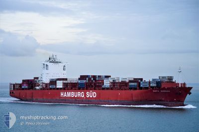
SANTA BARBARA
Container Ship
Current Trip
| Time Travelled | 10 h, 36 mins |
|---|---|
| Remaining Time | --- |
| Distance Travelled | 148.98 nm |
| Remaining Distance | --- |
| AVG Speed | 14.3 Noeuds |
| MAX Speed | 17.2 Noeuds |
| AVG Wind | 6.3 knots |
| MAX Wind | 19 knots |
| MIN Temp | 6.7°C / 44.06°F |
| MAX Temp | 16.4°C / 61.52°F |
| Tirant d eau | 11.8 m |
| Position reçue | 1 m depuis |
Current Position
| Longitude | -124.98205° |
|---|---|
| Latitude | 48.51801° |
| Etat | Under way using engine |
| Vitesse | 14.5 Noeuds |
| Parcours | 271.1° |
| Zone | North Pacific Ocean |
| Station | T-AIS |
| Position reçue | 1 m depuis |
Info
Information
The current position of SANTA BARBARA is in North Pacific Ocean with coordinates 48.51801° / -124.98205° as reported on 2024-04-24 05:26 by AIS to our vessel tracker app. The vessel's current speed is 14.5 Noeuds and is heading at the port of YOKOHAMA. The estimated time of arrival as calculated by MyShipTracking vessel tracking app is 2024-05-05 13:30 LT
The vessel SANTA BARBARA (IMO: 9430399, MMSI: 219068000) is a Container Ship that was built in 2012 ( 12 Age ). It's sailing under the flag of [DK] Denmark.
In this page you can find informations about the vessels current position, last detected port calls, and current voyage information. If the vessels is not in coverage by AIS you will find the latest position.
The current position of SANTA BARBARA is detected by our AIS receivers and we are not responsible for the reliability of the data. The last position was recorded while the vessel was in Coverage by the Ais receivers of our vessel tracking app.
The current draught of SANTA BARBARA as reported by AIS is 11.8 meters
Weather
| Temperature | 9.7°C / 49.46°F |
|---|---|
| Wind Speed | 11 knots |
| Direction | 287° WNW |
| Pressure | 1015.8 hPa |
| Humidity | 90.1 % |
| Cloud Coverage | 100 % |
Featured Company
Last Port Calls
| Port | Arrival | Departure | Time In Port |
|---|---|---|---|
| 2024-04-19 01:10 | 2024-04-23 18:51 | 4 d | |
| 2024-04-08 12:59 | 2024-04-12 01:07 | 3 d | |
| 2024-04-08 12:00 | 2024-04-08 12:12 | 11 m | |
| 2024-03-26 02:26 | 2024-03-26 10:08 | 7 h | |
| 2024-03-23 00:39 | 2024-03-24 02:51 | 1 d | |
| 2024-03-20 06:22 | 2024-03-20 21:08 | 14 h | |
| 2024-03-14 16:09 | 2024-03-15 10:16 | 18 h | |
| 2024-03-08 22:59 | 2024-03-09 09:29 | 10 h | |
| 2024-02-21 18:52 | 2024-02-27 20:42 | 6 d | |
| 2024-02-06 13:35 | 2024-02-09 07:27 | 2 d |
Most Visited Ports (Last year)
| Port | Arrivals | |
|---|---|---|
| 7 | ||
| 6 | ||
| 5 | ||
| 4 | ||
| 3 | ||
| 3 |
Last Trips
| Origin | Departure | Destination | Arrival | Distance | |
|---|---|---|---|---|---|
| 2024-04-11 18:07 | 2024-04-18 18:10 | 649.06 nm | |||
| 2024-04-08 05:12 | 2024-04-08 05:59 | 1.56 nm | |||
| 2024-03-26 19:08 | 2024-04-08 05:00 | 3876.89 nm | |||
| 2024-03-24 11:51 | 2024-03-26 11:26 | 891.86 nm | |||
| 2024-03-21 05:08 | 2024-03-23 09:39 | 568.14 nm | |||
| 2024-03-15 18:16 | 2024-03-20 14:22 | 883.48 nm | |||
| 2024-03-09 18:29 | 2024-03-15 00:09 | 1684.96 nm | |||
| 2024-02-27 12:42 | 2024-03-09 07:59 | 4339.24 nm | |||
| 2024-02-08 23:27 | 2024-02-21 10:52 | 644.32 nm | |||
| 2024-02-06 04:59 | 2024-02-06 05:35 | 1.16 nm |
Events
| Heure | Evenement | Détails | Position/ Destination | Info |
|---|---|---|---|---|
| 2024-04-24 05:12 | Etat Changé | Under way using engine Default |
48.51738 / -124.89567
CAVNR>JPYOK
|
Vitesse: 14.7 kn Parcours: 270° |
| 2024-04-24 05:09 | Etat Changé | Default Under way using engine |
48.51730 / -124.87900
CAVNR>JPYOK
|
Vitesse: 14.6 kn Parcours: 270.4° |
| 2024-04-24 04:51 | Changement de zone | Canadian part of the North Pacific Ocean Canadian part of the The Coastal Waters of Southeast Alaska and British Columbia |
48.51683 / -124.76838
North Pacific Ocean
CAVNR>JPYOK
|
Vitesse: 14.6 kn Parcours: 270.6° |
| 2024-04-24 04:51 | Etat Changé | Under way using engine Default |
48.51683 / -124.76838
CAVNR>JPYOK
|
Vitesse: 14.6 kn Parcours: 273° |
| 2024-04-24 04:37 | Etat Changé | Default Under way using engine |
48.50555 / -124.68497
CAVNR>JPYOK
|
Vitesse: 14.8 kn Parcours: 289.5° |
| 2024-04-24 04:33 | Etat Changé | Under way using engine Default |
48.49968 / -124.65971
CAVNR>JPYOK
|
Vitesse: 14.7 kn Parcours: 289° |
| 2024-04-24 04:30 | Dans la zone couverte |
48.49968 / -124.65971
The Coastal Waters of Southeast Alaska and British Columbia
CAVNR>JPYOK
|
Vitesse: 14.8 kn Parcours: 289.5° |
|
| 2024-04-24 03:26 | Etat Changé | Default Under way using engine |
48.39123 / -124.28519
CAVNR>JPYOK
|
Vitesse: 13.7 kn Parcours: 293.8° |
| 2024-04-24 03:19 | Hors de la zone couverte |
48.38193 / -124.25263
The Coastal Waters of Southeast Alaska and British Columbia
CAVNR>JPYOK
|
Vitesse: 13.7 kn Parcours: 293.8° |
|
| 2024-04-24 03:03 | Etat Changé | Under way using engine Default |
48.35494 / -124.16522
CAVNR>JPYOK
|
Vitesse: 13.3 kn Parcours: 295° |