
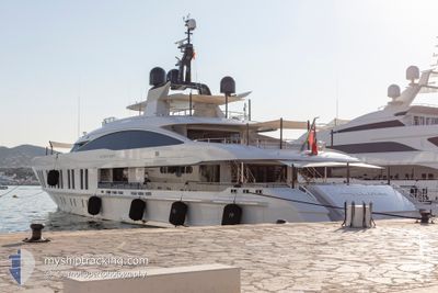
SAMURAI
Pleasure Craft
Current Position
| Longitude | -77.32099° |
|---|---|
| Latitude | 25.08317° |
| Etat | Moored |
| Vitesse | |
| Parcours | 278° |
| Zone | North Atlantic Ocean |
| Station | T-AIS |
| Position reçue | 22 m depuis |
Info
Information
The current position of SAMURAI is in North Atlantic Ocean with coordinates 25.08317° / -77.32099° as reported on 2024-04-25 15:58 by AIS to our vessel tracker app. The vessel's current speed is 0 Noeuds and is currently inside the port of NASSAU.
The vessel SAMURAI (IMO: 1012426, MMSI: 319099400) is a Pleasure Craft It's sailing under the flag of [KY] Cayman Is.
In this page you can find informations about the vessels current position, last detected port calls, and current voyage information. If the vessels is not in coverage by AIS you will find the latest position.
The current position of SAMURAI is detected by our AIS receivers and we are not responsible for the reliability of the data. The last position was recorded while the vessel was in Coverage by the Ais receivers of our vessel tracking app.
The current draught of SAMURAI as reported by AIS is 3.3 meters
Weather
| Temperature | 23.3°C / 73.94°F |
|---|---|
| Wind Speed | 10 knots |
| Direction | 75° ENE |
| Pressure | 1020.9 hPa |
| Humidity | 59.4 % |
| Cloud Coverage | 100 % |
Featured Company
Most Visited Ports (Last year)
| Port | Arrivals | |
|---|---|---|
| 4 | ||
| 3 | ||
| 3 | ||
| 2 | ||
| 2 | ||
| 2 |
Last Trips
| Origin | Departure | Destination | Arrival | Distance | |
|---|---|---|---|---|---|
| 2024-03-12 08:47 | 2024-03-17 08:47 | 387.99 nm | |||
| 2024-03-09 09:22 | 2024-03-09 19:44 | 15.50 nm | |||
| 2024-01-24 07:52 | 2024-02-22 19:45 | 2.24 nm |
Events
| Heure | Evenement | Détails | Position/ Destination | Info |
|---|---|---|---|---|
| 2024-04-25 15:10 | Dans la zone couverte |
25.08313 / -77.32098
North Atlantic Ocean
[BS] NASSAU
|
Vitesse: Parcours: 120° |
|
| 2024-04-25 00:05 | Hors de la zone couverte |
25.10283 / -77.44066
North Atlantic Ocean
|
Vitesse: 11.8 kn Parcours: 79° |
|
| 2024-04-24 22:54 | Démarrage | 11.71 nm, South West of NASSAU |
24.98783 / -77.52133
ALBANY NASSAU
|
Vitesse: 6 kn Parcours: 210° |
| 2024-04-24 22:44 | Etat Changé | Under way using engine At anchor |
24.98899 / -77.52249
ALBANY NASSAU
|
Vitesse: 0.1 kn Parcours: 98° |
| 2024-04-24 20:00 | Dans la zone couverte |
24.98966 / -77.52233
North Atlantic Ocean
|
Vitesse: Parcours: 186° |
|
| 2024-04-24 18:50 | Hors de la zone couverte |
24.98966 / -77.52233
North Atlantic Ocean
ALBANY NASSAU
|
Vitesse: Parcours: 215° |
|
| 2024-04-24 17:45 | Dans la zone couverte |
24.98966 / -77.52249
North Atlantic Ocean
ALBANY NASSAU
|
Vitesse: Parcours: 47° |
|
| 2024-04-24 15:41 | Hors de la zone couverte |
24.98966 / -77.52249
North Atlantic Ocean
ALBANY NASSAU
|
Vitesse: Parcours: 231° |
|
| 2024-04-24 14:53 | Etat Changé | At anchor Under way using engine |
24.98966 / -77.52249
ALBANY NASSAU
|
Vitesse: Parcours: 128° |
| 2024-04-24 14:36 | Arret | 11.73 nm, South West of NASSAU |
24.98917 / -77.52249
ALBANY NASSAU
|
Vitesse: 0.2 kn Parcours: 68° |