
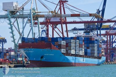
MAERSK NARMADA
Container Ship
Current Trip
| Trip Time | 21 h, 51 mins |
|---|---|
| Trip Distance | 358.85 nm |
| AVG Speed | 15.2 Noeuds |
| MAX Speed | 19.1 Noeuds |
| Tirant d eau | 9.8 m |
| AVG Wind | 11.3 knots |
| MAX Wind | 16.8 knots |
| MIN Temp | 22°C / 71.6°F |
| MAX Temp | 26.7°C / 80.06°F |
| Position reçue | 7 m depuis |
Current Position
| Longitude | 35.54002° |
|---|---|
| Latitude | 33.90887° |
| Etat | Moored |
| Vitesse | 0.1 Noeuds |
| Parcours | 94° |
| Zone | Mediterranean Sea - Eastern Basin |
| Station | T-AIS |
| Position reçue | 7 m depuis |
Info
Information
The current position of MAERSK NARMADA is in Mediterranean Sea - Eastern Basin with coordinates 33.90887° / 35.54002° as reported on 2024-04-25 15:44 by AIS to our vessel tracker app. The vessel's current speed is 0.1 Noeuds and is currently inside the port of BEIRUT.
The vessel MAERSK NARMADA (IMO: 9356098, MMSI: 477552700) is a Container Ship that was built in 2008 ( 16 Age ). It's sailing under the flag of [HK] Hong Kong.
In this page you can find informations about the vessels current position, last detected port calls, and current voyage information. If the vessels is not in coverage by AIS you will find the latest position.
The current position of MAERSK NARMADA is detected by our AIS receivers and we are not responsible for the reliability of the data. The last position was recorded while the vessel was in Coverage by the Ais receivers of our vessel tracking app.
The current draught of MAERSK NARMADA as reported by AIS is 9.8 meters
Weather
| Temperature | 25.5°C / 77.9°F |
|---|---|
| Wind Speed | 9 knots |
| Direction | 34° NE |
| Pressure | 1004.5 hPa |
| Humidity | 52.9 % |
| Cloud Coverage | 100 % |
Featured Company
Last Port Calls
| Port | Arrival | Departure | Time In Port |
|---|---|---|---|
| 2024-04-25 04:11 | |||
| 2024-04-22 19:17 | 2024-04-24 06:20 | 1 d | |
| 2024-04-17 06:20 | 2024-04-18 10:15 | 1 d | |
| 2024-04-15 15:16 | 2024-04-16 08:07 | 16 h | |
| 2024-04-13 20:17 | 2024-04-15 05:55 | 1 d | |
| 2024-04-08 17:25 | 2024-04-09 07:18 | 13 h | |
| 2024-04-02 04:06 | 2024-04-03 17:05 | 1 d | |
| 2024-03-29 08:17 | 2024-03-30 11:49 | 1 d | |
| 2024-03-28 04:20 | 2024-03-28 15:35 | 11 h | |
| 2024-03-25 23:24 | 2024-03-27 05:40 | 1 d |
Last Trips
| Origin | Departure | Destination | Arrival | Distance | |
|---|---|---|---|---|---|
| 2024-04-24 08:20 | 2024-04-25 07:11 | 358.85 nm | |||
| 2024-04-18 12:15 | 2024-04-22 21:17 | 1346.82 nm | |||
| 2024-04-16 10:07 | 2024-04-17 08:20 | 375.29 nm | |||
| 2024-04-15 07:55 | 2024-04-15 17:16 | 163.47 nm | |||
| 2024-04-09 09:18 | 2024-04-13 22:17 | 620.34 nm | |||
| 2024-04-03 20:05 | 2024-04-08 19:25 | 1653.92 nm | |||
| 2024-03-30 14:49 | 2024-04-02 07:06 | 620.51 nm | |||
| 2024-03-28 17:35 | 2024-03-29 11:17 | 368.40 nm | |||
| 2024-03-27 07:40 | 2024-03-28 06:20 | 389.35 nm | |||
| 2024-03-19 01:41 | 2024-03-26 01:24 | 1438.78 nm |
Events
| Heure | Evenement | Détails | Position/ Destination | Info |
|---|---|---|---|---|
| 2024-04-25 04:48 | Etat Changé | Moored Under way using engine |
33.90883 / 35.54002
[LB] BEIRUT
|
Vitesse: Parcours: 93° |
| 2024-04-25 04:18 | Arret |
33.90966 / 35.54362
[LB] BEIRUT
|
Vitesse: 0.2 kn Parcours: 70° |
|
| 2024-04-25 04:11 | Port d'arrivée |
|
33.91250 / 35.54138
[LB] BEIRUT
|
Vitesse: 3.2 kn Parcours: 171° |
| 2024-04-25 02:43 | Démarrage | 6.85 nm, West of BEIRUT |
33.93948 / 35.40199
EGALY>LBBEY
|
Vitesse: 12.6 kn Parcours: 90° |
| 2024-04-25 00:35 | Changement d'ETA | 2024/04/25 03:30 2024/04/25 03:00 |
33.81824 / 35.49081
EGALY>LBBEY
|
Vitesse: 0.2 kn Parcours: 64° |
| 2024-04-25 00:29 | Dans la zone couverte |
33.81828 / 35.49082
Mediterranean Sea - Eastern Basin
EGALY>LBBEY
|
Vitesse: 0.3 kn Parcours: 64° |
|
| 2024-04-24 23:00 | Hors de la zone couverte |
33.63212 / 34.44354
Mediterranean Sea - Eastern Basin
EGALY>LBBEY
|
Vitesse: 17 kn Parcours: 62.8° |
|
| 2024-04-24 22:53 | Tirant d'eau modifié | 9.8 10.4 |
33.61694 / 34.40919
EGALY>LBBEY
|
Vitesse: 17.1 kn Parcours: 62.5° |
| 2024-04-24 22:53 | Changement de destination | EGALY>LBBEY ITGOA>EGALY |
33.61694 / 34.40919
EGALY>LBBEY
|
Vitesse: 17.1 kn Parcours: 62.5° |
| 2024-04-24 22:53 | Changement d'ETA | 2024/04/25 03:00 2024/04/22 10:00 |
33.61694 / 34.40919
EGALY>LBBEY
|
Vitesse: 17.1 kn Parcours: 62.5° |