
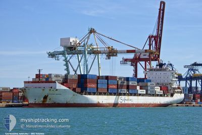
MAERSK NAKURU
Container Ship
Current Trip
| Time Travelled | 4 days |
|---|---|
| Remaining Time | 5 h, 59 mins |
| Distance Travelled | 1218.69 nm |
| Remaining Distance | 69.73 nm |
| AVG Speed | 12.3 Noeuds |
| MAX Speed | 15.9 Noeuds |
| AVG Wind | 10.8 knots |
| MAX Wind | 30.8 knots |
| MIN Temp | 13.3°C / 55.94°F |
| MAX Temp | 20.8°C / 69.44°F |
| Tirant d eau | 9.4 m |
| Position reçue | Maintenant |
Current Position
| Longitude | 25.78157° |
|---|---|
| Latitude | 38.60607° |
| Etat | Under way using engine |
| Vitesse | 11.3 Noeuds |
| Parcours | 35.5° |
| Zone | Aegean Sea |
| Station | T-AIS |
| Position reçue | Maintenant |
Info
Information
The current position of MAERSK NAKURU is in Aegean Sea with coordinates 38.60607° / 25.78157° as reported on 2024-04-25 03:29 by AIS to our vessel tracker app. The vessel's current speed is 11.3 Noeuds and is heading at the port of IZMIR. The estimated time of arrival as calculated by MyShipTracking vessel tracking app is 2024-04-25 09:29 LT
The vessel MAERSK NAKURU (IMO: 9356103, MMSI: 477552900) is a Container Ship that was built in 2008 ( 16 Age ). It's sailing under the flag of [HK] Hong Kong.
In this page you can find informations about the vessels current position, last detected port calls, and current voyage information. If the vessels is not in coverage by AIS you will find the latest position.
The current position of MAERSK NAKURU is detected by our AIS receivers and we are not responsible for the reliability of the data. The last position was recorded while the vessel was in Coverage by the Ais receivers of our vessel tracking app.
The current draught of MAERSK NAKURU as reported by AIS is 9.4 meters
Weather
| Temperature | 17.7°C / 63.86°F |
|---|---|
| Wind Speed | 10 knots |
| Direction | 142° SE |
| Pressure | 1004.3 hPa |
| Humidity | 90 % |
| Cloud Coverage | 100 % |
Featured Company
Last Port Calls
| Port | Arrival | Departure | Time In Port |
|---|---|---|---|
| 2024-04-22 08:35 | 2024-04-23 00:21 | 15 h | |
| 2024-04-18 19:52 | 2024-04-20 10:02 | 1 d | |
| 2024-04-16 08:23 | 2024-04-17 03:34 | 19 h | |
| 2024-04-12 21:57 | 2024-04-14 01:46 | 1 d | |
| 2024-04-10 08:31 | 2024-04-11 07:30 | 22 h | |
| 2024-04-06 19:54 | 2024-04-08 00:10 | 1 d | |
| 2024-04-04 11:44 | 2024-04-05 22:51 | 1 d | |
| 2024-04-01 23:37 | 2024-04-02 22:17 | 22 h | |
| 2024-03-28 20:01 | 2024-03-30 23:58 | 2 d | |
| 2024-03-25 10:41 | 2024-03-26 10:20 | 23 h |
Last Trips
| Origin | Departure | Destination | Arrival | Distance | |
|---|---|---|---|---|---|
| 2024-04-20 13:02 | 2024-04-22 10:35 | 639.90 nm | |||
| 2024-04-14 04:46 | 2024-04-18 22:52 | 1265.95 nm | |||
| 2024-04-14 04:46 | 2024-04-16 10:23 | 636.86 nm | |||
| 2024-04-08 03:10 | 2024-04-13 00:57 | 1249.51 nm | |||
| 2024-04-08 03:10 | 2024-04-10 10:31 | 616.76 nm | |||
| 2024-04-06 01:51 | 2024-04-06 22:54 | 210.83 nm | |||
| 2024-03-31 02:58 | 2024-04-04 14:44 | 1274.62 nm | |||
| 2024-03-31 02:58 | 2024-04-02 01:37 | 642.37 nm | |||
| 2024-03-23 21:50 | 2024-03-28 23:01 | 1260.44 nm | |||
| 2024-03-23 21:50 | 2024-03-25 12:41 | 622.50 nm |
Events
| Heure | Evenement | Détails | Position/ Destination | Info |
|---|---|---|---|---|
| 2024-04-25 01:51 | Changement d'ETA | 2024/04/25 09:00 2024/04/25 10:00 |
38.32576 / 25.66437
EGPSD - TRIZM
|
Vitesse: 10.9 kn Parcours: 357.6° |
| 2024-04-24 21:40 | Etat Changé | Under way using engine Default |
37.56688 / 25.71194
EGPSD - TRIZM
|
Vitesse: 11.2 kn Parcours: 2° |
| 2024-04-24 20:55 | Etat Changé | Default Under way using engine |
37.43583 / 25.73738
EGPSD - TRIZM
|
Vitesse: 10.8 kn Parcours: 352.9° |
| 2024-04-24 20:52 | Etat Changé | Under way using engine Default |
37.42687 / 25.73880
EGPSD - TRIZM
|
Vitesse: 10.6 kn Parcours: 353° |
| 2024-04-24 20:38 | Etat Changé | Default Under way using engine |
37.38385 / 25.74520
EGPSD - TRIZM
|
Vitesse: 10.6 kn Parcours: 352.9° |
| 2024-04-24 17:39 | Etat Changé | Under way using engine Default |
36.98500 / 26.14863
EGPSD - TRIZM
|
Vitesse: 10.7 kn Parcours: 318° |
| 2024-04-24 17:21 | Etat Changé | Default Under way using engine |
36.94505 / 26.19402
EGPSD - TRIZM
|
Vitesse: 10.5 kn Parcours: 316.2° |
| 2024-04-24 08:41 | Changement de zone | Greek part of the Aegean Sea Greek part of the Mediterranean Sea - Eastern Basin |
35.73674 / 27.45592
Aegean Sea
EGPSD - TRIZM
|
Vitesse: 11.1 kn Parcours: 332.8° |
| 2024-04-24 04:52 | Etat Changé | Under way using engine Default |
35.17570 / 27.96895
EGPSD - TRIZM
|
Vitesse: 11.9 kn Parcours: 313° |
| 2024-04-24 04:40 | Etat Changé | Default Under way using engine |
35.14659 / 28.00192
EGPSD - TRIZM
|
Vitesse: 12.1 kn Parcours: 313.5° |