
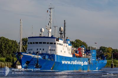
RS SENTINEL
Research/Survey Vessel
Current Trip
| Trip Time | 7 days |
|---|---|
| Trip Distance | 28.46 nm |
| AVG Speed | 7.8 Noeuds |
| MAX Speed | 11 Noeuds |
| Tirant d eau | 4.9 m |
| AVG Wind | 12.2 knots |
| MAX Wind | 16.2 knots |
| MIN Temp | 4.9°C / 40.82°F |
| MAX Temp | 14.3°C / 57.74°F |
| Position reçue | 14 h, 10 m depuis |
Current Position
| Longitude | 10.81156° |
|---|---|
| Latitude | 54.09970° |
| Etat | Moored |
| Vitesse | |
| Parcours | 351° |
| Zone | Baltic Sea |
| Station | T-AIS |
| Position reçue | 14 h, 10 m depuis |
Info
Information
The current position of RS SENTINEL is in Baltic Sea with coordinates 54.09970° / 10.81156° as reported on 2024-04-18 21:19 by AIS to our vessel tracker app. The vessel's current speed is 0 Noeuds and is currently inside the port of NEUSTADT.
The vessel RS SENTINEL (IMO: 7106877, MMSI: 229964000) is a Research/Survey Vessel that was built in 1971 ( 53 Age ). It's sailing under the flag of [MT] Malta.
In this page you can find informations about the vessels current position, last detected port calls, and current voyage information. If the vessels is not in coverage by AIS you will find the latest position.
The current position of RS SENTINEL is detected by our AIS receivers and we are not responsible for the reliability of the data. The last position was recorded while the vessel was in Coverage by the Ais receivers of our vessel tracking app.
The current draught of RS SENTINEL as reported by AIS is 4.9 meters
Weather
| Temperature | 4.3°C / 39.74°F |
|---|---|
| Wind Speed | 8 knots |
| Direction | 254° WSW |
| Pressure | 1013.4 hPa |
| Humidity | 77.7 % |
| Cloud Coverage | 100 % |
Featured Company
Last Port Calls
| Port | Arrival | Departure | Time In Port |
|---|---|---|---|
| 2024-04-18 09:48 | |||
| 2024-04-10 04:49 | 2024-04-10 11:41 | 6 h | |
| 2024-03-23 10:28 | 2024-03-27 08:22 | 3 d | |
| 2024-03-21 09:07 | 2024-03-23 08:27 | 1 d | |
| 2024-03-19 22:09 | 2024-03-21 07:19 | 1 d | |
| 2024-03-15 22:05 | 2024-03-16 17:09 | 19 h | |
| 2024-02-29 17:48 | 2024-03-09 15:33 | 8 d | |
| 2024-02-28 10:19 | 2024-02-29 08:30 | 22 h | |
| 2024-02-26 14:12 | 2024-02-27 18:10 | 1 d | |
| 2024-02-24 09:08 |
Last Trips
| Origin | Departure | Destination | Arrival | Distance | |
|---|---|---|---|---|---|
| 2024-04-10 13:41 | 2024-04-18 11:48 | 28.46 nm | |||
| 2024-03-27 09:22 | 2024-04-10 06:49 | 623.17 nm | |||
| 2024-03-23 09:27 | 2024-03-23 11:28 | 17.31 nm | |||
| 2024-03-21 08:19 | 2024-03-21 10:07 | 16.68 nm | |||
| 2024-03-16 18:09 | 2024-03-19 23:09 | 213.48 nm | |||
| 2024-03-09 16:33 | 2024-03-15 23:05 | 690.24 nm | |||
| 2024-02-29 09:30 | 2024-02-29 18:48 | 10.57 nm | |||
| 2024-02-27 19:10 | 2024-02-28 11:19 | 7.77 nm | |||
| 2024-02-24 10:08 | 2024-02-26 15:12 | 8.66 nm |
Events
| Heure | Evenement | Détails | Position/ Destination | Info |
|---|---|---|---|---|
| 2024-04-18 21:19 | Hors de la zone couverte |
54.09970 / 10.81156
Baltic Sea
[DE] NEUSTADT
|
Vitesse: Parcours: 312.9° |
|
| 2024-04-18 21:19 | Dans la zone couverte |
54.09970 / 10.81156
Baltic Sea
[DE] NEUSTADT
|
Vitesse: Parcours: 312.9° |
|
| 2024-04-18 19:49 | Hors de la zone couverte |
54.09972 / 10.81155
Baltic Sea
[DE] NEUSTADT
|
Vitesse: Parcours: 2.3° |
|
| 2024-04-18 19:19 | Dans la zone couverte |
54.09972 / 10.81156
Baltic Sea
[DE] NEUSTADT
|
Vitesse: Parcours: 354.7° |
|
| 2024-04-18 09:48 | Port d'arrivée |
|
54.09972 / 10.81156
[DE] NEUSTADT
|
Vitesse: 10.5 kn Parcours: 307.1° |
| 2024-04-18 09:26 | Hors de la zone couverte |
54.04761 / 10.87657
Baltic Sea
NEUSTADT
|
Vitesse: 10.5 kn Parcours: 307.1° |
|
| 2024-04-18 08:24 | Etat Changé | Under way using engine At anchor |
54.03809 / 10.82218
NEUSTADT
|
Vitesse: Parcours: 260° |
| 2024-04-18 08:24 | Démarrage | 2.68 nm, North of NIENDORFER |
54.03809 / 10.82218
NEUSTADT
|
Vitesse: 8.2 kn Parcours: 115.1° |
| 2024-04-18 06:02 | Changement de destination | NEUSTADT OFFSHORE |
54.04769 / 10.79587
NEUSTADT
|
Vitesse: Parcours: 272° |
| 2024-04-18 06:02 | Changement d'ETA | 2024/04/18 10:00 2024/04/19 06:00 |
54.04769 / 10.79587
NEUSTADT
|
Vitesse: Parcours: 272° |