
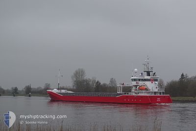
ROBIJN
General Cargo
Current Trip
| Time Travelled | 1 day |
|---|---|
| Remaining Time | 6 h, 56 mins |
| Distance Travelled | 421.92 nm |
| Remaining Distance | 90.40 nm |
| AVG Speed | 9.8 Noeuds |
| MAX Speed | 11 Noeuds |
| AVG Wind | 14.5 knots |
| MAX Wind | 22.9 knots |
| MIN Temp | 1.6°C / 34.88°F |
| MAX Temp | 7.5°C / 45.5°F |
| Tirant d eau | 4.7 m |
| Position reçue | 23 h, 20 m depuis |
Current Position
| Longitude | 16.88269° |
|---|---|
| Latitude | 56.17524° |
| Etat | Under way using engine |
| Vitesse | 10.2 Noeuds |
| Parcours | 21.1° |
| Zone | Baltic Sea |
| Station | T-AIS |
| Position reçue | 23 h, 20 m depuis |
Info
Information
The current position of ROBIJN is in Baltic Sea with coordinates 56.17524° / 16.88269° as reported on 2024-04-17 06:42 by AIS to our vessel tracker app. The vessel's current speed is 10.2 Noeuds and is heading at the port of TURKU. The estimated time of arrival as calculated by MyShipTracking vessel tracking app is 2024-04-18 12:58 LT
The vessel ROBIJN (IMO: 9423669, MMSI: 245909000) is a General Cargo that was built in 2008 ( 16 Age ). It's sailing under the flag of [NL] Netherlands.
In this page you can find informations about the vessels current position, last detected port calls, and current voyage information. If the vessels is not in coverage by AIS you will find the latest position.
The current position of ROBIJN is detected by our AIS receivers and we are not responsible for the reliability of the data. The last position was recorded while the vessel was in Coverage by the Ais receivers of our vessel tracking app.
The current draught of ROBIJN as reported by AIS is 4.7 meters
Weather
| Temperature | 1.8°C / 35.24°F |
|---|---|
| Wind Speed | 5 knots |
| Direction | 352° N |
| Pressure | 1011.5 hPa |
| Humidity | 80.9 % |
| Cloud Coverage | 100 % |
Featured Company
Last Port Calls
| Port | Arrival | Departure | Time In Port |
|---|---|---|---|
| 2024-04-15 14:32 | 2024-04-16 10:18 | 19 h | |
| 2024-04-12 05:42 | 2024-04-12 06:52 | 1 h | |
| 2024-04-09 14:09 | 2024-04-11 20:28 | 2 d | |
| 2024-04-01 18:07 | 2024-04-05 14:45 | 3 d | |
| 2024-03-20 15:54 | 2024-03-25 13:14 | 4 d | |
| 2024-03-18 22:37 | 2024-03-20 15:36 | 1 d | |
| 2024-03-12 06:28 | 2024-03-15 16:41 | 3 d | |
| 2024-03-07 12:54 | 2024-03-11 12:54 | 4 d | |
| 2024-02-28 00:56 | 2024-02-29 11:01 | 1 d | |
| 2024-02-20 20:36 | 2024-02-21 19:01 | 22 h |
Most Visited Ports (Last year)
| Port | Arrivals | |
|---|---|---|
| 4 | ||
| 3 | ||
| 3 | ||
| 2 | ||
| 2 | ||
| 2 |
Last Trips
| Origin | Departure | Destination | Arrival | Distance | |
|---|---|---|---|---|---|
| 2024-04-12 08:52 | 2024-04-15 16:32 | 502.43 nm | |||
| 2024-04-11 22:28 | 2024-04-12 07:42 | 102.57 nm | |||
| 2024-04-05 15:45 | 2024-04-09 16:09 | 982.10 nm | |||
| 2024-03-25 14:14 | 2024-04-01 19:07 | 1102.11 nm | |||
| 2024-03-20 16:36 | 2024-03-20 16:54 | 3.23 nm | |||
| 2024-03-15 17:41 | 2024-03-18 23:37 | 850.62 nm | |||
| 2024-03-11 13:54 | 2024-03-12 07:28 | 178.76 nm | |||
| 2024-02-29 12:01 | 2024-03-07 13:54 | 1703.87 nm | |||
| 2024-02-21 20:01 | 2024-02-28 01:56 | 974.94 nm | |||
| 2024-02-20 01:33 | 2024-02-20 21:36 | 242.36 nm |
Events
| Heure | Evenement | Détails | Position/ Destination | Info |
|---|---|---|---|---|
| 2024-04-17 06:48 | Etat Changé | Default Under way using engine |
56.19071 / 16.89407
TURKU
|
Vitesse: 10.2 kn Parcours: 21.1° |
| 2024-04-17 06:42 | Hors de la zone couverte |
56.17524 / 16.88269
Baltic Sea
TURKU
|
Vitesse: 10.2 kn Parcours: 21.1° |
|
| 2024-04-17 01:46 | Changement de zone | Swedish part of the Baltic Sea Danish part of the Kattegat |
55.45917 / 16.07256
Baltic Sea
TURKU
|
Vitesse: 10.2 kn Parcours: 32° |
| 2024-04-16 21:55 | Detecté en mer | Danish part of the Kattegat |
54.90514 / 15.47815
Kattegat
TURKU
|
Vitesse: 9.6 kn Parcours: 31.8° |
| 2024-04-16 17:17 | Tirant d'eau modifié | 4.7 5.4 |
54.31660 / 14.89029
TURKU
|
Vitesse: 9 kn Parcours: 29.1° |
| 2024-04-16 17:17 | Changement de destination | TURKU PLSZZ |
54.31660 / 14.89029
TURKU
|
Vitesse: 9 kn Parcours: 29.1° |
| 2024-04-16 17:17 | Changement d'ETA | 2024/04/18 14:00 2024/04/15 18:00 |
54.31660 / 14.89029
TURKU
|
Vitesse: 9 kn Parcours: 29.1° |
| 2024-04-16 16:50 | Etat Changé | Under way using engine Default |
54.26637 / 14.81200
PLSZZ
|
Vitesse: 9 kn Parcours: 51° |
| 2024-04-16 16:44 | Etat Changé | Default Under way using engine |
54.25500 / 14.79167
PLSZZ
|
Vitesse: 9.5 kn Parcours: 49.5° |
| 2024-04-16 16:27 | Etat Changé | Under way using engine Default |
54.22788 / 14.73233
PLSZZ
|
Vitesse: 9 kn Parcours: 49° |