
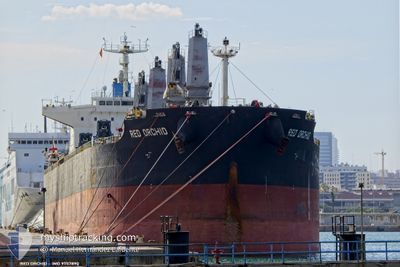
RED ORCHID
Cargo
Current Trip
| Time Travelled | 57 days |
|---|---|
| Remaining Time | --- |
| Distance Travelled | 9742.81 nm |
| Remaining Distance | --- |
| AVG Speed | 11.6 Noeuds |
| MAX Speed | 15 Noeuds |
| AVG Wind | 10.2 knots |
| MAX Wind | 23 knots |
| MIN Temp | 11.8°C / 53.24°F |
| MAX Temp | 31.2°C / 88.16°F |
| Tirant d eau | 6.8 m |
| Position reçue | 11 m depuis |
Current Position
| Longitude | 151.47860° |
|---|---|
| Latitude | -23.83089° |
| Etat | At anchor |
| Vitesse | 0.2 Noeuds |
| Parcours | 152° |
| Zone | Coral Sea |
| Station | T-AIS |
| Position reçue | 11 m depuis |
Info
Information
The current position of RED ORCHID is in Coral Sea with coordinates -23.83089° / 151.47860° as reported on 2024-04-16 19:19 by AIS to our vessel tracker app. The vessel's current speed is 0.2 Noeuds
The vessel RED ORCHID (IMO: 9757890, MMSI: 374249000) is a Cargo It's sailing under the flag of [PA] Panama.
In this page you can find informations about the vessels current position, last detected port calls, and current voyage information. If the vessels is not in coverage by AIS you will find the latest position.
The current position of RED ORCHID is detected by our AIS receivers and we are not responsible for the reliability of the data. The last position was recorded while the vessel was in Coverage by the Ais receivers of our vessel tracking app.
The current draught of RED ORCHID as reported by AIS is 6.8 meters
Weather
| Temperature | 23.5°C / 74.3°F |
|---|---|
| Wind Speed | 14 knots |
| Direction | 135° SE |
| Pressure | 1018.6 hPa |
| Humidity | 84.8 % |
| Cloud Coverage | 100 % |
Featured Company
Events
| Heure | Evenement | Détails | Position/ Destination | Info |
|---|---|---|---|---|
| 2024-04-16 19:25 | Etat Changé | Default At anchor |
-23.83107 / 151.47823
AU GLT
|
Vitesse: 0.2 kn Parcours: 152° |
| 2024-04-16 19:16 | Etat Changé | At anchor Default |
-23.83080 / 151.47870
AU GLT
|
Vitesse: 0.1 kn Parcours: 144° |
| 2024-04-16 19:07 | Etat Changé | Default At anchor |
-23.83108 / 151.47836
AU GLT
|
Vitesse: 0.2 kn Parcours: 142° |
| 2024-04-16 18:58 | Etat Changé | At anchor Default |
-23.83084 / 151.47859
AU GLT
|
Vitesse: 0.2 kn Parcours: 139° |
| 2024-04-16 18:52 | Etat Changé | Default At anchor |
-23.83094 / 151.47853
AU GLT
|
Vitesse: 0.1 kn Parcours: 131° |
| 2024-04-16 18:46 | Etat Changé | At anchor Default |
-23.83107 / 151.47831
AU GLT
|
Vitesse: 0.2 kn Parcours: 135° |
| 2024-04-16 18:25 | Etat Changé | Default At anchor |
-23.83110 / 151.47819
AU GLT
|
Vitesse: 0.2 kn Parcours: 149° |
| 2024-04-16 18:13 | Etat Changé | At anchor Default |
-23.83103 / 151.47842
AU GLT
|
Vitesse: Parcours: 127° |
| 2024-04-16 18:01 | Etat Changé | Default At anchor |
-23.83087 / 151.47849
AU GLT
|
Vitesse: 0.1 kn Parcours: 142° |
| 2024-04-16 17:55 | Etat Changé | At anchor Default |
-23.83106 / 151.47837
AU GLT
|
Vitesse: 0.1 kn Parcours: 124° |